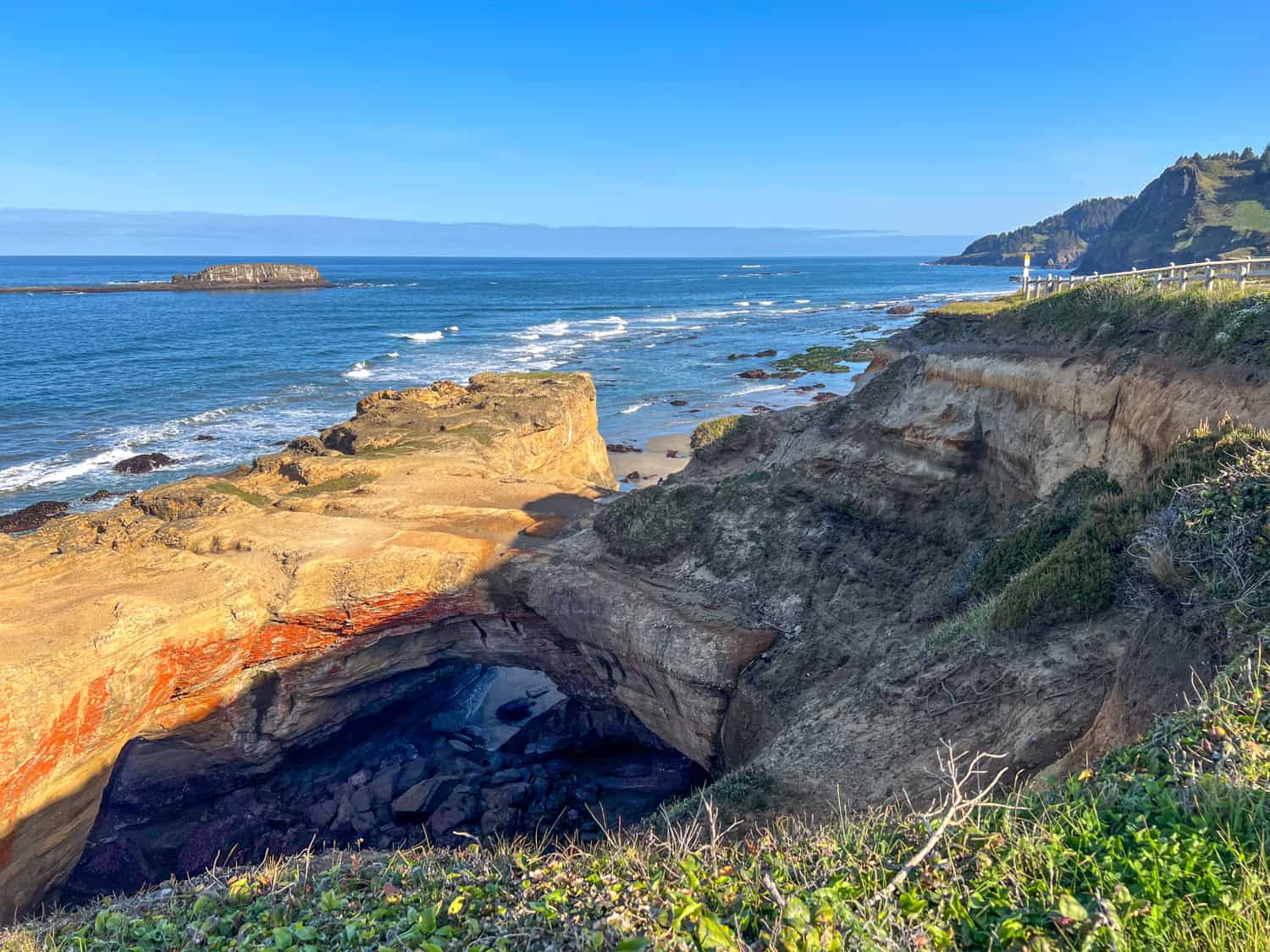
The Devils Punchbowl State Natural Area had been on our Oregon Coast wish list from the moment we started planning the spring trip.
Kel was especially excited about it, not just for the classic view from above at high tide, when waves crash and swirl inside the collapsed sea cave, but for the chance to walk into it at low tide.

Before our visit, she tried searching for details on how to do that safely, but came up mostly empty-handed aside from one blog post.
So if we could pull it off, we'd share the experience with anyone else curious about stepping inside this wild, bowl-shaped wonder.
I'll admit, she was the confident one. I was the nervous half of the team, imagining a rogue wave rushing in and tossing us around the boulders.
But on the morning of our hike, as we stood on Otter Crest Beach and saw how far the tide had pulled back, that anxiety eased into curiosity.
The Punchbowl looked calm, exposed, and surprisingly accessible. We'd spent the night before at the Inn at Otter Crest so we could start early and catch the lowest tide on a Wednesday morning.
From our room, it was just a short walk down to the shoreline, no racing the clock, no scrambling for parking. This was to be one of the highlights of our Oregon Coast road trip, and the conditions couldn't have been better.
What follows is everything we wish we'd known ahead of time: how to get there, when to go, and what it's actually like to stand inside Devils Punchbowl at low tide.
Table of Contents
Devils Punchbowl Hike
What To Know Before You Go (Logistics & Safety)
Before you step inside Devils Punchbowl in Oregon, a little planning goes a long way. This won't be a challenging walk for most hikers, but timing and conditions matter.
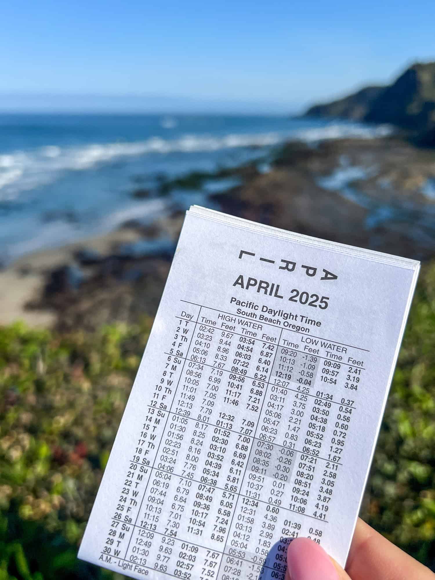
Check the Tide Charts First
You can only enter the Punchbowl at low tide, and even then, the window is short. Aim for the lowest tide of the day, ideally a minus tide, when the beach and rocks leading to the cave are fully exposed.
What's a Minus Tide? A minus tide occurs when the water level drops below the average low-tide mark. On the Oregon Coast, these tides expose far more of the shoreline than usual, revealing tide pools, rock formations, and access points you'd never see otherwise.
For Devils Punchbowl, a minus tide is ideal because it gives you the widest, safest window to walk into the cave before the water returns. These tides usually occur during new and full moons, and often in the early morning.
We lucked out: the one morning we had for this hike coincided with a minus tide. The early start also meant fewer people and calmer conditions.
A good rule of thumb:
- If the tide is still dropping, the walk-in will be more relaxed.
- If the tide is rising, plan to leave sooner than you think.
Visit the official website for the Devils Punchbowl State Natural Area for a PDF of Central Oregon tide charts. You can also find miniature paper versions in local shops and restaurants along the coast.
Know the Conditions
Waves and swell size matter just as much as the tide. On calmer days, the interior feels peaceful and open. On days with heavy surf or large swells, even a "low tide" can feel unpredictable.
If the ocean looks rough or water is still pouring into the cave, skip it. There's no shortage of safe viewpoints from above.
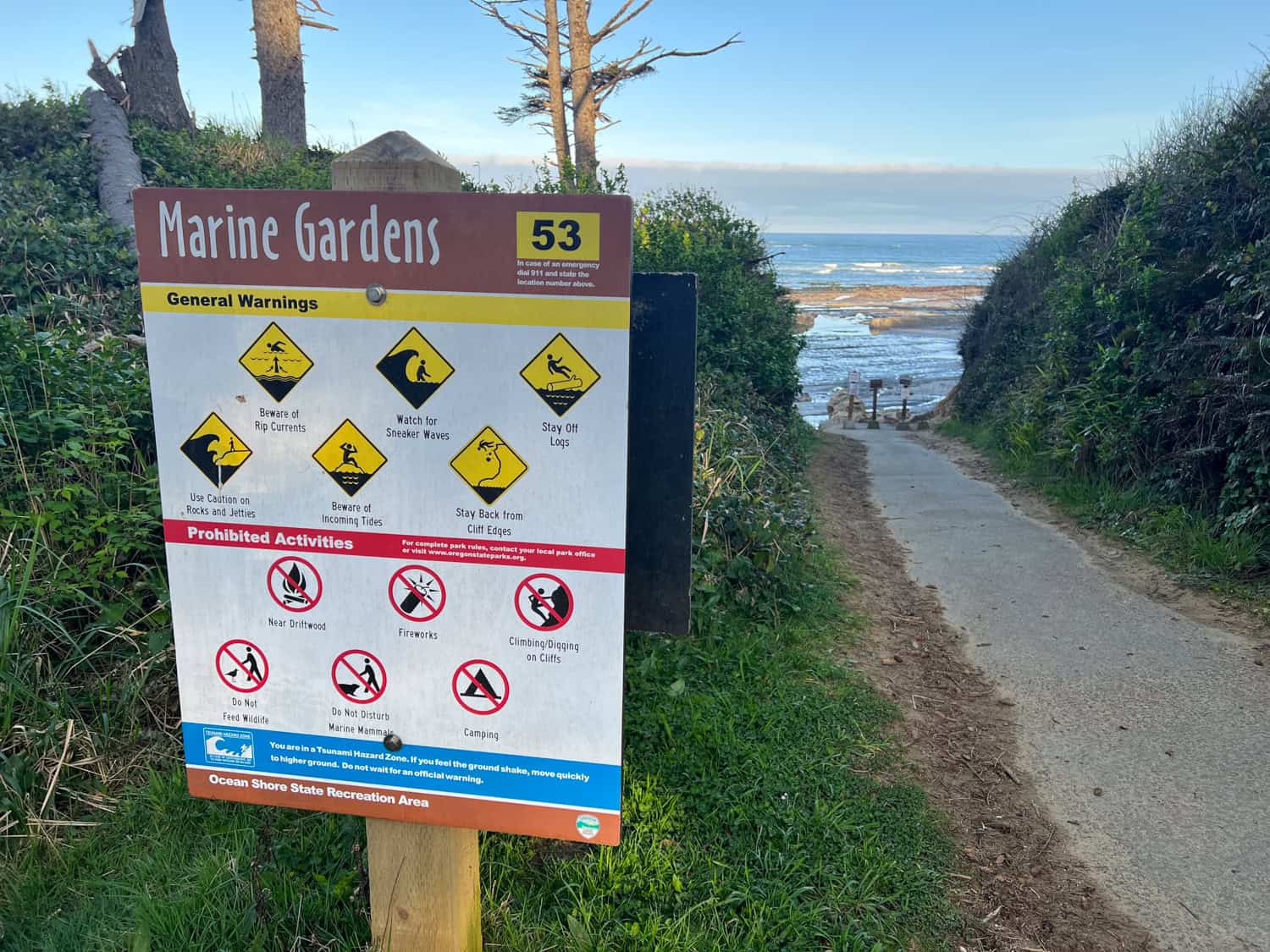
Parking and Access
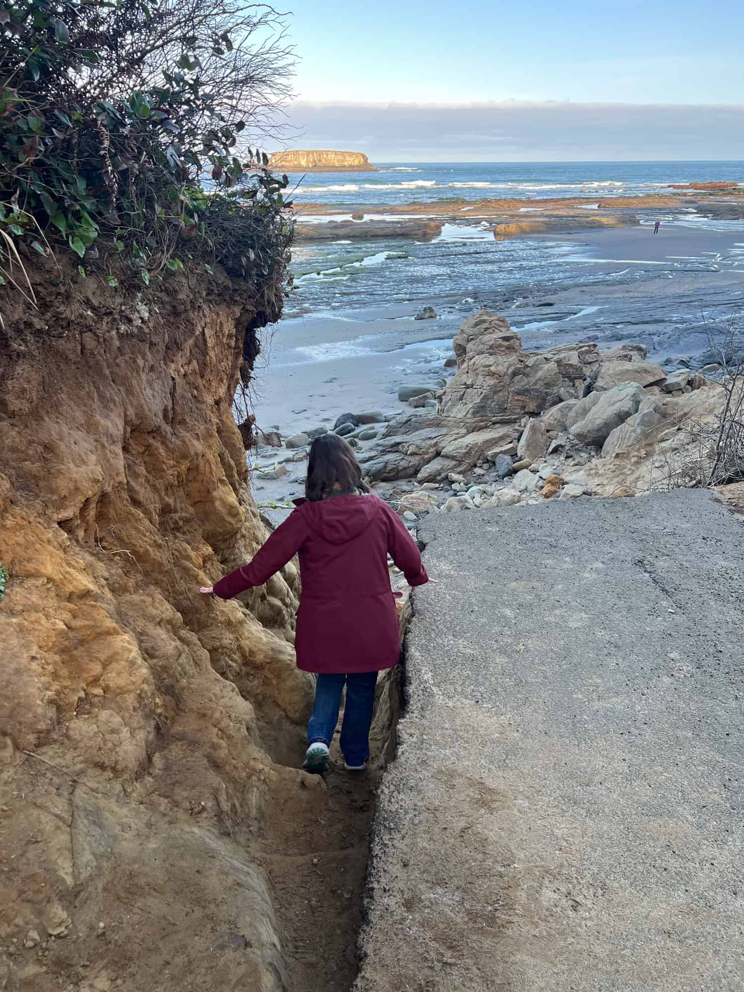
Most people view the Punchbowl from the fenced clifftop area, but entering it means starting at Otter Crest Beach below.
You can reach it from public access points or by staying nearby, as we did at the Inn at Otter Crest. From the beach, you'll walk south along the exposed shoreline until the cave comes into view.
You won't find trail markers on the beach, so rely on satellite view (Google Maps) and obvious terrain to hug the cliffs to your left as you head south.
Footwear and Gear
You'll be walking on:
- Wet sand
- Slick rocks
- Seaweed-covered boulders
- Shallow tide pools
Grippy shoes are essential. Water-resistant hiking shoes or trail runners work best; avoid flip-flops. Bring a light jacket if you're going early; it's cooler and breezier near the water.
Stay Aware Inside the Cave
Once you're in the Punchbowl, it's easy to get swept up in the scenery and lose track of time. But keep an eye on the waterline. If waves start creeping farther in or the sound changes, that's your cue to head out.
You can also set an alarm on your watch or phone to give you an audible signal when it's time to go. The exit is the same route you came in, so you'll want to leave with plenty of time before the tide shifts.
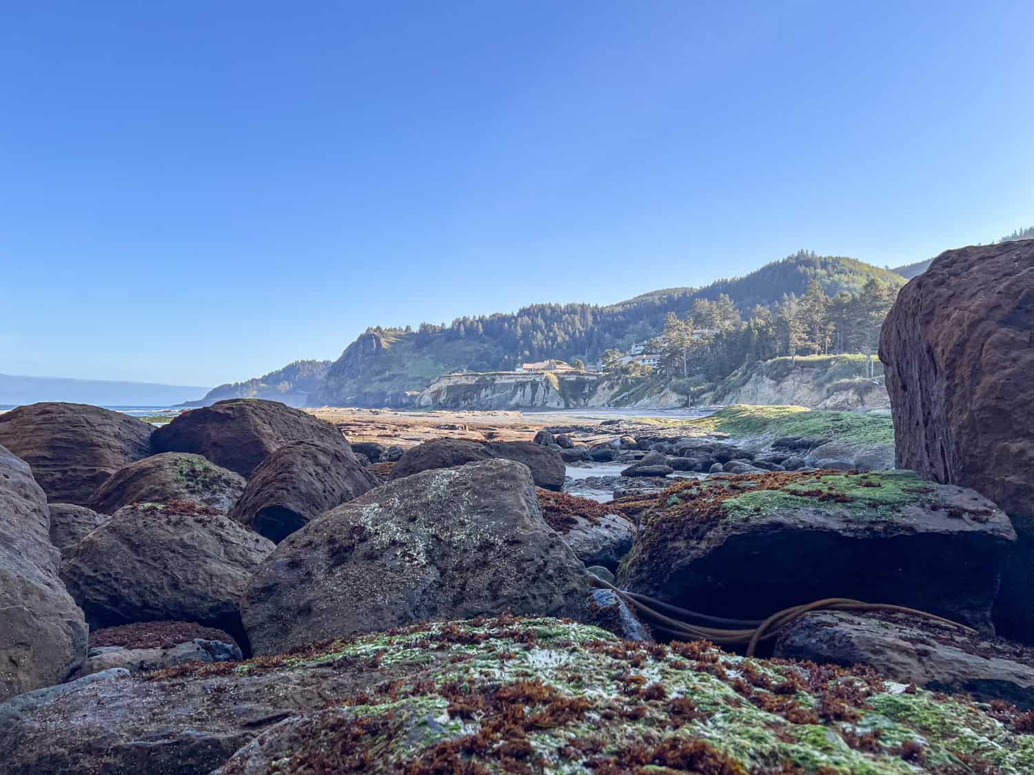
Begin at Otter Crest Beach
Our walk into the Devils Punchbowl, Oregon, began on Otter Crest Beach, which sits just north of the cave's opening. At low tide, this stretch of coastline turns into a broad, rocky runway, wet sand, and long ribbons of seaweed shining in the morning light.
Because we didn't want to lose any of the precious low-tide window, we headed straight toward the Punchbowl instead of stopping to explore.
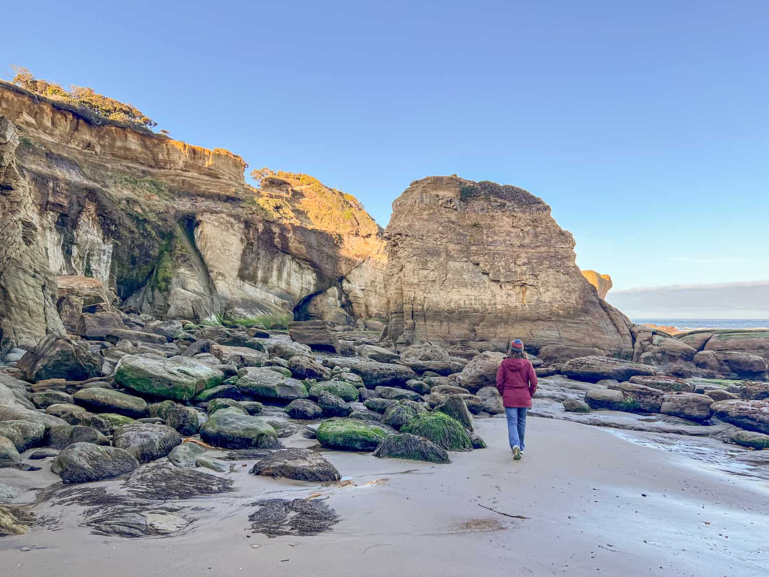
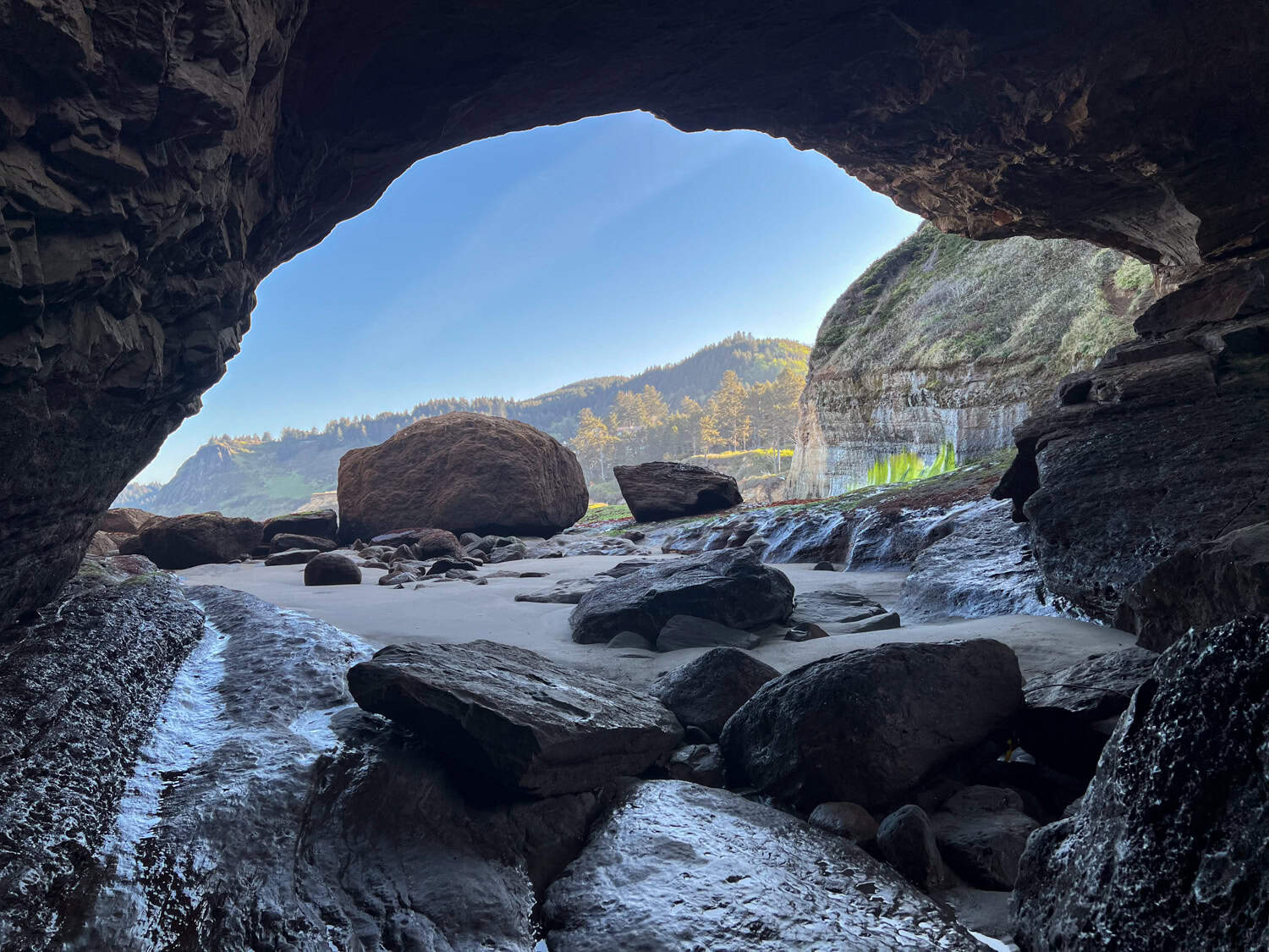
The beach slopes gently south, and as you walk, the cave stays hidden at first. Only when you get closer does the entrance begin to take shape: a broad, shadowed arch cut into the sandstone, with the jagged rim of the collapsed roof visible high above.
The terrain shifts underfoot as you go: firm sand gives way to slippery algae-covered rocks, tide pools, and boulders. You'll need to step around and over some rocks, but nothing technical.
Reminder: Never attempt this hike at mid- or high-tide.
With the ocean pulled far back, the whole approach was calm and quiet. Waves broke well offshore, leaving the entryway surprisingly approachable.
We kept a steady pace, saving the tide-pool wandering and photo stops for the walk back. At this point, the goal was simple: reach the Punchbowl while the tide was low, and the cave was wide open.
How To Follow the Correct Route
At low tide, the path isn't marked, but it's intuitive: stay close to the cliffs on your left as you walk south. This line keeps you on the most stable terrain and gives you the most straightforward approach to the Punchbowl's opening. If you drift too far right toward the waves, the rocks become slicker and the footing less predictable.
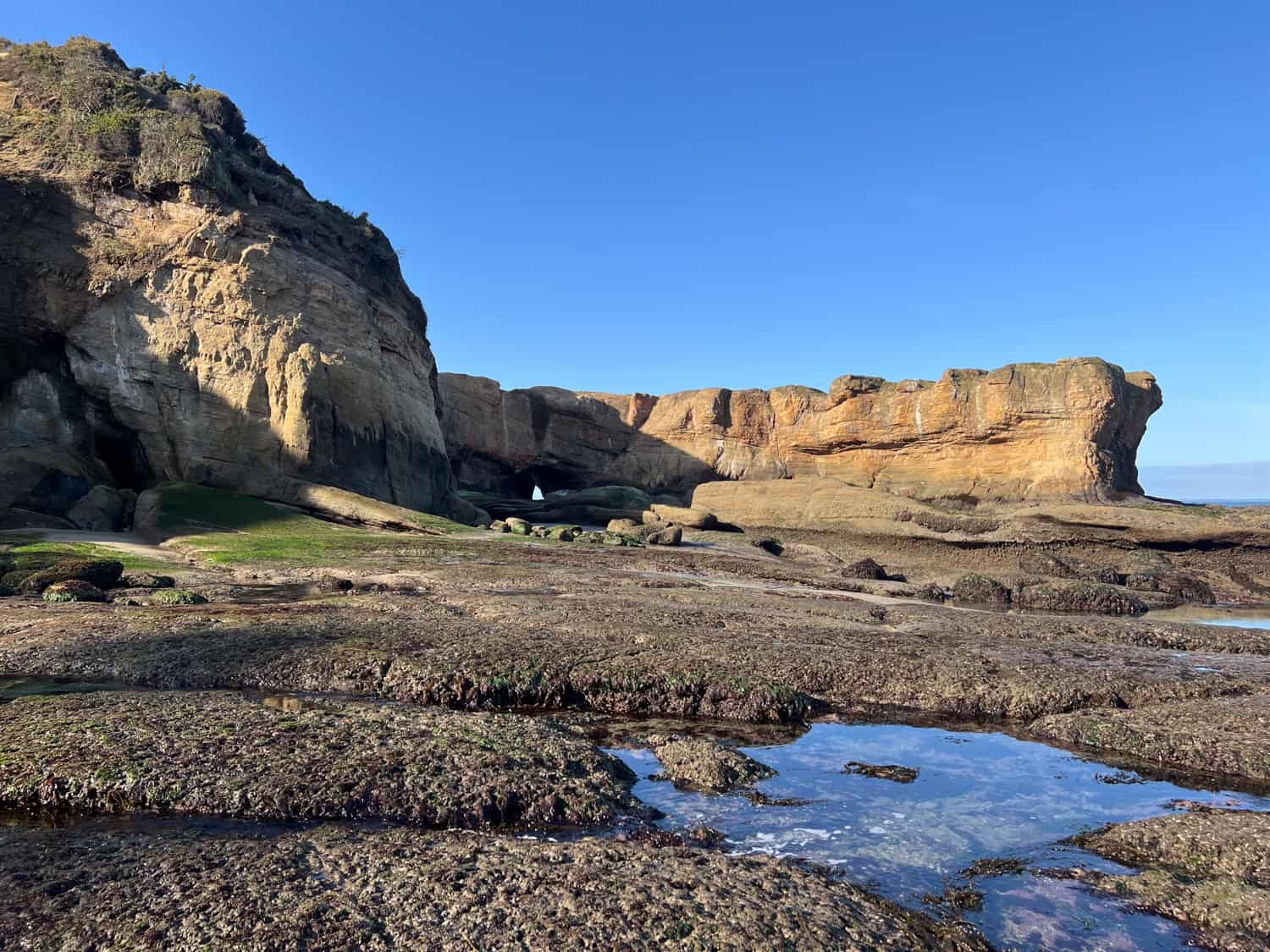
Entering the Punchbowl
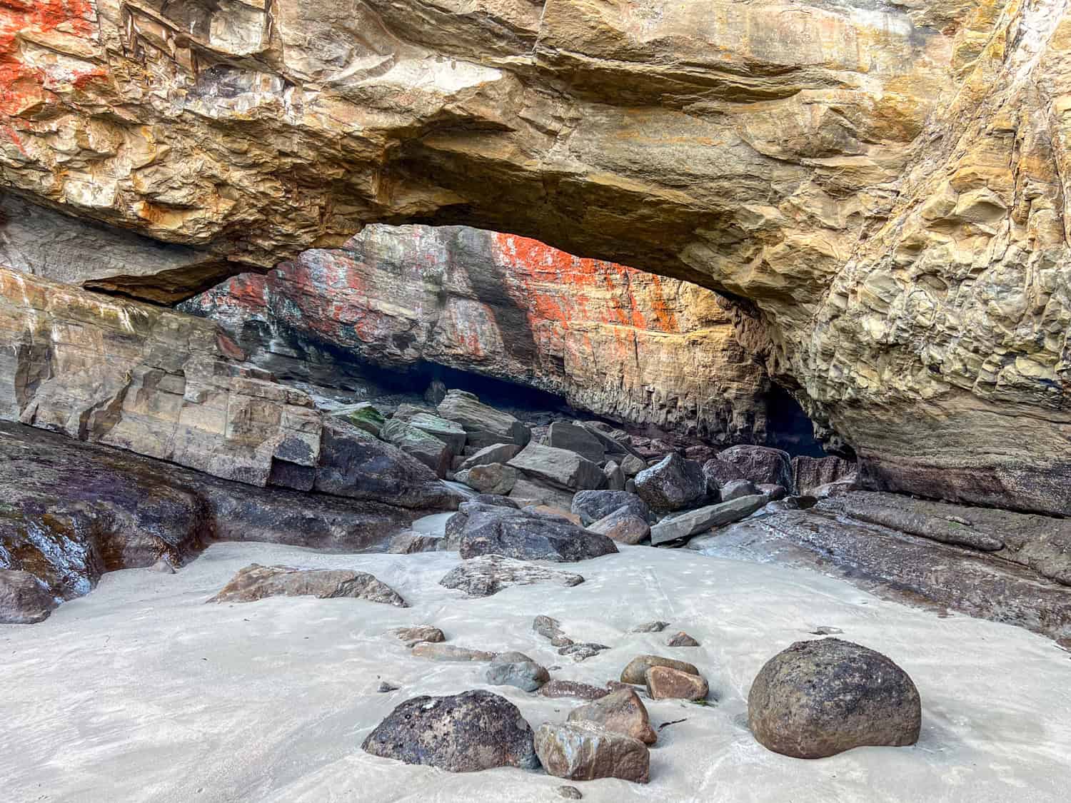
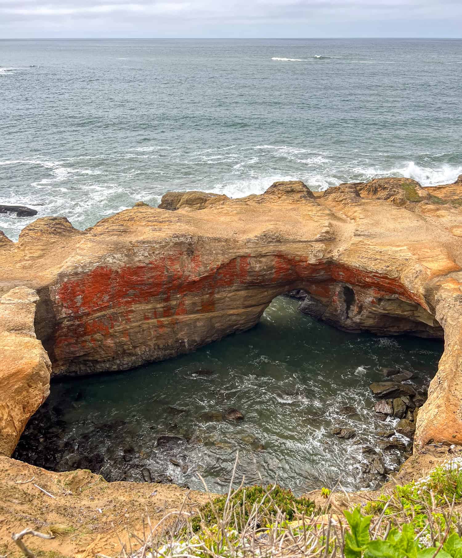
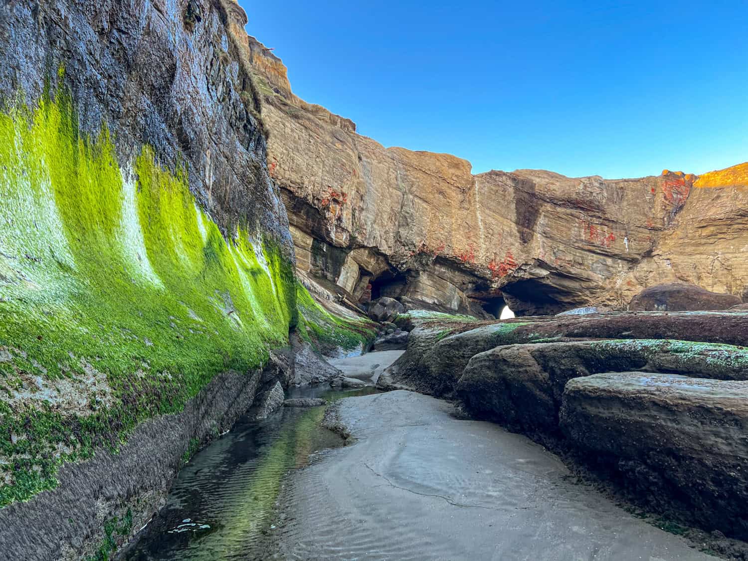
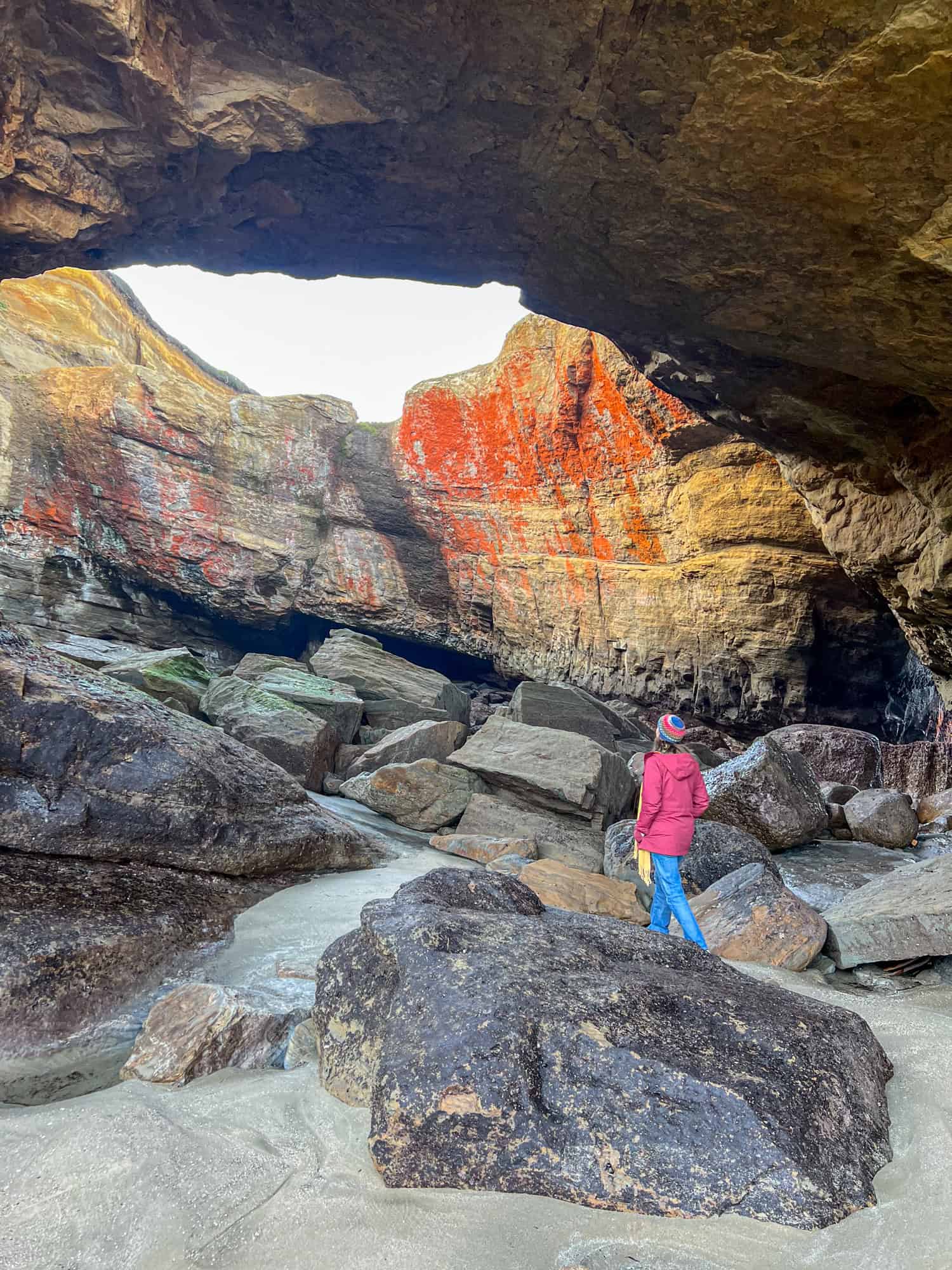
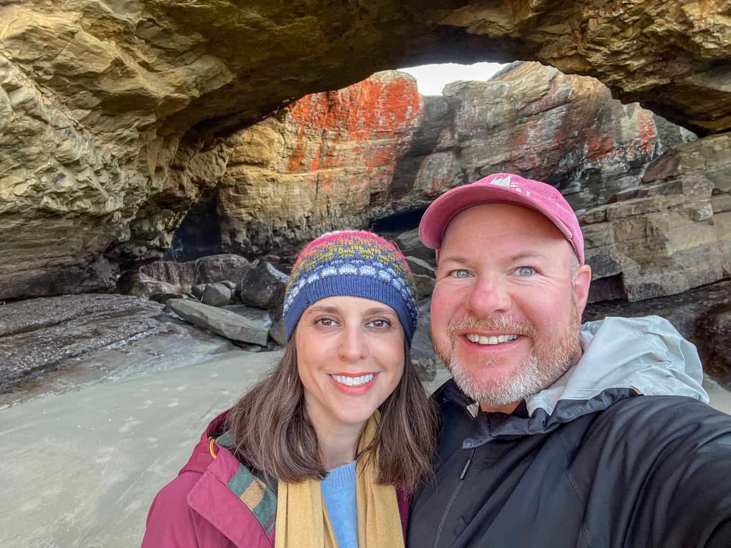
As we reached the opening of Devils Punchbowl, Oregon, the scale of the cave finally hit us. From above, the Punchbowl looks dramatic, but standing at its entrance gives you a whole new perspective.
The archway rises high overhead, carved out of layered sandstone that glows warm and golden in the morning light. The tide was so far out that we didn't have to time our steps or dodge incoming waves; we could walk in.
The floor of the Punchbowl is a mix of smooth sand, rounded stones, and scattered driftwood that has been tossed in during storms.
Pools of water linger along the walls, catching reflections of the rock above. Look up, and you'll see the broken rim of the Punchbowl framing a circle of sky.
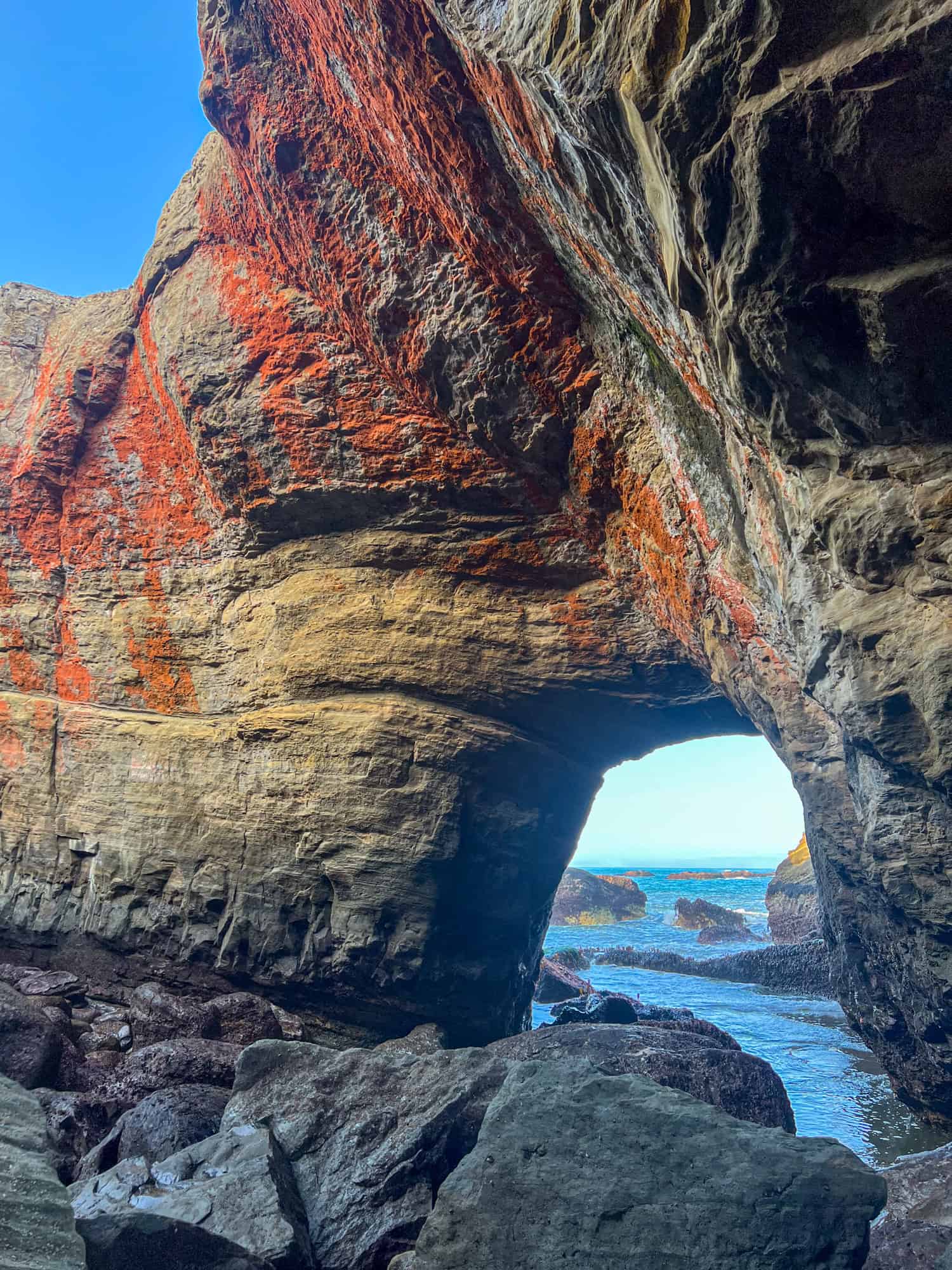
Geologists believe the Devils Punchbowl is roughly 18 million years old, formed from sandstone and basalt layers that have been shaped by relentless coastal erosion.
The cave likely began as a small sea grotto carved out by wave action through fractures in the rock. Over thousands of years, the waves continued to hollow it out from below until the roof eventually collapsed (roughly 80,000 years ago), creating the open, bowl-like chamber we see today.
See also: Hiking Devil's Bridge in Sedona
What surprised me most was how calm it felt. After imagining worst-case scenarios, actually walking around inside the Punchbowl was peaceful.
The juxtaposition of quiet during my visit with the chaos/noise I imagined at other times reminded me of my experience visiting SpaceX at Boca Chica Beach.
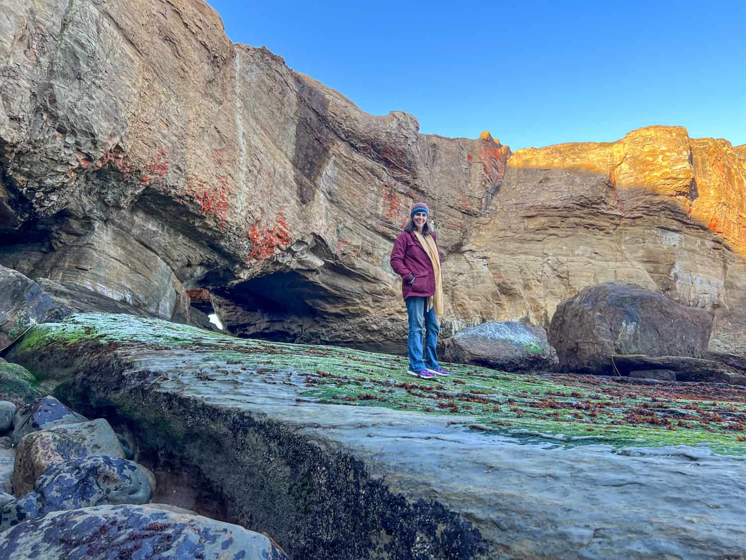
Kel was already moving ahead, exploring the cave's curves and streaks of color on the walls: rust, tan, black, and muted green, each marking where the ocean had shaped the chamber over time.
The terrain inside isn't too tricky, but it does require attention. Some rocks stay slick even at low tide, and the ground can dip unexpectedly. Take your time, watch your footing, and stay mindful of the waterline.
Only walk in as far as you're comfortable. The truth is, you can get a terrific view from the cave's entrance, so there's no need to risk injury climbing into the middle.
If you hear waves starting to creep farther in or notice a change in the swell outside, that's your sign to head out. We spent about 15 minutes exploring and taking photos inside the cave.
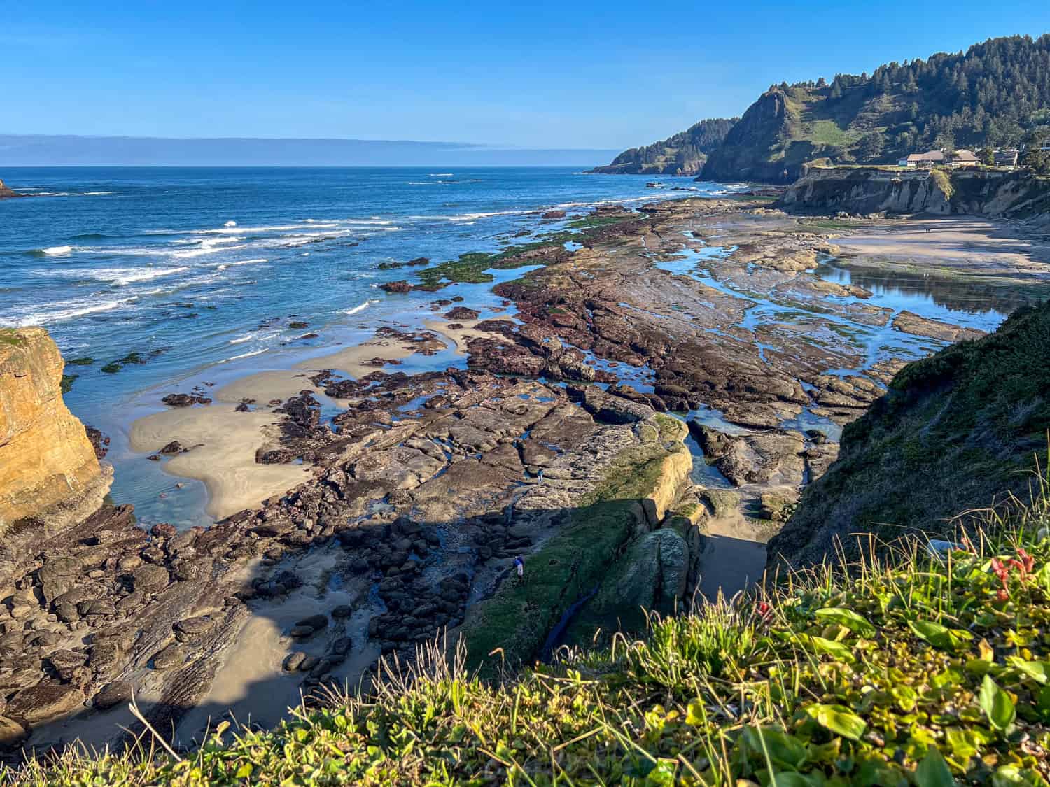
The Return Walk (and Tide Pools)
After exploring the inside of the Punchbowl, we stepped back into the daylight and started our return up along Otter Crest Beach. With the primary goal checked off, we finally let ourselves slow down.
The tide was still low, revealing a long stretch of tide pools that felt like a bonus round to the morning. This part of the walk is more meandering than the hike in.
We wandered between shallow pools filled with anemones, scuttling crabs, small fish, and carpets of bright green seaweed. The rising sun added a warm sheen to the rocks, making everything look a little more vivid than it had on our way in.
Eventually, we followed the cliffs back north toward our starting point, enjoying the easy walk as a few new visitors made their way to the cave. For us, this stretch of tide pools made the morning feel complete.
Related: Hiking the Lost Coast Trail in California
Tide-Pool Etiquette
A few simple habits help keep Oregon's marine life healthy for future visitors:
- Watch your step: Many creatures blend into the rocks and sand.
- Don't touch or pry anything off the rocks: Anemones, starfish, and other residents are fragile.
- Stay on durable surfaces: Walk on bare rock or sand rather than algae-covered areas.
- Leave everything where you found it: Even small shells and stones can be part of an animal's home.
Final Thoughts
Walking inside Devils Punchbowl was one of the most memorable moments of our Oregon Coast road trip, not just for the scenery, but for the sense of discovery it offered.
Seeing the Punchbowl perched from above is impressive, but standing in the middle of its sunken walls, surrounded by color and texture at low tide, is more thrilling.
The early start, the careful timing with the tides, and even my initial nerves were all worth it. Kel's confidence pushed us to try something we might have skipped otherwise, and I'm glad we didn't.
It's a rare chance to step into a place shaped by millions of years of ocean energy and see it during one of the few moments it's accessible. If you're planning your own Oregon Coast trip, make time for this adventure. Check the tides, pick a calm morning, and explore.
While the Devils Punchbowl is a quick stop along the Oregon Coast, travelers with more time should consider heading inland to explore Oregon's waterfalls. Nearby, Silver Falls State Park offers one of the state's most scenic hiking experiences, including the famous Trail of Ten Falls.