Big Bend National Park is full of beautiful vistas, and the Ross Maxwell Scenic Drive is an efficient way to enjoy many of them from the comfort of your car or SUV.
The 30.9-mile paved road runs south from Panther Junction Road to the Santa Elena Canyon Trail and the Rio Grande River along the United States-Mexican border.
It's the only paved road to the canyon, a popular spot for hiking and kayaking on the park's west side. Along the way are trailheads for short hikes, scenic overlooks, and historical points of interest.
Regardless of whether you plan to do any hiking, there are enough points of interest along the way to make the drive worthwhile.
[Note: Old Maverick Road is a shorter, more direct route to Santa Elena Canyon; however, it's a dirt road and not the focus of this article.]
Where to Stop on the Ross Maxwell Scenic Drive
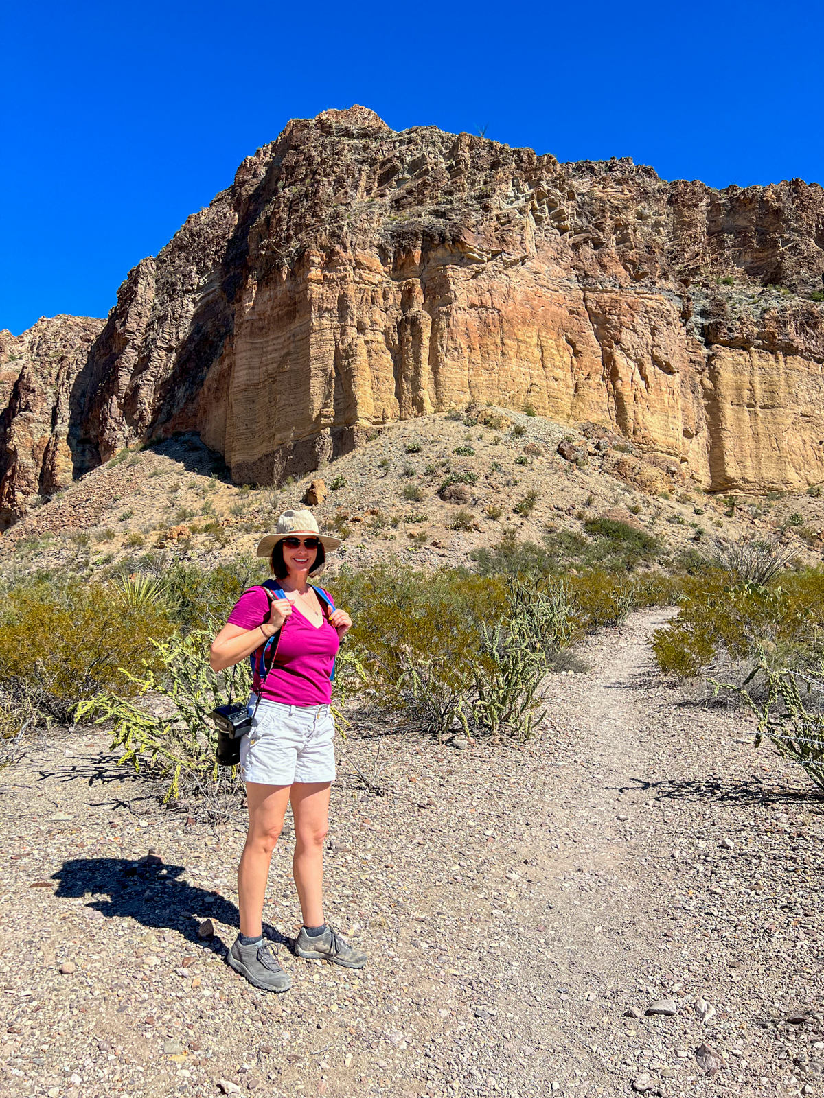
On our first morning in Big Bend National Park, Kel and I drove straight from the Panther Junction Visitor Center to the Santa Elena Canyon to hike before it got busy.
After the hike, we enjoyed the incredible scenery on the drive back before calling it a day and getting dinner in Terlingua. I'd recommend the same approach if you've got one day in the park.
If you skip the hike at Santa Elena Canyon Trail, you'll save an hour, which you can spend in another part of the park (Chisos Basin would be my suggestion).
I will present the most interesting places to stop on the Ross Maxwell Scenic Drive from south to north as if you were to take the same approach as Kel and me. As this is a U.S. national park, there are marked signs along the road for everything I mention.
Santa Elena Canyon Trail

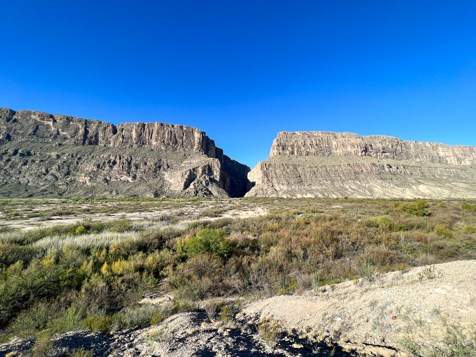
As I mentioned, the Santa Elena Canyon is the Ross Maxwell Scenic Drive's southern terminus. Here, a towering 1,500-foot wall has slowly been pulled apart by seismic activity along the Terlingua Fault.
The Rio Grande River runs through the narrow canyon walls, separating the U.S. from Mexico just as it does throughout Big Bend National Park.
The 1.4-mile hike was pretty easy. From the time we left the car to the time we got back, Kel and I took 75 minutes.
If you're not interested in the whole hike, it's a short five-minute walk on flat ground to get a clear view of the canyon's entrance-it's pretty impressive.
Santa Elena Canyon Overlook
The first stop on Ross Maxwell Drive heading north from Santa Elena Canyon is a scenic viewpoint. It's a quick and easy stop to get another perspective on the canyon, though you can skip it if your time is limited.
Castolon Visitor Center

Drive 7.8 miles east of Santa Elena Canyon overlook to reach the Castolon historical district. It's just after the turnoff for Cottonwood Campground, a site big enough for a spacious 12 person tent.
Here, you can learn about an early twentieth-century cotton boom from 1922 to 1942, run by businessman Wayne Cartledge. He grew about 100 acres of cotton, totaling nearly one million pounds over his 20-year run.
Today, the only remnants are some of his old cotton gin machinery, which helped to separate the seeds from the cotton, thus increasing its value.
In 2019, a wildfire in Mexico jumped the Rio Grande River and burned several historical structures in Castolon.
As it was noon, I bought a turkey and cheese sandwich from a small convenience shop, and we had a quick lunch at a picnic table in the shade.
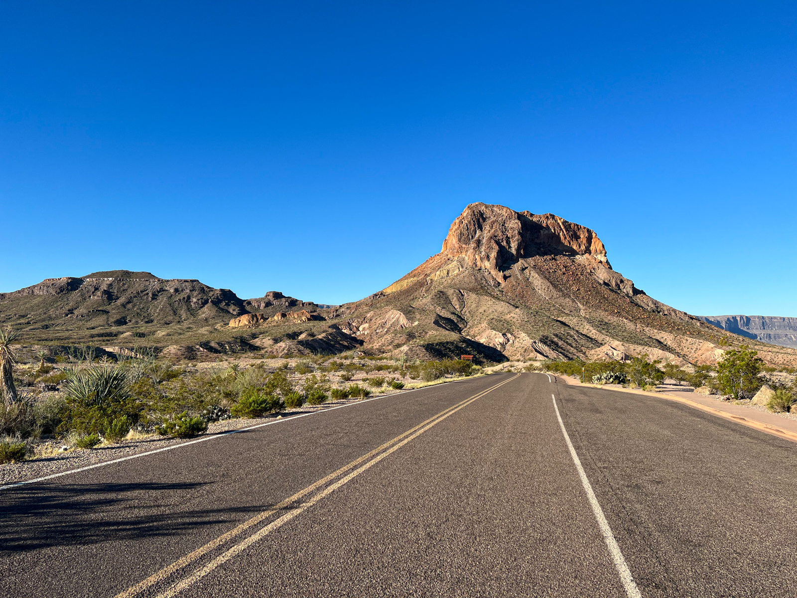
Tuff Canyon Overlook
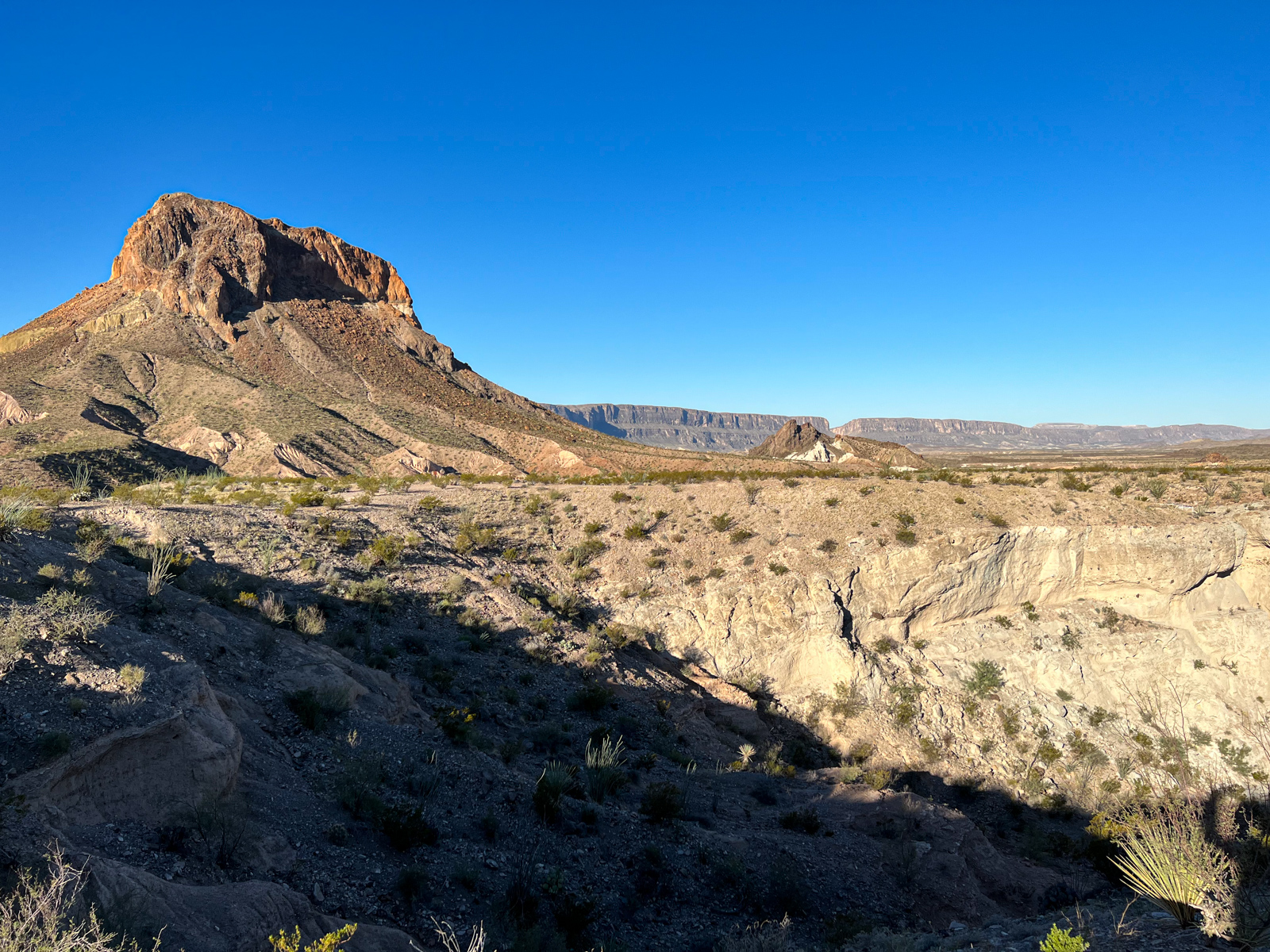
It's a 2.8-mile drive from the Castolon Visitor Center to the Tuff Canyon overlook. You can see the Cerro Castellan mountain, Tuff Canyon, and the Santa Elena Canyon in the distance.
Tuff is a term for compressed volcanic ash, and the canyon is named after the material from which it is made. The easy one-mile Tuff Canyon Trail runs through the gorge and takes about 30 to 60 minutes to walk (round-trip).
Mule Ears Viewpoint
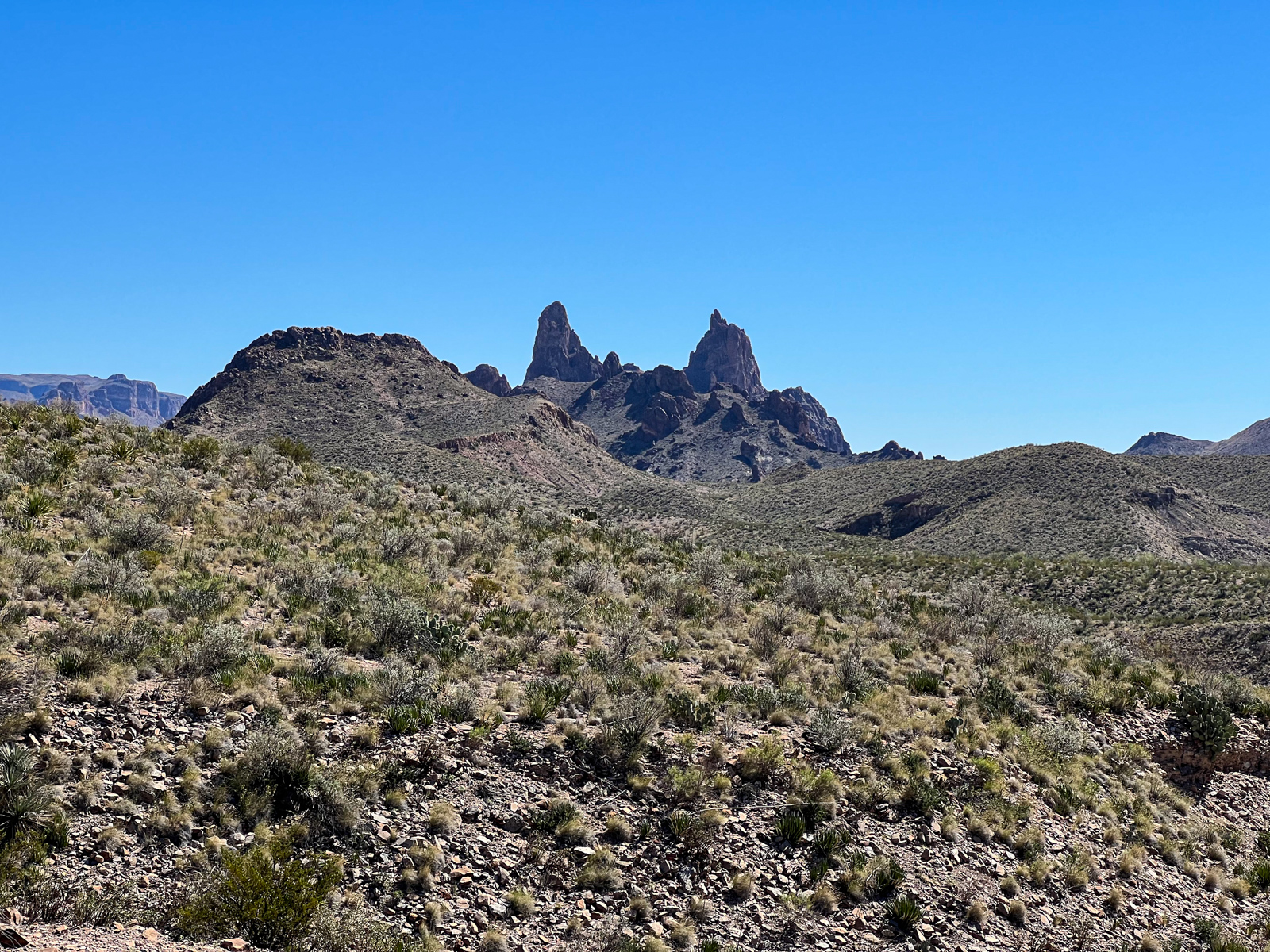
Continue north from Tuff Canyon for 4.9 miles to reach the Mule Ears overlook. Look south to see the Mule Ears Peaks, two rock spires that make for silly photos.
The easy-to-moderate 3.9-mile Mule Ears Springs Trail begins from this parking lot. It's a shadeless walk through the desert that ends at the Mule Ears spring.
Lower Burro Mesa Pour-off Trail
A 6.2-mile drive north of Mule Ears is the trailhead to the Lower Burro Mesa Pour-off Trail (a mouthful, I know). Kel and I stopped to do this easy one-mile hike and had the nature trail to ourselves in the mid-afternoon.
The trail follows a gravel creek bed into a box canyon, ending at a 100-foot-high pouroff carved through the Burro Mesa by summer rains.
A pouroff is a seasonal waterfall, meaning it's dry in the off-season and prone to flooding during periods of heavy rain. For Big Bend, that's in the summer, so it's essential to know the forecast before hiking here.
The scenery is fantastic. The yellow and orange bands in the bluffs (as pictured above) are ash-flow tuffs, geologic features that reflect the region's volcanic past.
Sotol Vista Overlook
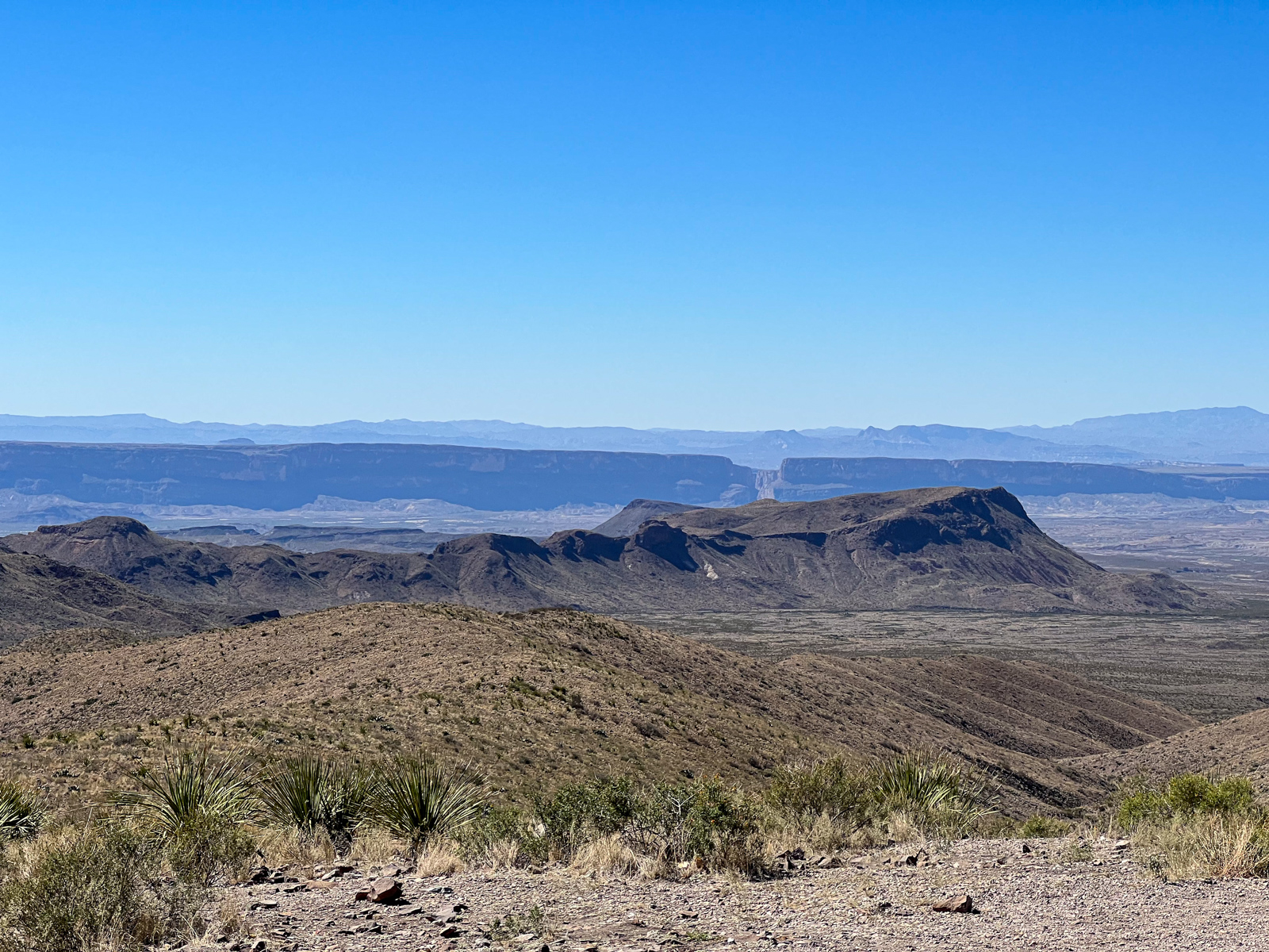
Continue north on the Ross Maxwell Scenic Drive for 5.4 miles to reach the Sotol Vista Overlook, a beautiful viewpoint offering an expansive look at Big Bend National Park.
Looking south, you can see the Santa Elena Canyon in the distance. Beyond that imposing wall, you're in Mexico. A spacious parking area makes it easy to stop here.
Homer Wilson Ranch

Less than a minute north of the Sotol Vista Overlook is a viewpoint for the historic Homer Wilson Ranch, abandoned in 1945.
If you want to see the old buildings more closely, the end of the 11.5-mile Blue Creek Ranch Trail runs between the Ross Maxwell Scenic Drive and the ranch.
Upper Burro Mesa Pour-off Trail
The Upper Burro Mesa Pour-off Trailhead is less than a mile north of the Homer Wilson Ranch. This moderately strenuous 3.5-mile hike takes about two hours to complete.
The end of this trail is the same pouroff you see from the Lower Burro Mesa Pour-Off Trail, only now you're viewing it from above.
Sam Nail Ranch
The last point of interest when driving north on the Ross Maxwell Scenic Drive is the Sam Nail Ranch, which features a short trail (0.5 miles) around an old adobe two-room home built by Sam Nail in 1916.
This ranch is about 3.6 miles north of the Upper Burro Mesa Pour-off trailhead or 3.4 miles south of Panther Junction Road, where the scenic drive begins.