The Hot Springs Canyon Trail is a moderately challenging 5.6-mile hike along the Rio Grande River in eastern Big Bend National Park.
The day after Kel and I hiked the Santa Elena Canyon Trail at the end of the Ross Maxwell Scenic Drive, we explored Big Bend's hot springs.
At one of Big Bend's visitor centers, we were informed that heavy rains had washed out Hot Springs Road the previous week.
There's a small parking lot at the end of that access road. From there, it's a short 0.5-mile round-trip hike on the Hot Springs Historic Trail to reach the Langford Hot Springs.
Despite the road closure, we checked it out anyway, knowing there's a longer, alternative route via the east on the Hot Springs Canyon Trail.
We'd spent the morning exploring the Chisos Basin and some scenic viewpoints along the way, so it was about 12:30 p.m. when we reached the turnoff for Hot Springs Road.
The road was indeed blocked off. However, a few cars were parked at the intersection; people were hiking down the road.
Checking Google Maps on my phone, I did a quick calculation and determined that with the extra walking on the access road, it wasn't that much shorter than taking the Hot Springs Canyon Trail.
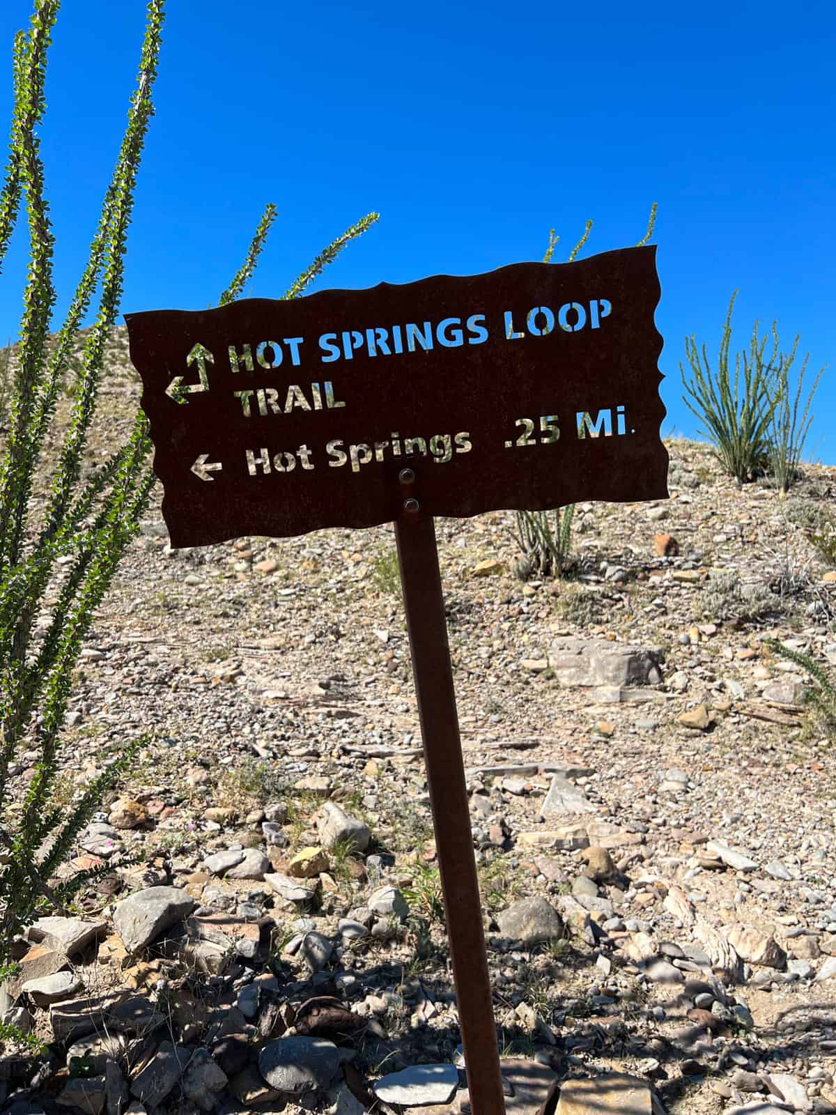
Hot Springs Canyon Trail
We continued driving east and stopped at the Rio Grande Village Store, where we chatted with the saleswoman inside about the hike. She said it's certainly the more scenic option.
We reached the Daniels Ranch parking lot near the Hot Springs trailhead at about 1 p.m. I was concerned we'd do a 5.5-mile hike in hot weather without shade.
I had a 20-ounce water bottle, but I'd brought my small Patagonia backpack, which didn't have space for much more than my bottle, bathing suit, and towel. Kel's water bottle was smaller than mine.
She'd been excited to visit the natural hot springs since we began talking about a road trip to Marfa and Big Bend National Park, and I didn't want to be the one to cancel.
The trail sign indicated the hike was 6.0 miles with 921 feet in total elevation gain. According to my watch, that distance might include hiking past the hot springs to the start of the Hot Springs Historic Trail, as we only walked about 5.5 miles.
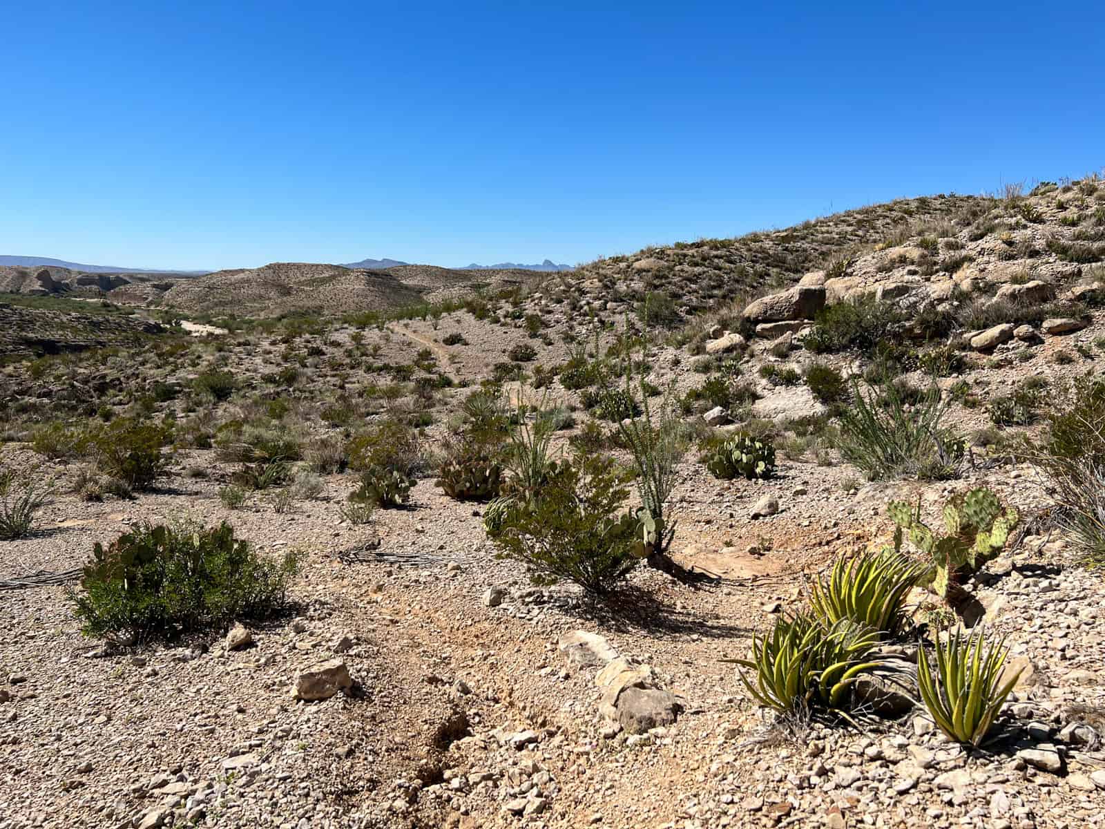
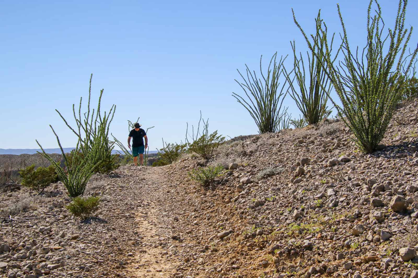
The Hot Springs Historic Trail starts with a steep rocky incline before leveling off. There's no shade, so I was glad we were doing the hike in October-summer would be unbearable and dangerous mid-afternoon.
The trail was pretty clear to follow, but disappeared into the brush at times, giving us pause as to where to walk.
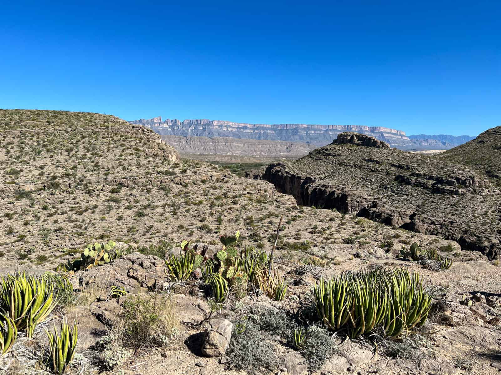
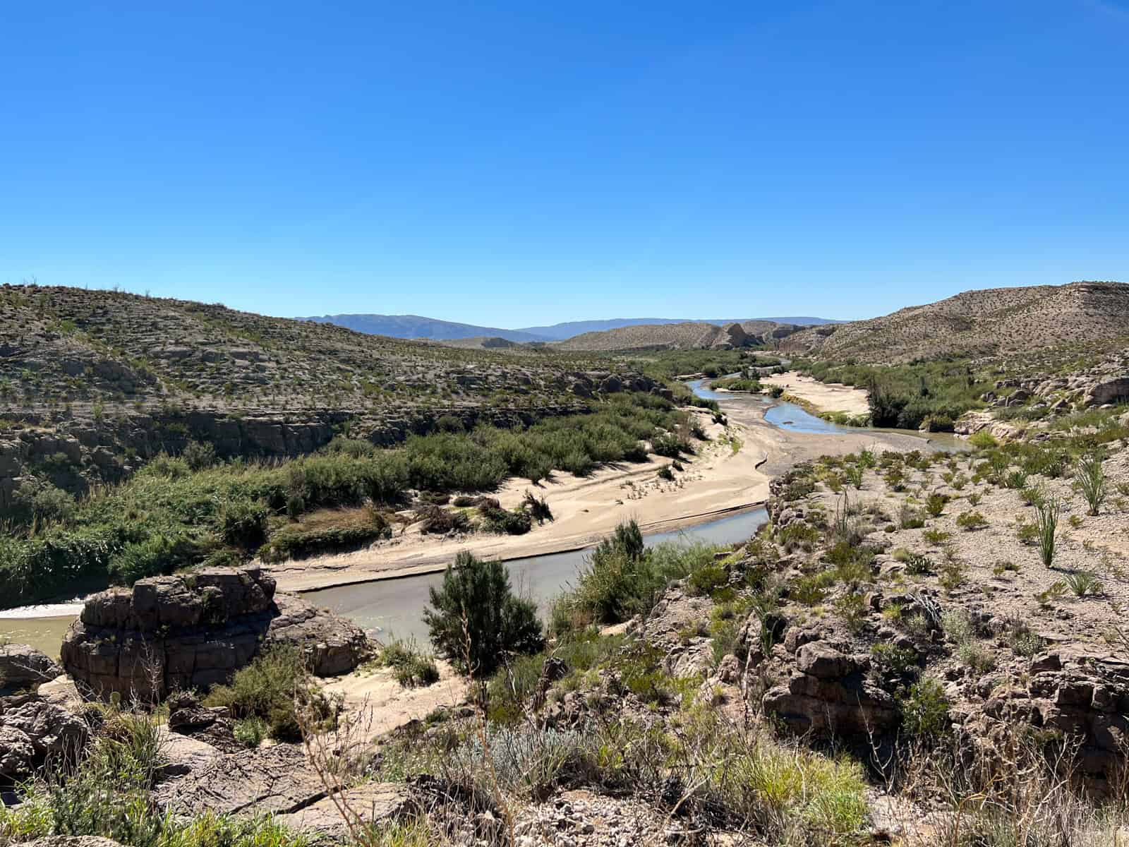
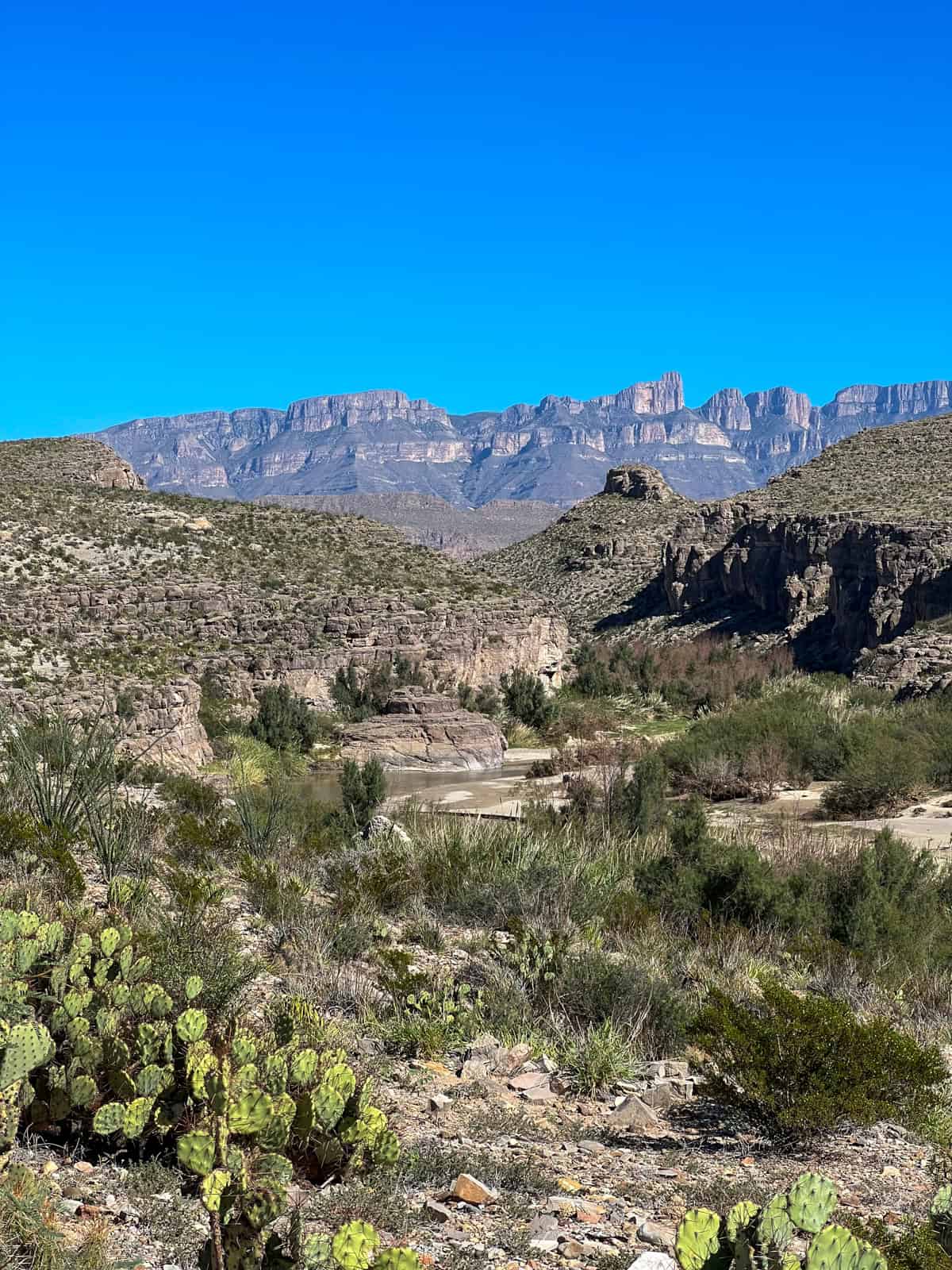
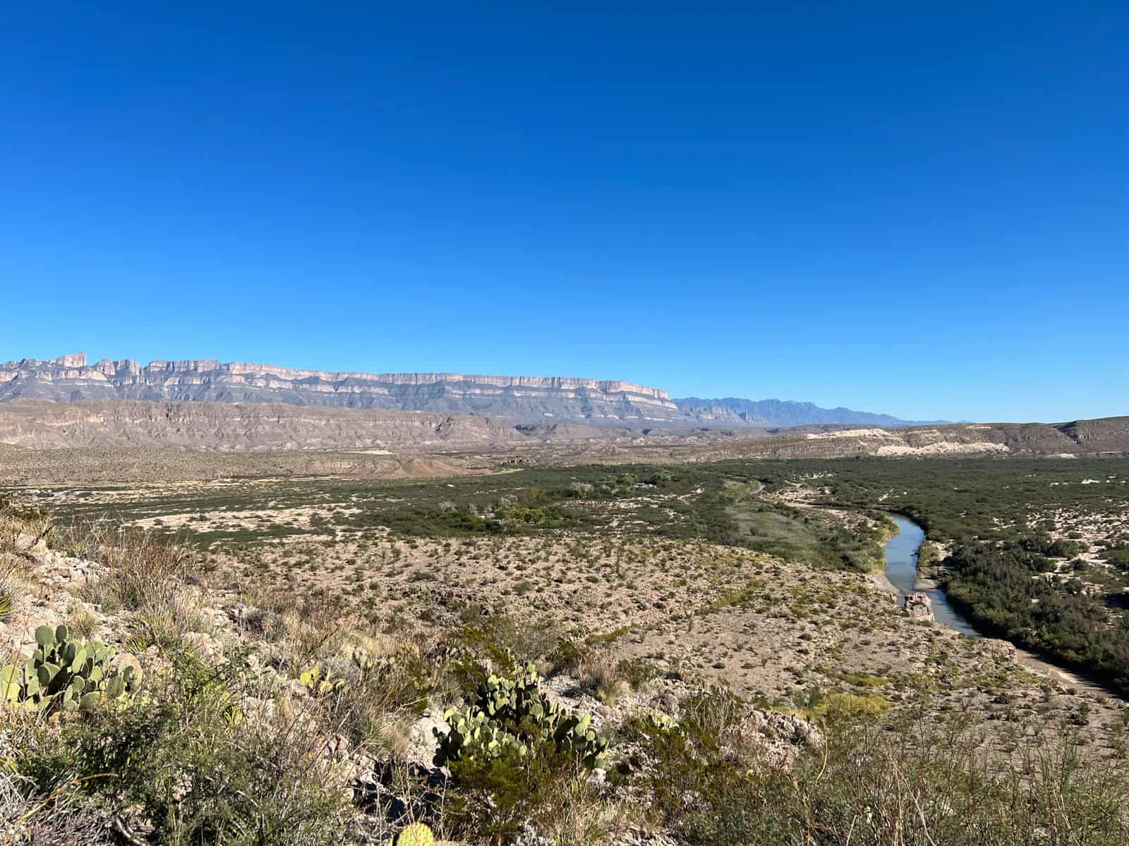
Once we'd hiked up in elevation, there was a point where we could see the rugged Hot Springs Canyon in the foreground and the imposing Sierra del Carmen mountains of Mexico in the distance.
At about 2 p.m., around one hour into our desert hike, I was relieved to catch our first glimpse of the Rio Grande River snaking along the U.S.-Mexico border. We were getting closer to the hot springs.
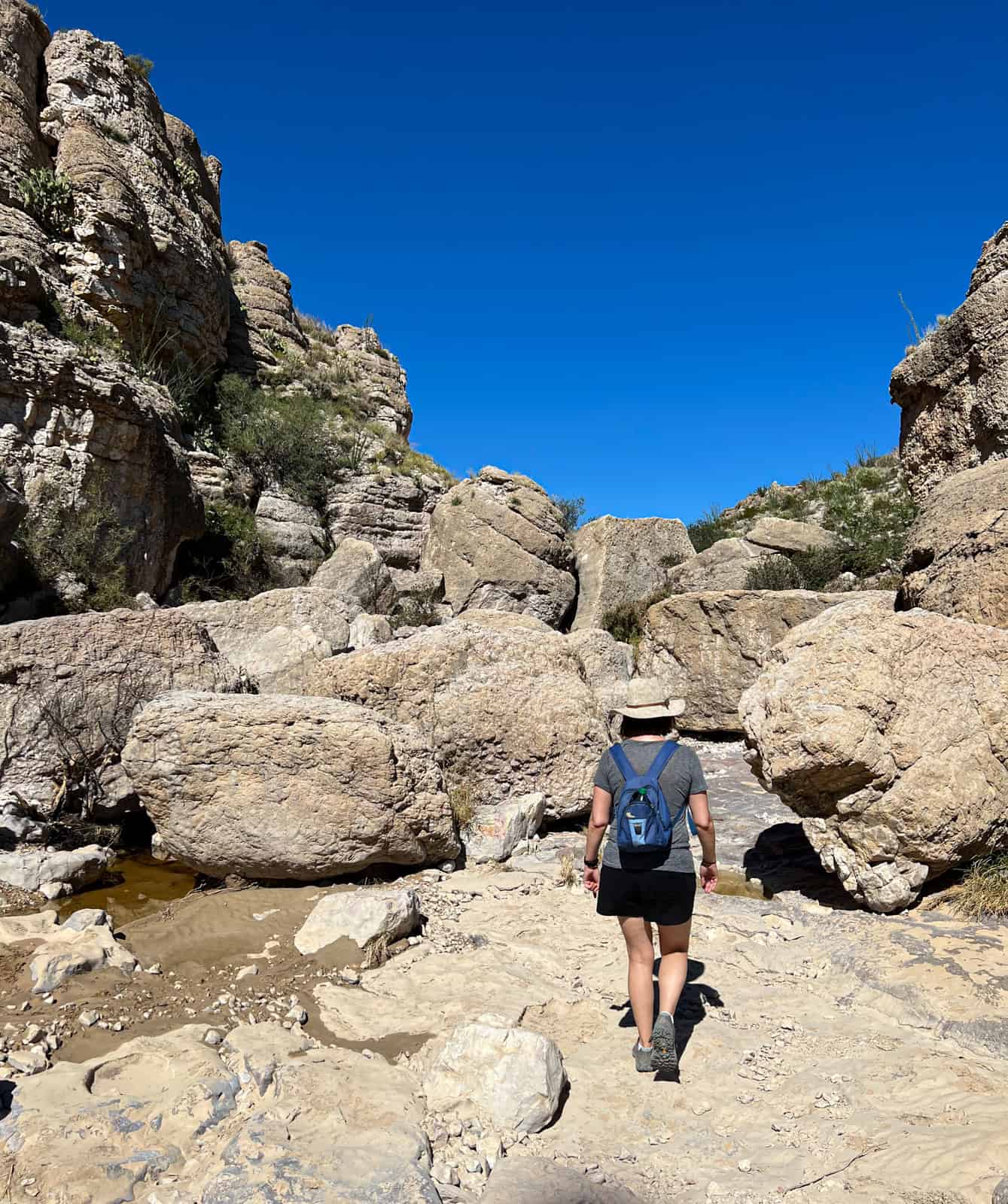
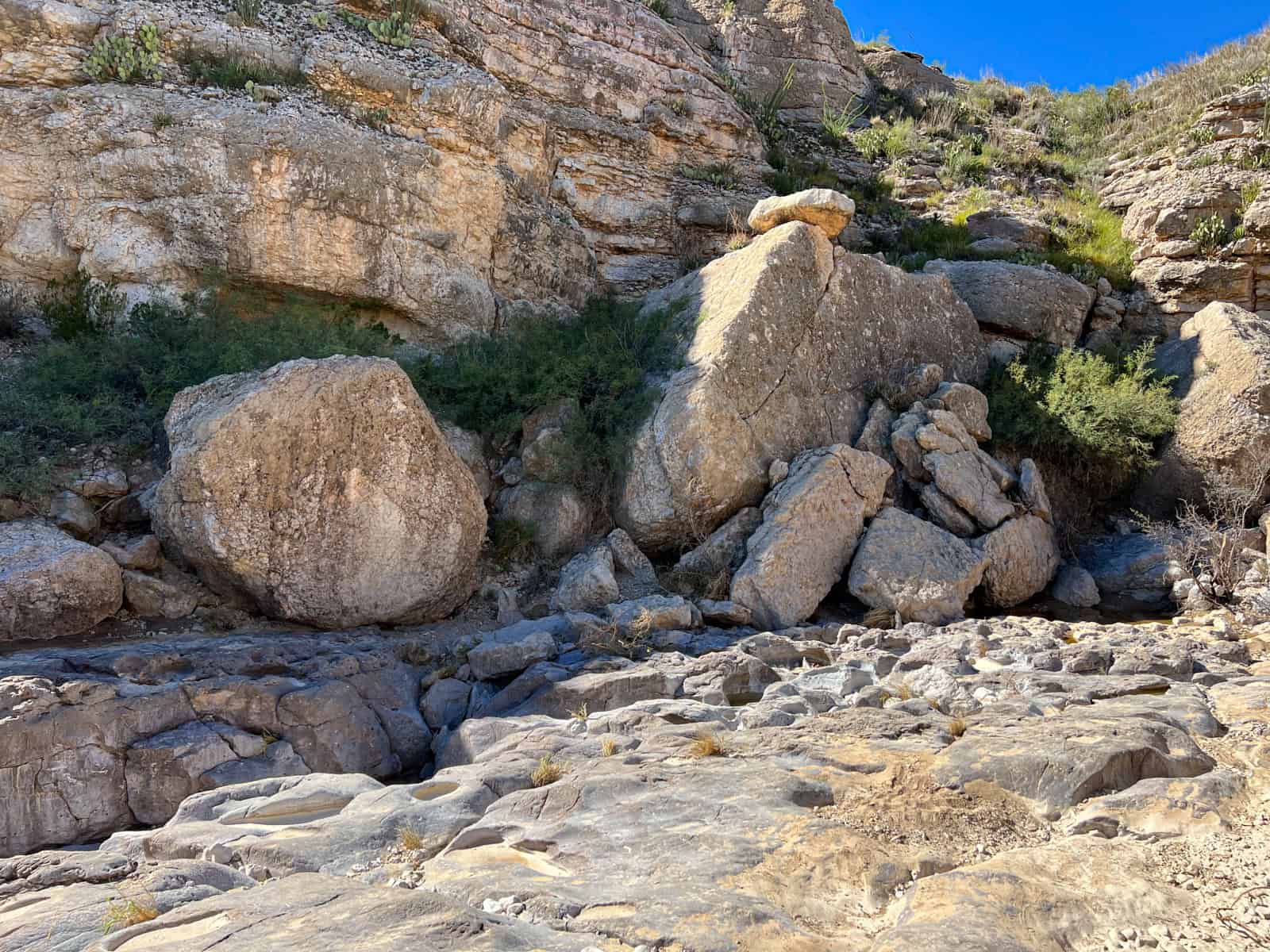
Soon after, we arrived at a boulder-strewn section of the Hot Springs Historic Trail. I passed some fresh poop on the rocks, hoping it wasn't from a mountain lion, which had recently been spotted on a camera trap in the area.
It wasn't immediately clear where the trail went next, so it took us a minute to figure it out. Thankfully, I still had a GPS location on Google Maps (on my iPhone), so I could tell if we would ever go off the trail.
Once we'd solved that problem, I felt more confident in our ability to safely hike to Big Bend's hot springs and back to the car. Still, I rationed my drinking water and encouraged Kel to do the same.
We passed a sign indicating the hot springs were only 0.25 miles away, a significant relief after 90 minutes of desert hiking.
Big Bend Hot Springs
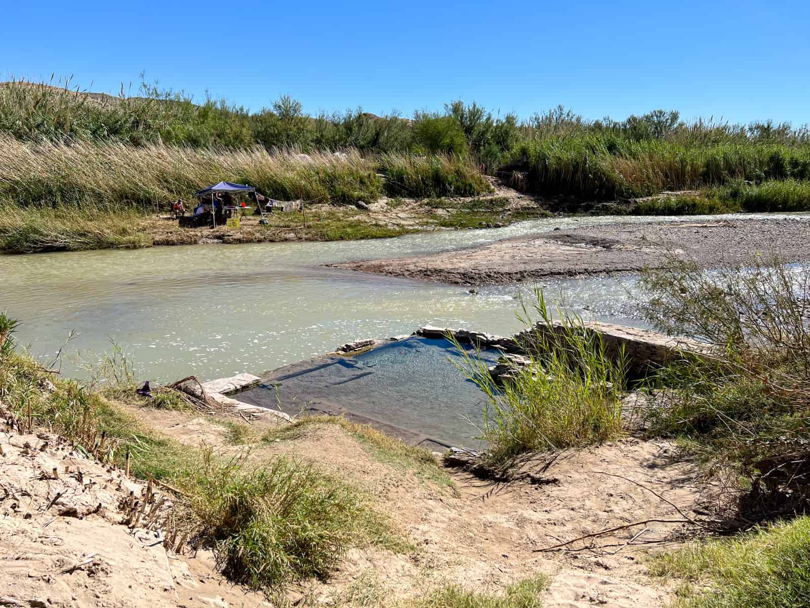
As we descended to the Rio Grande River in that last quarter-mile, the rocky terrain turned to sand until we were upon the hot springs. They were tiny!
Before our trip, I'd read that flash floods from heavy rain can cover the hot springs in mud and silt. It's easy to see how that can happen as the hot springs are at river level. We lucked out and were happy to see clear water and an opportunity to dip.
There were no changing rooms or facilities, so we just held up a towel for one another as a few Mexican people were cooking tamales on the other side of the river.
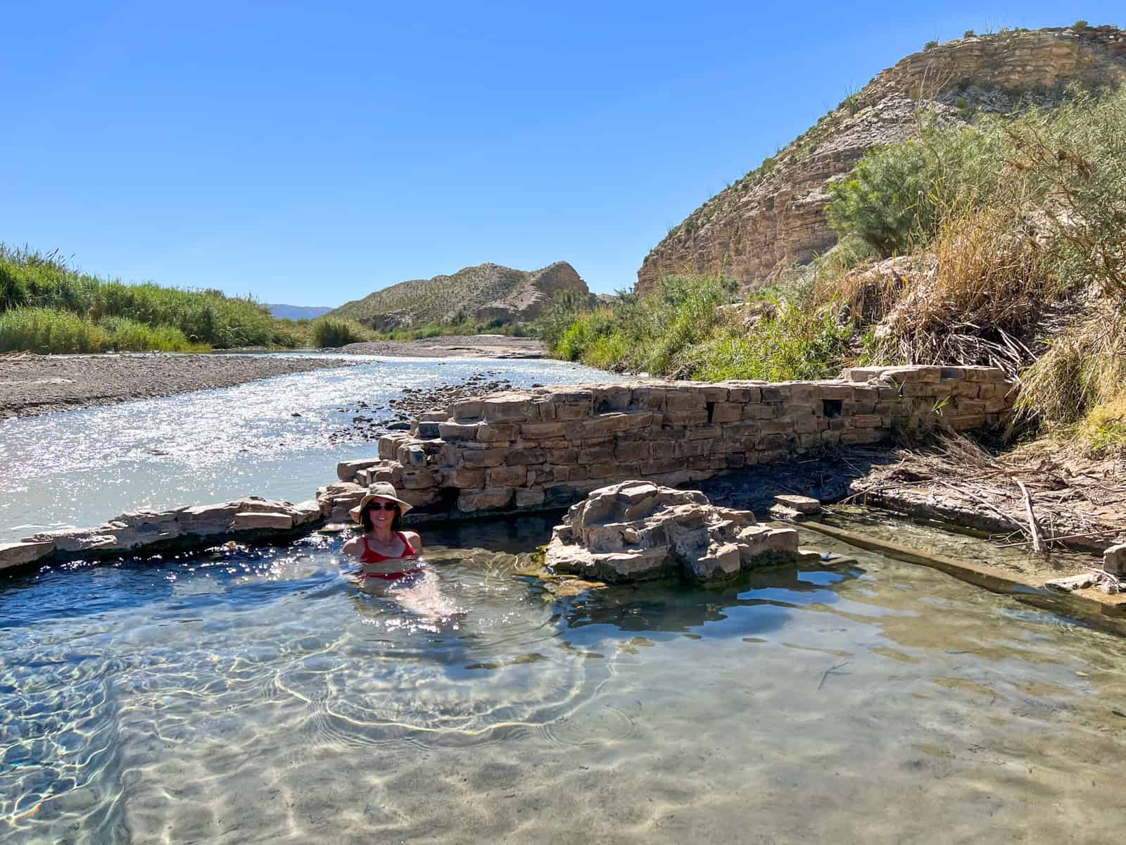
The water in the hot springs was warm but not too hot, which I appreciated, given that we were in a desert. We spent about 15 to 20 minutes there in total.
As we were packing up to hike out, another couple arrived, and the tall guy confidently strode across the river to buy a tamale. They'd been there before. I was surprised at how shallow the river was, though I imagine it changes quickly when it rains.
Hike Back to the Car
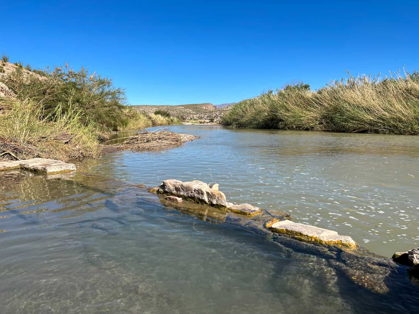
The hike back to the car was familiar as you walked out the way you came in. Now I was hiking in my Prana board shorts as I didn't want to bother changing again.
The sun and heat were getting to me. I was slowly running out of water. I fantasized about taking big gulps from the extra bottles in the car.
As much as I didn't want to encounter a rattlesnake in Big Bend National Park, I secretly did as long as it was from a safe distance.
I constantly scanned the rocky terrain of the Hot Springs Historic Trail but came up empty. Camouflaged snakes may have been in short supply; however, incredible views were plentiful.
The hike back to the car gave me an even greater appreciation for Big Bend National Park's rugged beauty.
Related: Things To Do in Big Bend
Unlike the three shorter, easier trails we'd done previously, hiking the Hot Springs Historic Trail felt like earning my supper and a cold beer. We reached the car after about three hours total. I chugged plenty of water to rehydrate and felt a sense of accomplishment.