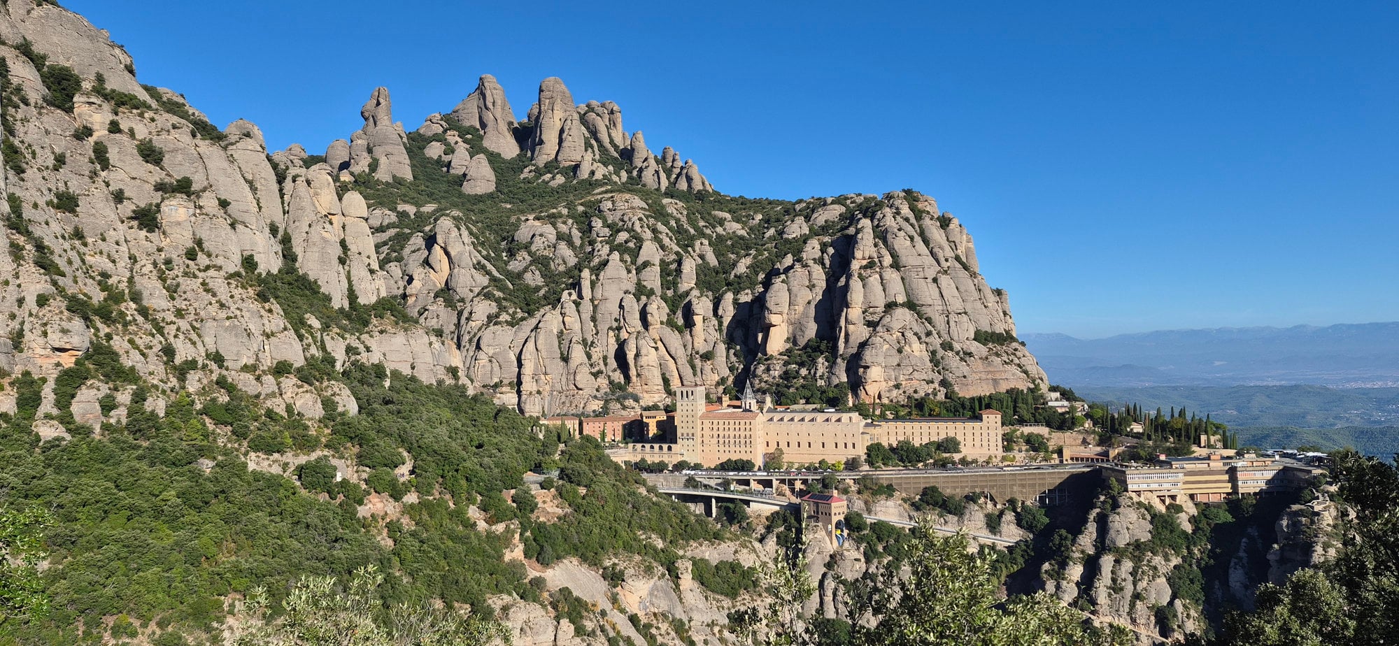
Montserrat is a mountain near Barcelona, Spain, and home to the Abbey of Santa Maria de Montserrat. This hike starts in Collbató and follows the Camí Vell, an old pilgrimage route, past stone waymarks and viewpoints to the monastery.
Today we are going up to this old shrine by one of the paths used by legendary pilgrims and hermits who came to venerate the famous Virgin Mary. This is why the place of worship was founded more than a thousand years ago.
Route Data
| Item | Value |
| Trailhead | El Pujolet (Collbató) |
| Distance | 15.52 km / 9.64 mi (there and back) |
| Total elevation gain | 663 m / 2,175 ft |
| My moving time / total time | 2 h 14 min / 2 h 48 min (there and back) |
| Walking time according to the mountain board (Patronat de la Muntanya de Montserrat) | 1 h 50 min (1 h 35 min up + 15 min down to the monastery) |
| Difficulty | Easy |
The Camí de la Costa
The Camí de la Costa is a well-known path once used by men, pack animals, and traders to reach Montserrat. Traffic on this route into the mountain mattered so much that even Peter III, king of Aragon, made his pilgrimage to Montserrat along this historic path in 1344.
The route starts on Montserrat's southern side, in the old village of Collbató. This place is so extraordinary that even the devil himself took to deceiving the mountain's hermits, and that is where the legend of the famous hermit Fra Garí comes from: he gave in to worldly pleasures after listening to the devil disguised as a holy man.
Getting to the Trailhead
The route starts at El Pujolet in Collbató on the south side of the mountain. If you have a vehicle, you can drive straight there. If coming by bus from Barcelona, choose a Monbus departure that stops inside Collbató village. From there, it's a short walk to the El Pujolet trailhead.
By public transport from Barcelona
| Detail | |
| Operator and line | Monbus. Barcelona-Esparreguera-Igualada |
| Stop in Barcelona | Avinguda Diagonal, Maria Cristina |
| Stop in Collbató | Collbató village stop. |
| Frequency | Varies by day. Check the Monbus timetable. |
| From the stop to the trailhead | 10 minutes, 800 m (half a mile) |
The Route, Step by Step
1. Setting off From El Pujolet
km 0 · elevation 407 m (1,335 ft) · suggested start 8:00 a.m.
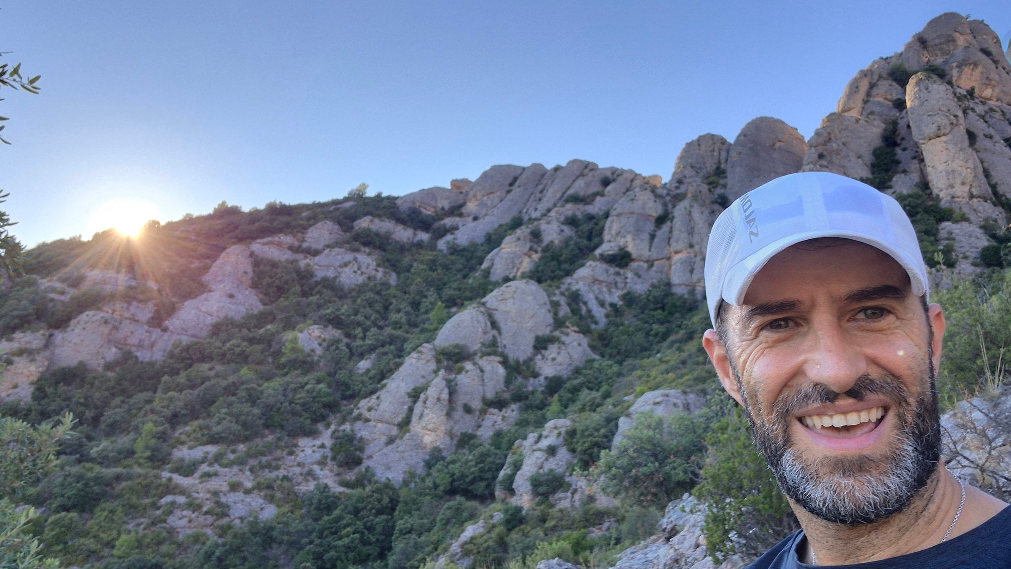
We set off early from El Pujolet. Starting along this legendary path first thing in the morning is pure magic. The first rays of sun stroke the mountain, and the summits begin to take on color.
2. The First Section
km 2.12 · elevation 571 m (1,874 ft) · elapsed time 23 min 30 s
The path is quiet. As I say, it was an old pilgrim way up to the monastery, and the gradients are gentle. On clear days we can make out the Mediterranean in the distance.
Little by little we gain height. It is a good idea to go up the mountain as the old ascetics did: in silence, listening to the mountain and its sounds. With luck, you may come across some of its inhabitants.
3. The Pilgrim Waymarks
km 3.03 · elevation 719 m (2,359 ft) · elapsed time 36 min 13 s
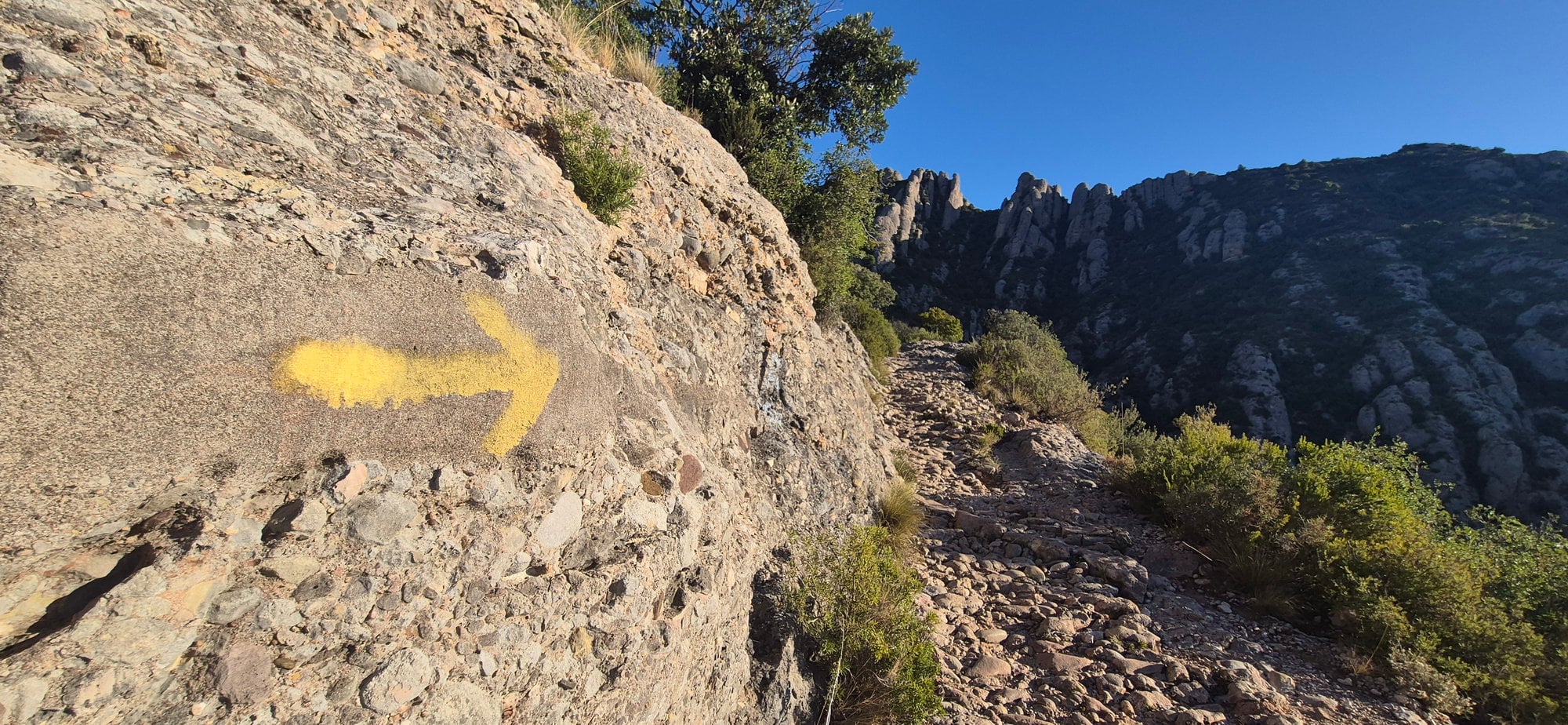
Along the way, at the start and as we go, we see signs showing us that we are on a very old pilgrim route, one still in use today.
We walk this fine old path and notice that in many stretches the stone paving still survives. The path was made good so pack animals and traders could reach the Marian monastery of Santa Maria de Montserrat.
km 3.50 · elevation 771 m (2,530 ft) · elapsed time 42 min 50 s
Almost without noticing, we reach the turn-off towards the Sant Joan sector. We carry on straight and don't take it because we are following the original path, the Camí Vell de Collbató al Monestir.
The summits and sharp needles of Montserrat soon appear ahead, showing all their character and coming out to greet us. Around every bend, the mountain gives us a new picture, like a film sequence.
4. Pla dels Soldats (Pla de Sant Miquel)
km 5.33 · elevation 850 m (2,789 ft) · elapsed time 1 h 00 min
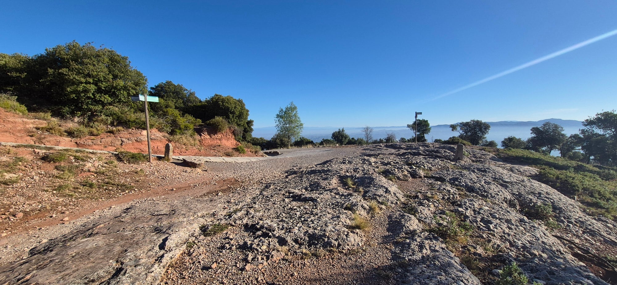
About 18 minutes later we reach the Pla dels Soldats, or Pla de Sant Miquel. Here we leave the southern side and enter the monastery's surroundings.
Several paths meet here, such as the Camí de les Ermites and the Camí de Sant Miquel, which we will take. This place mattered greatly to old pilgrims: reaching it meant they could almost breathe the monastery's air. They were very close, like us.
5. The Capella de Sant Miquel
km 5.93 · elevation 819 m (2,687 ft) · elapsed time 1 h 05 min
We continue along an easy track with the mountain on our left and soon reach the Capella de Sant Miquel. In these parts, long ago, the monastery's Abbot would come out to receive the day's important visitors.
6. The Creu de Sant Miquel
km 6.20 · elevation 777 m (2,549 ft) · elapsed time 1 h 14 min · 7-minute detour there and back
A little further down, off to one side of the path, we can make a short detour to see one of the most incredible views of the monastery from the famous Creu de Sant Miquel. It is one of the finest views of the monastery and is worth staying a while to enjoy.
The Marian monastery of Santa Maria de Montserrat appears in the distance, as if carved out of the rock. Beyond its roofs, crowned by the legendary conglomerate needles of the Tebaida area, la Mòmia (the Mummy), l'Elefant (the Elephant), la Prenyada (the Pregnant One), and a few more stand watch.
7. The Holm Oak Wood
km 6.57 · elevation 778 m (2,552 ft) · elapsed time 1 h 16 min
We carry on, perhaps hearing the bells announcing the eleven o'clock conventual Mass. A lovely holm oak opens ahead and keeps us company for a stretch where shade travels with us as we follow the Camí de Sant Miquel.
8. The Porta de Sant Miquel
km 7.00 · elevation 747 m (2,451 ft) · elapsed time 1 h 19 min
Shortly after, we pass the Porta de Sant Miquel. From there, sculptures and offerings left by the faithful appear at every step, reminding us of the faith that fills these places.
9. Arriving at the Monastery
km 7.76 · elevation 723 m (2,372 ft) · elapsed time 1 h 24 min
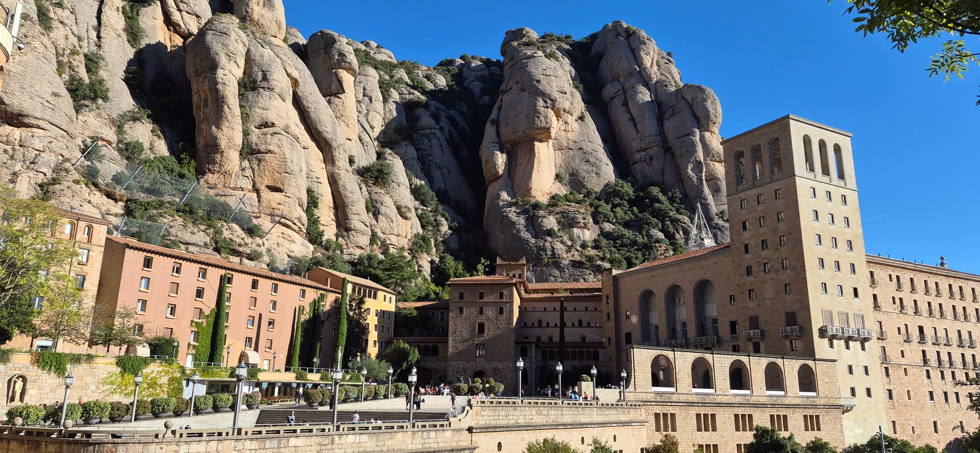
Little by little, we follow this paved road to the monastery's edge. We leave the Way of the Cross path on our left and continue to Placa de l'Abat Oliba, named after the monastery's founder in 1025, where a small church once stood.
We pass under the arch of Montserrat and walk the last few meters to the monastery's outer façade, carved from the mountain's stone after the Spanish Civil War.
Once in the Placa de Santa Maria, that outer façade stands right in front of us in all its magnificence, and surrounded by the huge conglomerate needles of Montserrat, we are standing in the famous Abbey of Montserrat.
10. What to Look at When You Arrive
Pilgrims as legendary as Saint Ignatius of Loyola got this far; he traded his sword for a pilgrim's habit in March 1522. That is how much Montserrat can change a person.
On the façade, below Saint George's feet, you can read the inscription "Catalunya serà cristiana o no serà" (Catalonia will be Christian, or it will not be). This phrase has become a symbol of Catholicism in Catalan society.
When you are here, do not forget to turn around: the mountain that holds this monastery, the one behind you, hides a whole area that was declared a natural park on 6 March 1987.
The path is straightforward and easy to follow. The Patronat de la Muntanya de Montserrat has signs at key points to show hikers which way to go. Once you are near the monastery, at the Pla dels Soldats, the way in is impossible to miss. Even so, it is always sensible to follow the route on a navigation device.
Signage
We will come across the mountain board's signs and pilgrim waymarks, usually yellow. One curious thing: we should always follow the arrows uphill, but at some point on the path we will find the same arrows pointing downhill. Ignore them.
This happens because the path is also the Camí de Sant Jaume, another pilgrim route that leaves the monastery of Montserrat and joins the Camino Francés, part of the Camino de Santiago.
Where people actually go wrong:
| Point | What happens | What to do |
| Camí de la Vinya Nova turn-off | Mistake: carrying straight on. | Take the right-hand fork, Camí Vell de Collbató a Montserrat. |
| Turn-off towards the Sant Joan sector | Mistake: taking the left-hand fork. | Continue straight; do not take any turn-off. |
| Arriving at the Pla dels Soldats | Mistake: taking the forks on the left. | Carry straight on along the dirt track, heading downhill. |
Difficulty and Terrain
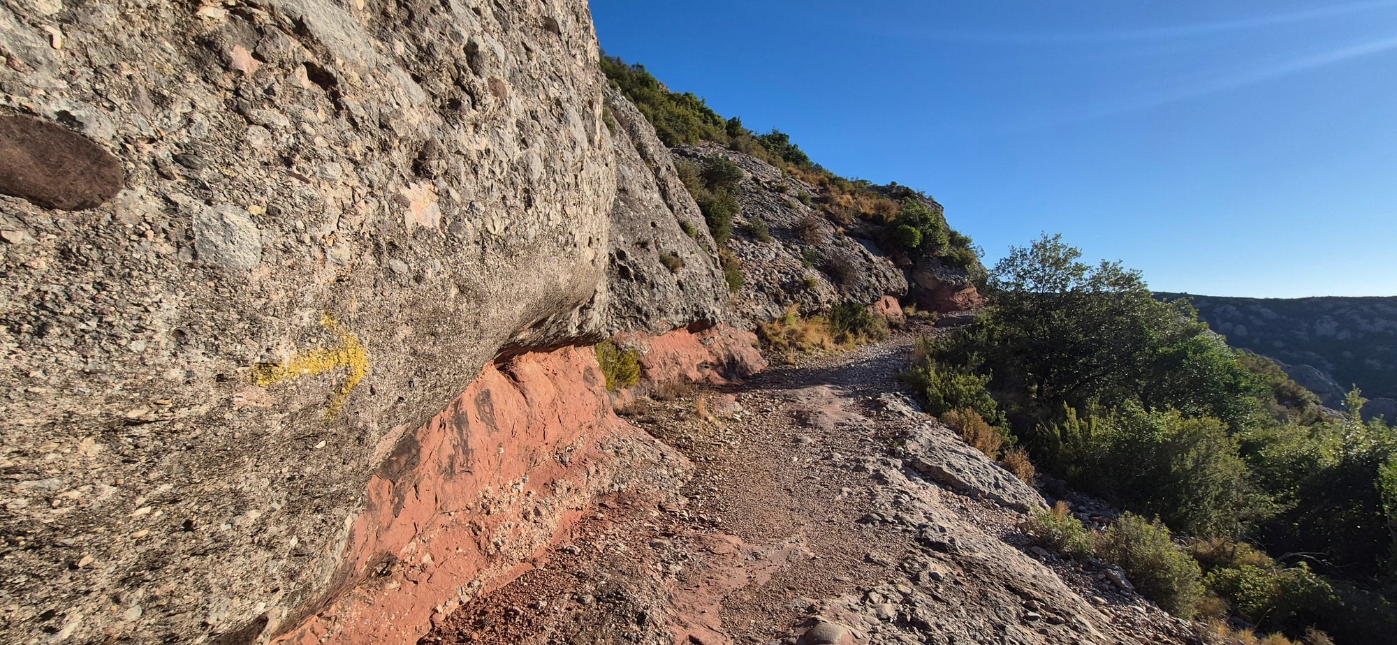
This route is not difficult. It involves following the path up gentle gradients on obvious ground until you reach the area closest to the monastery. The route suits regular hikers, families, and children used to mountain walking.
Terrain, section by section:
| Section | Surface | Gradient |
| El Pujolet to the Sant Joan turn-off | Stony path, well-trodden. Loose stones. | Uphill, +364 m (1,194 ft) |
| Sant Joan turn-off to the Pla dels Soldats | Stony path, well-trodden. Loose stones. | Uphill, +82 m (269 ft) |
| Pla dels Soldats to the monastery | Wide track | Downhill, -132 m (433 ft) |
The toughest part.
The first section, from El Pujolet to the Sant Joan turn-off, is the hardest and where most effort is concentrated. You climb about 364 m (1,194 ft) in 3.50 km, so even though it is gentle, pace yourself.
The old stone paving.
The path still has stretches of old stone paving, though erosion sometimes makes them hard to spot. These stretches mark the old pilgrim way that carried traders and animals up to the monastery.
Any exposed sections or scrambling?
No. The way is a simple path and asks only for attention, as it is a mountain path with loose stones and uneven ground.
Water, Heat, and Safety
Water
There is no water on the path until you reach the monastery, so carry 1 to 1.5 liters per person. At the monastery, there are restrooms and a small supermarket where you can restock whatever you need.
The Heat
This route is almost entirely in the open. Until we get to the monastery area, past the Pla dels Soldats, we will not have any shaded stretches, and by then we will already be very close to the monastery.
Emergency Number
The mountain has coverage at almost every point along the main paths and plenty of good signage. Download an offline map before you leave. In an emergency, call 112.
When to Do It
Take the weather into account whenever you go into the mountains. In summer especially, carry plenty of water, start early, and avoid midday. Visiting Montserrat in each season is a different experience. I recommend enjoying it in spring and fall.
| Season | Condition of the path | Advice |
| Spring | In perfect shape | Ideal time of year |
| Summer | In perfect shape | Avoid the middle of the day. Better to get up early and start first thing |
| Fall | In perfect shape | Ideal time of year |
| Winter | In perfect shape | It's colder, so watch your footing where it has frozen. Fewer hours of daylight |
Getting Back
| Option | Time | Price | Things to bear in mind |
| Walk back by the same path | 1 h 50 min to 2 h at an average pace (30 min up, 1 h 20 min down) | Free | The hours of daylight, and take enough water and food |
| Cremallera (rack railway) down to Monistrol | 15 min | €9 | It does not drop you in Collbató. |
| Cable car down to the Aeri de Montserrat station | 5 min | €10 | It does not drop you in Collbató |
If you left your car in Collbató
If you came to Collbató by bus or car, you will have to get back to Collbató. You have several options:
- Walk back, the classic option.
- Take a taxi from the monastery. +34 607 237 237
- You can also come off the mountain on the Cremallera de Montserrat (the rack railway) or the cable car, then take a taxi to Collbató. That would be a bonus for getting to know Montserrat. If you want all the information on that option, you can read up here.
Either way, this route takes you through the steps of the old pilgrims who came to Montserrat on the Camí de la Costa.
You can see with your own eyes and feel in your stride what it was like to cross the heart of this mountain the way the old travelers did, the ones who arrived at the house of Jerusalem, the Marian shrine of Santa Maria de Montserrat, as it says over its entrance: URBS JERUSALEM BEATA DICTA PACIS VISIO ("blessed city of Jerusalem, called the vision of peace").