Phoenix, Arizona, is one of the best places for hiking in the United States. Located in the middle of the state, Phoenix is a major metropolitan area surrounded by pristine nature trails and parks in the wild Sonoran Desert. While Phoenix is world-famous for hot weather and desert landscapes, it can also be a hiker's paradise.
Weekend fitness buffs can hike, bike, and walk all over the Valley of the Sun. There are many parks and trails in the Phoenix area, but the hike I recommend stands out as a particularly challenging one.
Spur Cross Ranch Conservation Area
I have visited Phoenix more than 20 times over the last 15 years and have gone on a hike nearly every time. My favorite areas are the Spur Cross Ranch Conservation Area and the Elephant Mountain Trail. I even added the Metate and Tortuga trails to create a "super loop," resulting in a route totaling nine miles (15 kilometers).
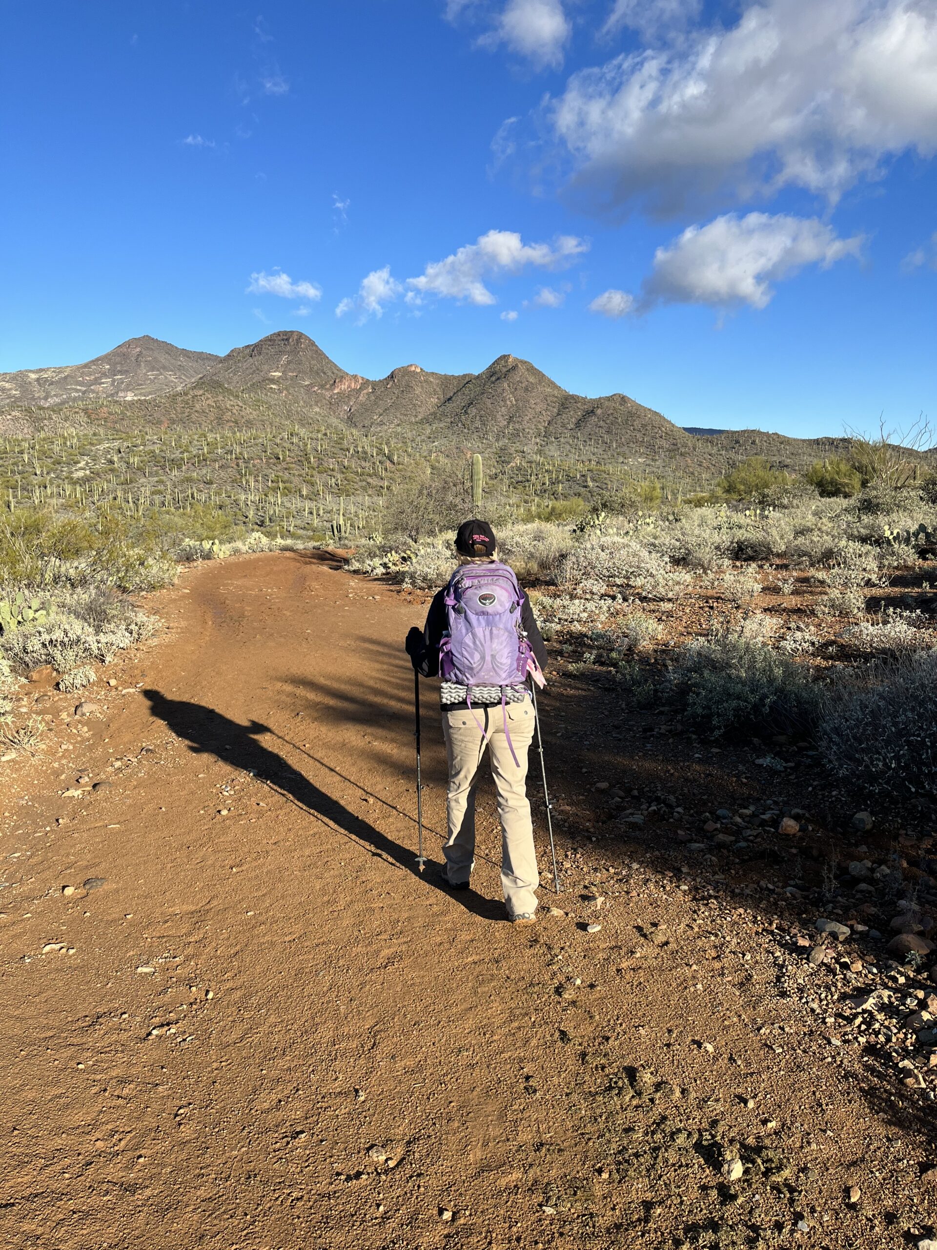
My Elephant Mountain Super Loop Trail is a sure way to get a great workout and spend time on the trail with very few people around. The last time my better half and I made the circuit was New Year's Day. The weather was clear and cold, with a temperature of just 43 F (6 C) at the trailhead.
Dangerous But Beautiful
This trail is hot and dangerous half the year. Signs at the trailhead warn of the heat and the importance of staying hydrated to make it back to the car. Additionally, diamondback rattlesnakes are a common reptile in this area.
The trail map warns that much of the route is steep and unmaintained and is not for novice hikers or equestrian travelers. Dogs on a leash are welcome at Spur Cross Ranch, and we see several pups near the start and the end of our hike.
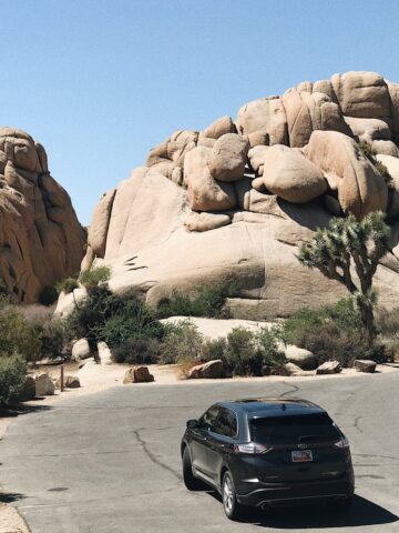
There are perhaps more than 80 dirt and gravel parking spaces at the Spur Cross Ranch Conservation Area entrance, but few spaces are taken on this New Year's morning.
Spur Cross Conservation Area is the newest addition to Maricopa County's Regional Park System. The area was once an old cattle ranch and mining claim, and several archaeological sites remain on the 2,154 acres (870 hectares) of Sonoran Desert land.
There are very few animals around this time of year, but the Arizona Audubon Society notes that this area is vital due to its diverse habitat, which supports a wide range of species. It is part of a global network of places recognized for their outstanding value to bird conservation.
See also: McDowell Mountain Hiking in Phoenix
Where is Spur Cross Ranch?
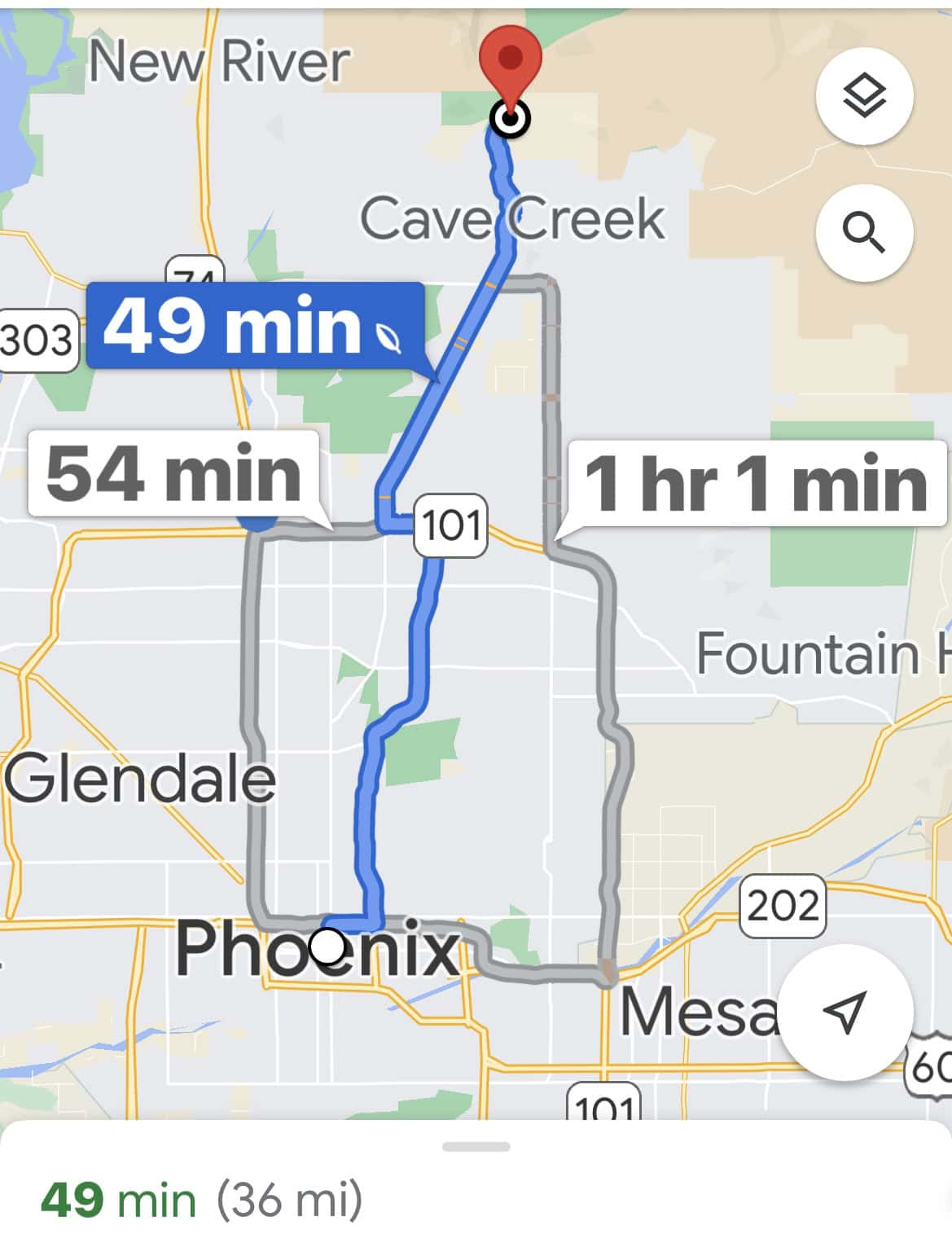
The Spur Cross Conservation Area is less than an hour north of Phoenix, just past the upscale but quaint historical towns of Cave Creek and Carefree. A simple request on your directional map app for "Spur Cross Trailhead" will take you there.
The drive is mostly freeway, but later changes to the back roads of "Old Town" Cave Creek, where a post-hike stop for lunch, dinner, or art gallery shopping is a must.
Cave Creek and Carefree have several hotels and motels. We stayed at a lovely Airbnb in Carefree, which had a view of Elephant Mountain and gorgeous open space in every direction.
As you arrive at the trailhead for the best hike near Phoenix, there is no fee for parking, but a $3 fee per person is collected by a volunteer docent at the gate.
We asked for a map and information about current conditions and hazards. This is a dream hangout for snakes during the warm months, but on New Year's Day, they are tucked underground for the winter.
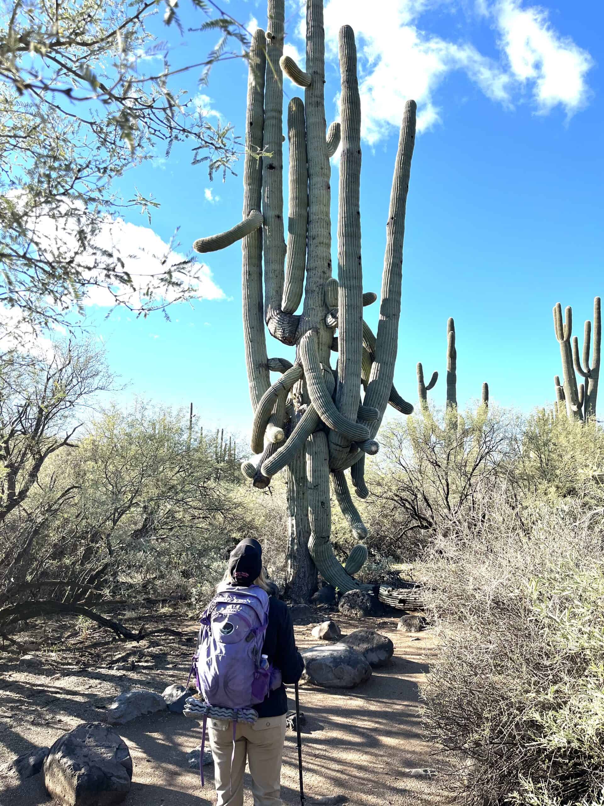
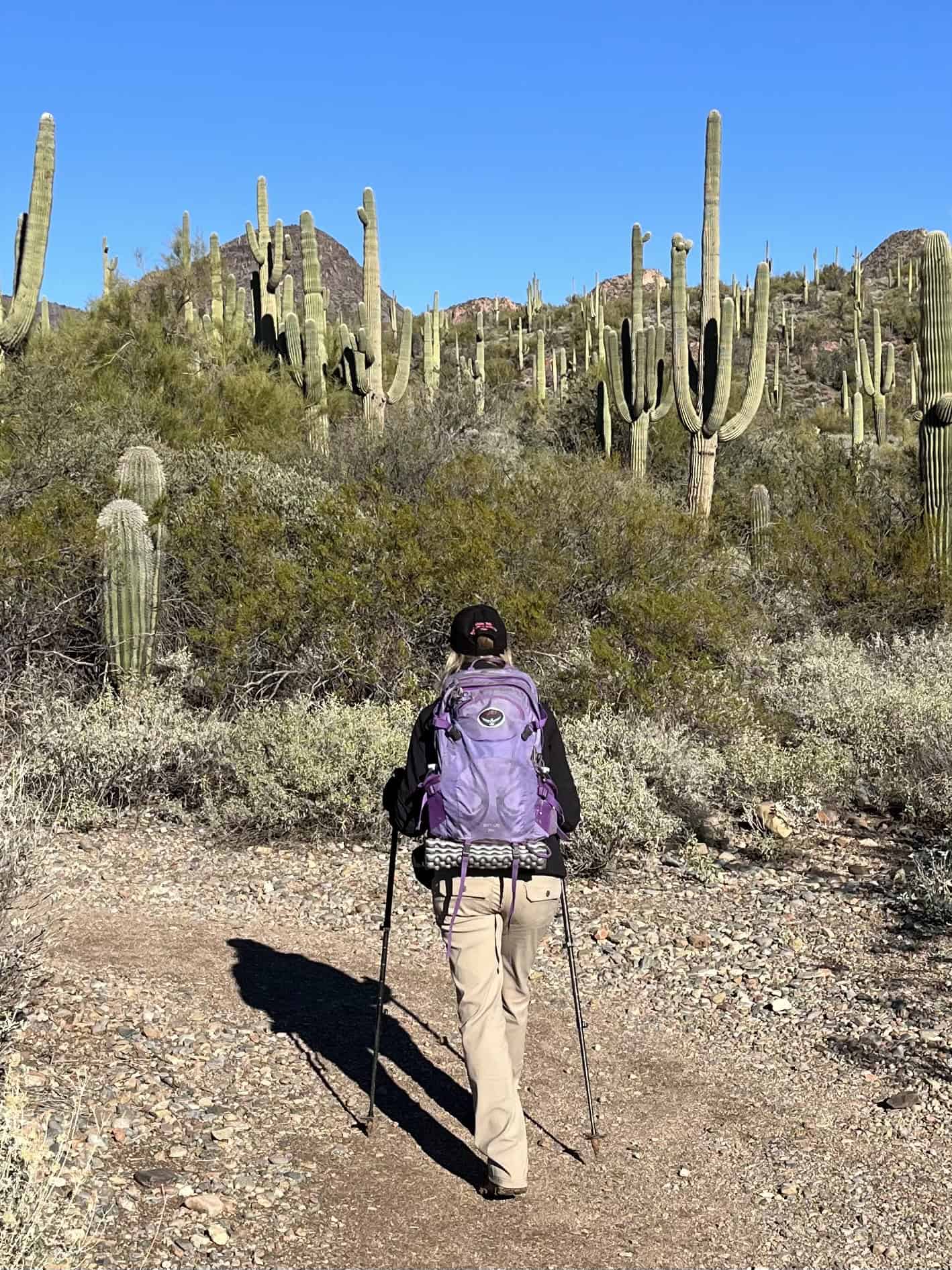
Cactus is Everywhere
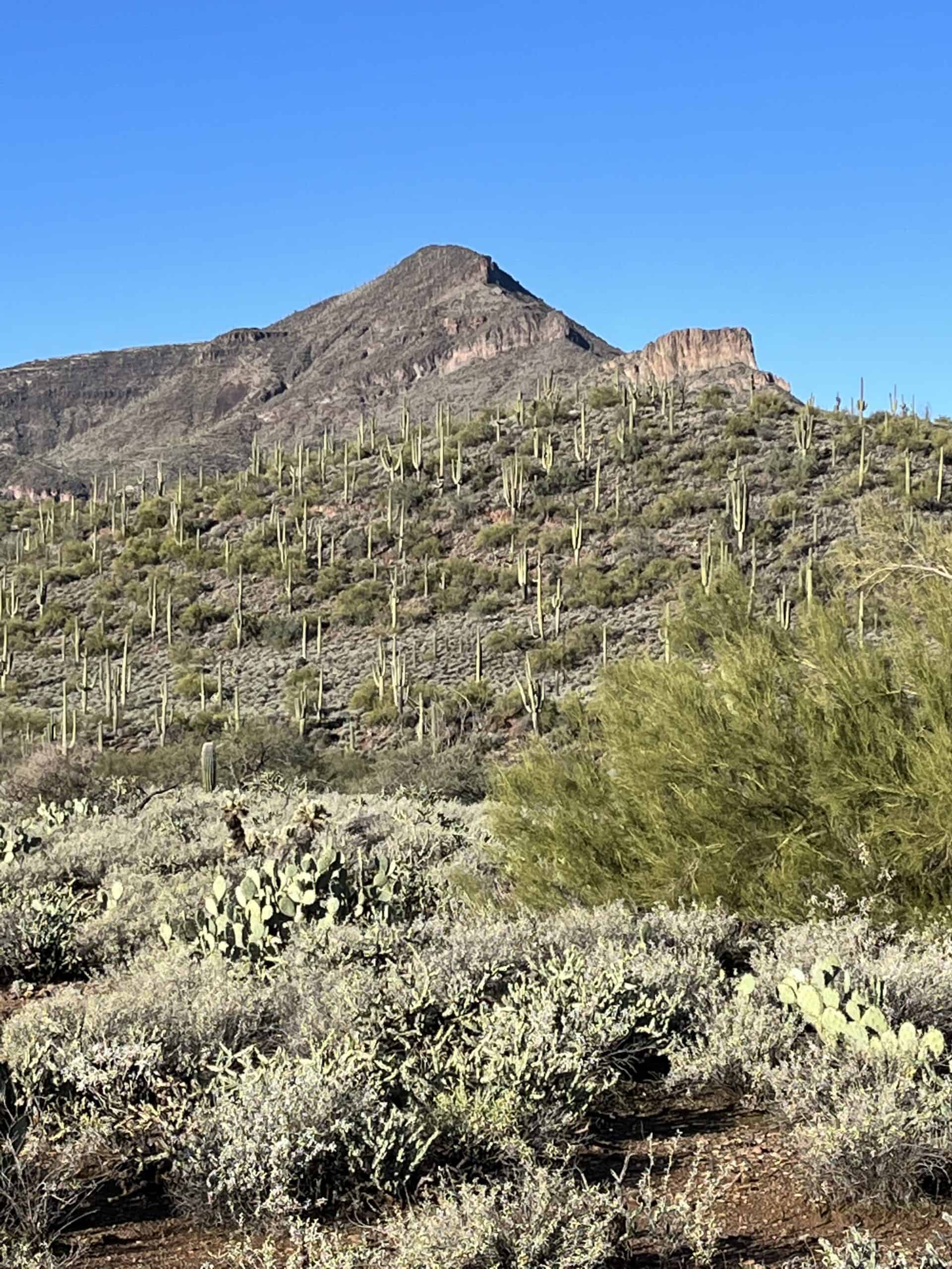
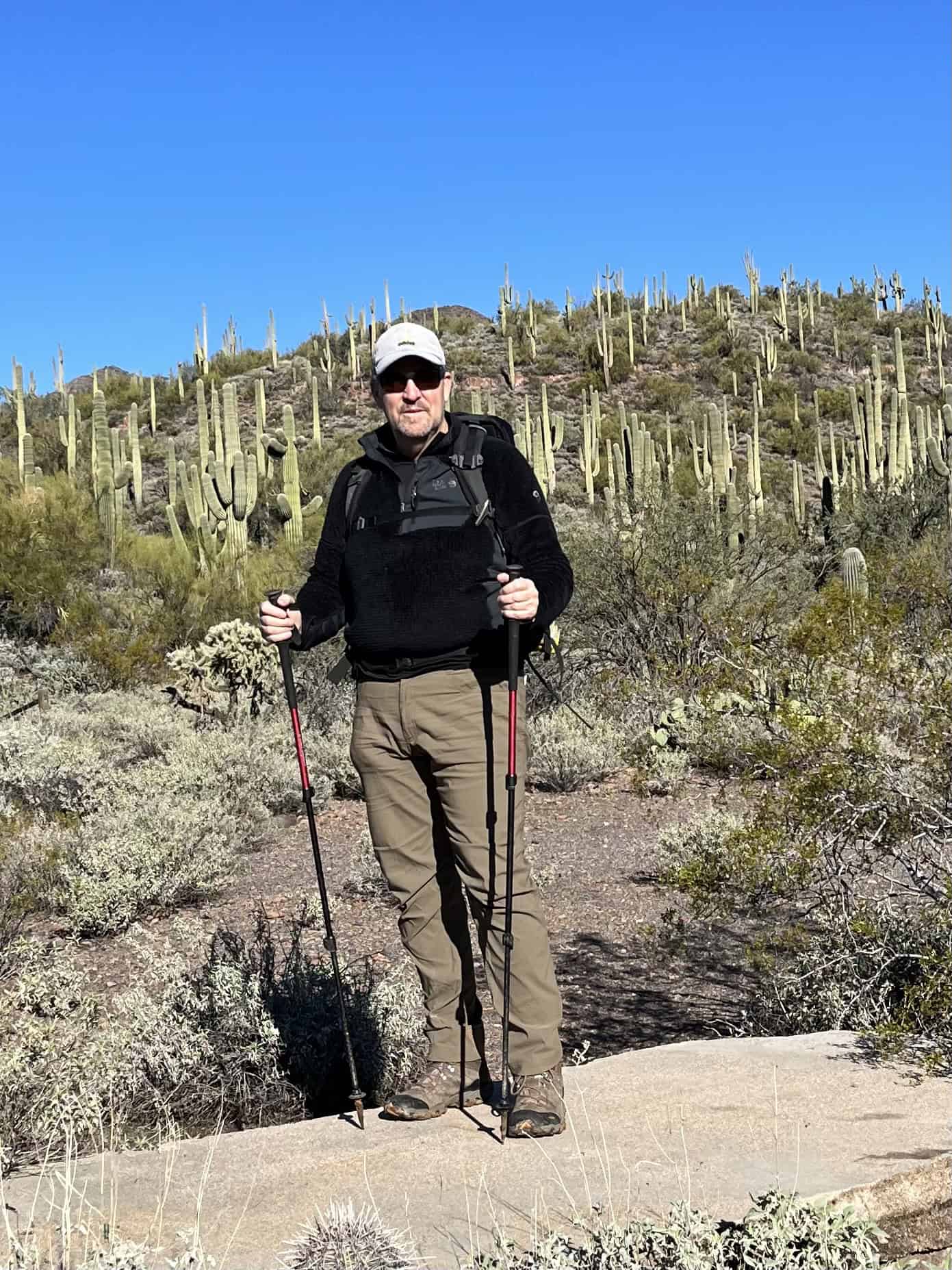
The trail is filled with healthy examples of an endless variety of cacti. The dominant saguaro is everywhere and is hard to miss at every turn because it is as big as a tree.
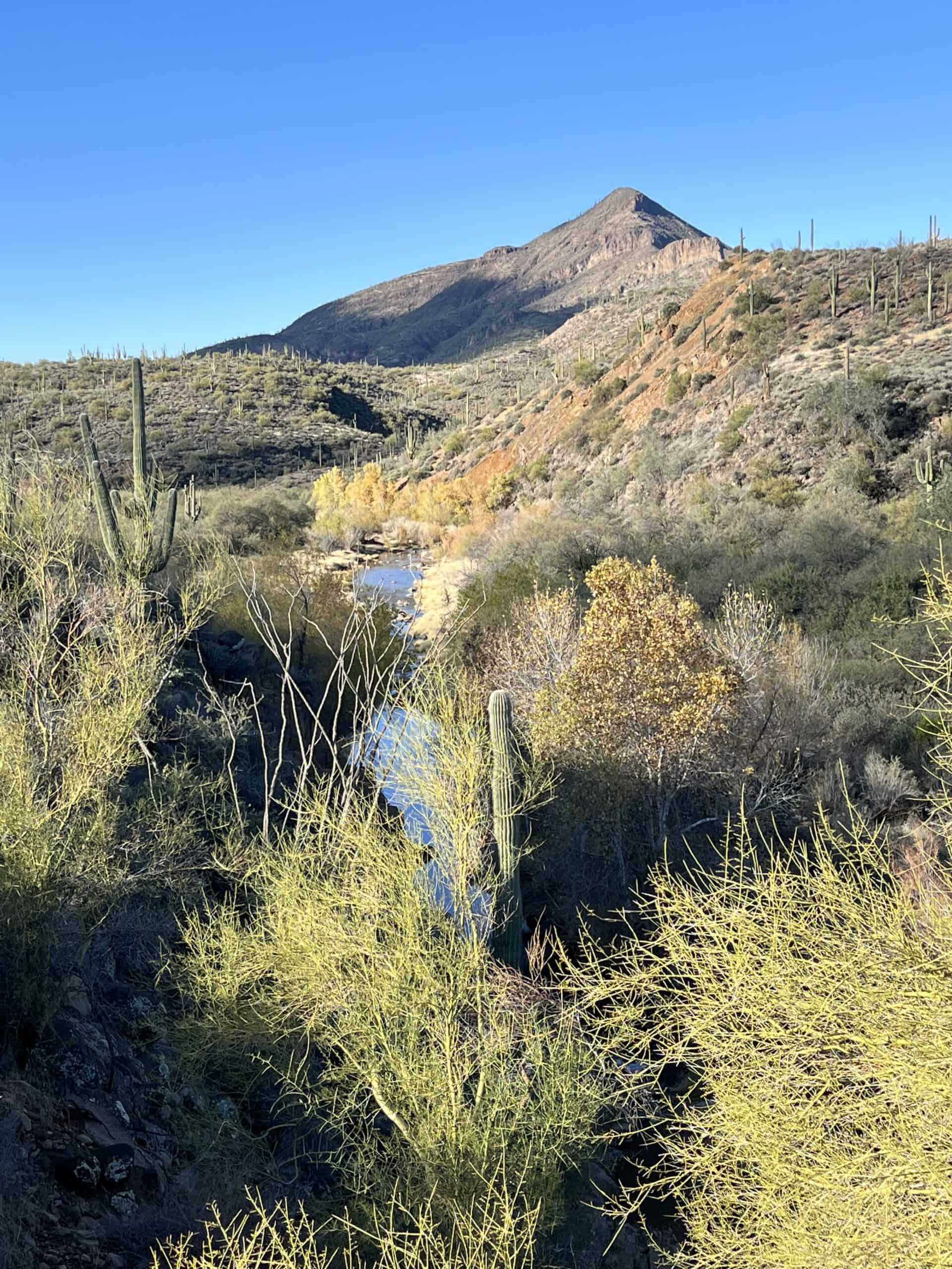
However, the area is also littered with barrel cactus, beehive and Santa Cruz cacti, prickly pear (paddle) cacti, and several cholla and hedgehog cactus varieties. Since Cave Creek runs through the area, everything seems well-watered and lush.
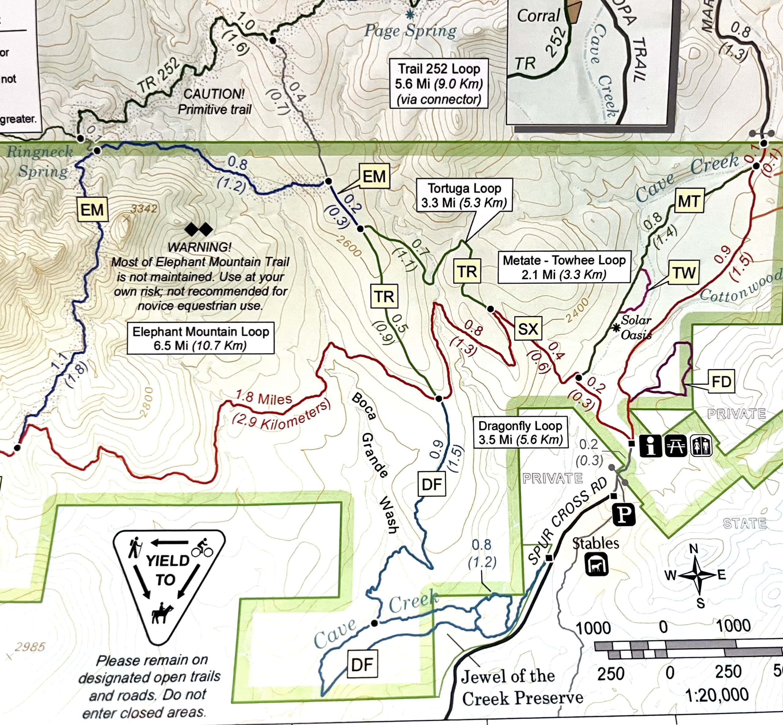
Nine-Mile Elephant Mountain Trail
After picking up your map at the trailhead, hike past the restrooms and picnic area and stay on the Spur Cross dirt road toward the "old gate." This section of the trail is mostly downhill, providing the hiker with an overall perspective of what is to come.
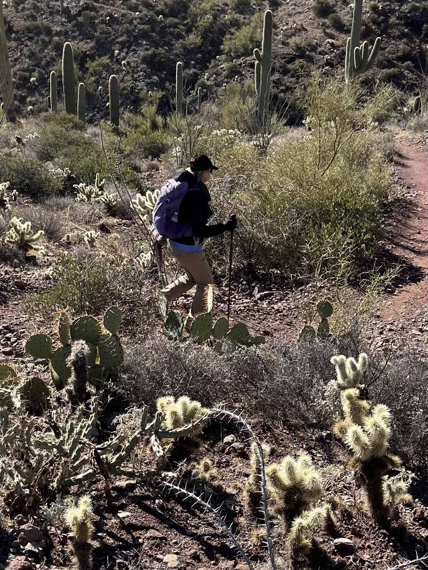
After about one mile (1.6 kilometers), a sign directs you to take an almost hairpin turn to the left on the Metate Trail. This trail runs along Cave Creek, into the heart of the old Dude Ranch site, and through the Solar Oasis. It is an enjoyable and beautiful part of the trail.
After passing the Dude Ranch, make a right turn going up, up, up, and follow the signs to Tortuga Trail. The trail rises quickly to a vantage point over the whole area, but then falls again rapidly into the valley made by another tributary creek. Once we are hiking on the trail, we see no other people for nearly two hours.
Much of the trail is rocky and steep, and parts of it even pass through a dry creek bed. Eventually, the Tortuga Trail merges with the Elephant Mountain Trail. Take a right turn and mark 3.6 miles (5.8 kilometers) down, 5.4 miles (8.6 kilometers) to go.
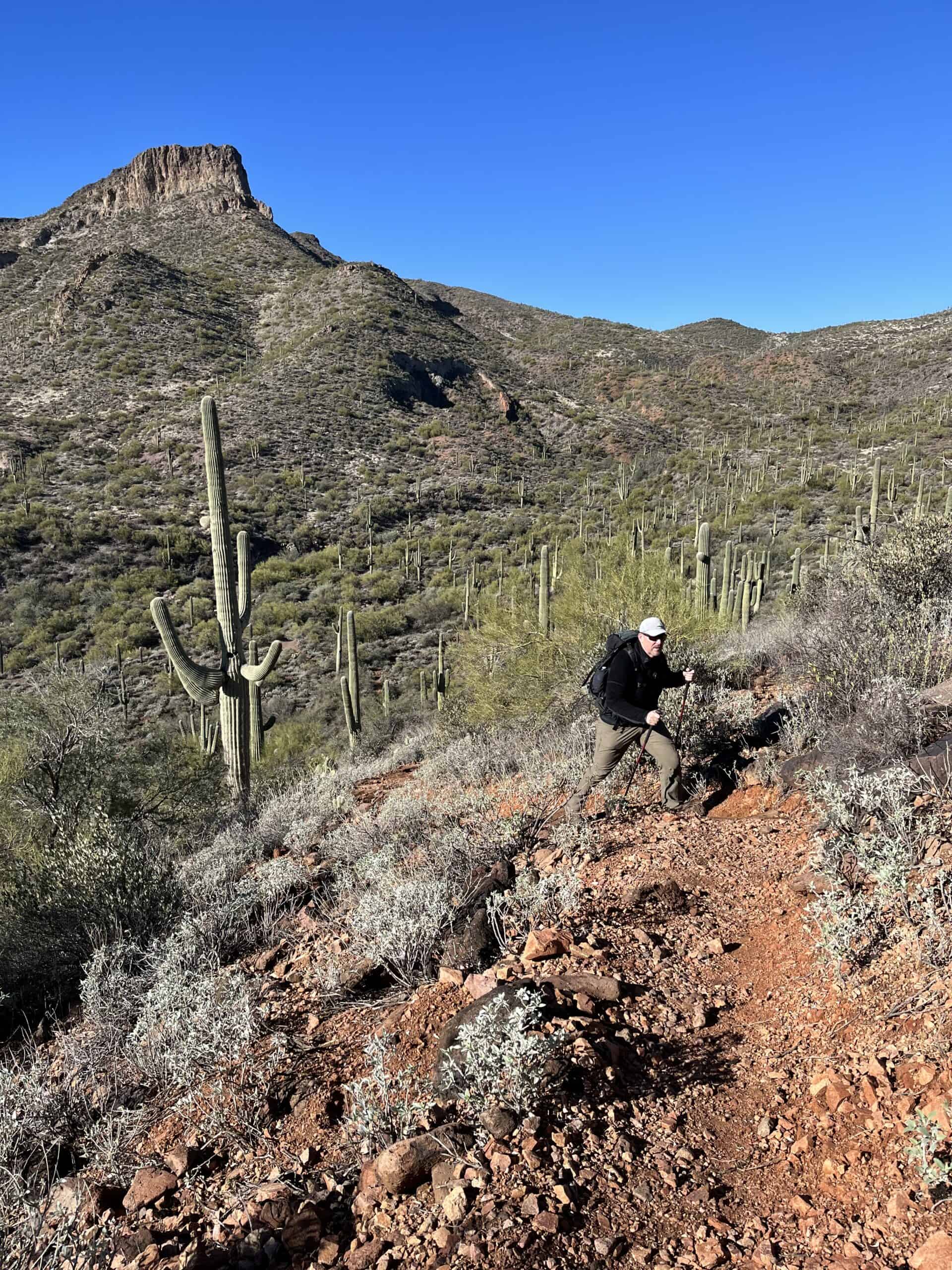
Elephant Mountain Trail is steep and rugged - just the kind of challenge we like, and another reason it's the best hike near Phoenix. No horses or bikes are allowed here, and the final mile to the base of the final climb to the mountain is straight up.
See also: Sierra Nevada Adventure - White Mountain Peak
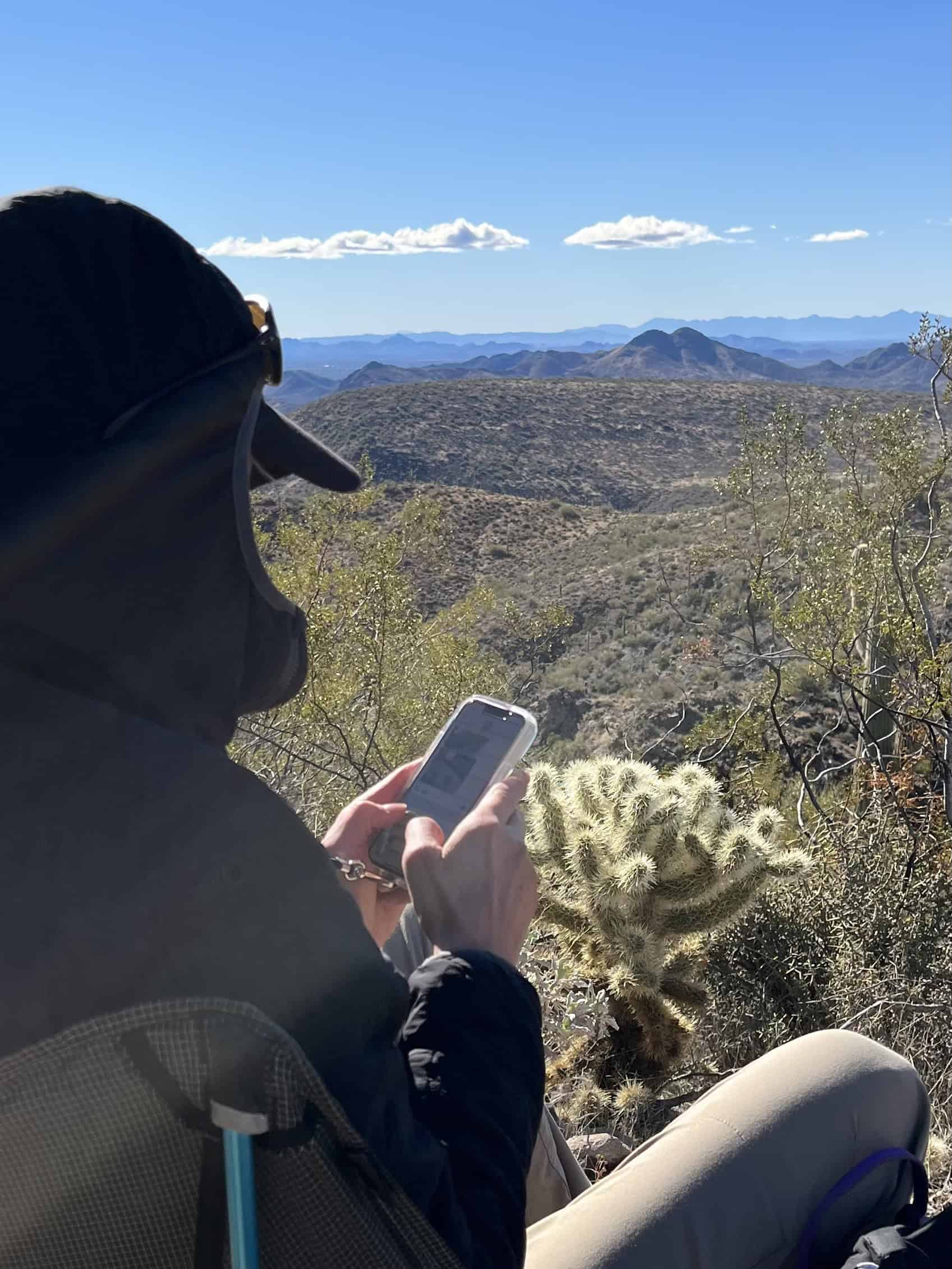
We stopped for a meal break and took in the views at the pass, which is the halfway point. Downtown Phoenix is visible to the naked eye, but the wilderness area feels rare, so close to a major city like Phoenix.
We are just a half-hour hike from the summit of Elephant Mountain. An unmaintained trail seems to lead up to the peak, but an official sign states that the path is closed.
After our rest and food stop, we complete the Elephant Trail Super Loop and descend the mountain at full speed for an additional 4.5 miles (7.4 kilometers) directly to the truck. Our hike was four hours of pure bliss; it's the best hike in Phoenix.
The next time you're in Phoenix, Arizona, strap on your boots and head to the Star Cross Ranch Conservation Area. My Elephant Mountain Super Loop Trail may just become your favorite, too.