We pulled into Coconino National Forest around 3 p.m. after driving from Prescott, Arizona, following Highway 179 into Sedona. With a few hours to kill before hotel check-in, we decided to hike Bell Rock, one of the area's most iconic formations.
Hiking enthusiasts and nature lovers alike will find Sedona's rugged trails and dramatic landscapes endlessly rewarding.
The drive from Prescott took a little more than one hour, while the drive from Phoenix takes about two hours. After stopping by the Hilton Sedona Resort at Bell Rock in the Village of Oak Creek and learning our room wasn't ready, we drove a few minutes further north.
Bell Rock Trailheads and Parking
There are two trailheads for hiking Bell Rock:
- Bell Rock Trailhead North is closer to Sedona.
- Bell Rock Trailhead South is closer to the Village of Oak Creek.
Each has a small parking area and is accessible from Highway 179. The northern trailhead and parking lot can be located by searching for "Courthouse Vista" on Google Maps.
Pull into the Courthouse Vista parking lot for the shortest walk to Bell Rock, which has direct access; the Bell Rock Access Trail will take you there.
Unless you arrive early in the morning, you're taking your chances on getting a parking spot. The spaces are often full; however, some visitors only stop for a quick photo (not a hike), resulting in higher turnover rates here than at other lots.
Buying a Parking Pass
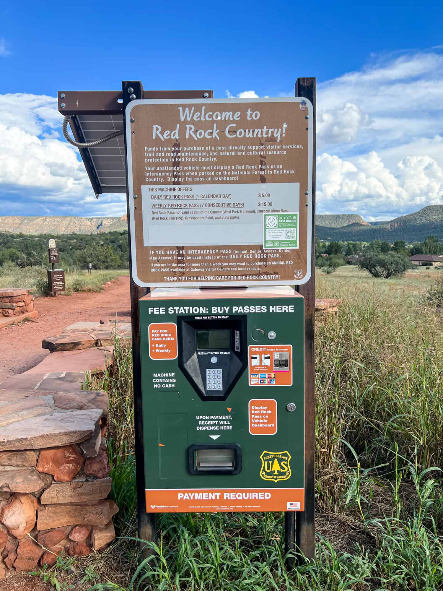
Since Bell Rock was our first hike of my birthday weekend in Sedona, I used a credit card to purchase the $15 weekly Red Rock Pass, which I displayed on the dashboard of our rental car.
Purchasing a pass is required; otherwise, you risk receiving a ticket. A daily pass is $5. Kel used the bathroom facilities to change into hiking shoes while I began applying sunscreen.
Even though it was now 3:30 p.m. and partly cloudy, there was no shade on the Bell Rock Trail, and I didn't know how long we'd be gone.
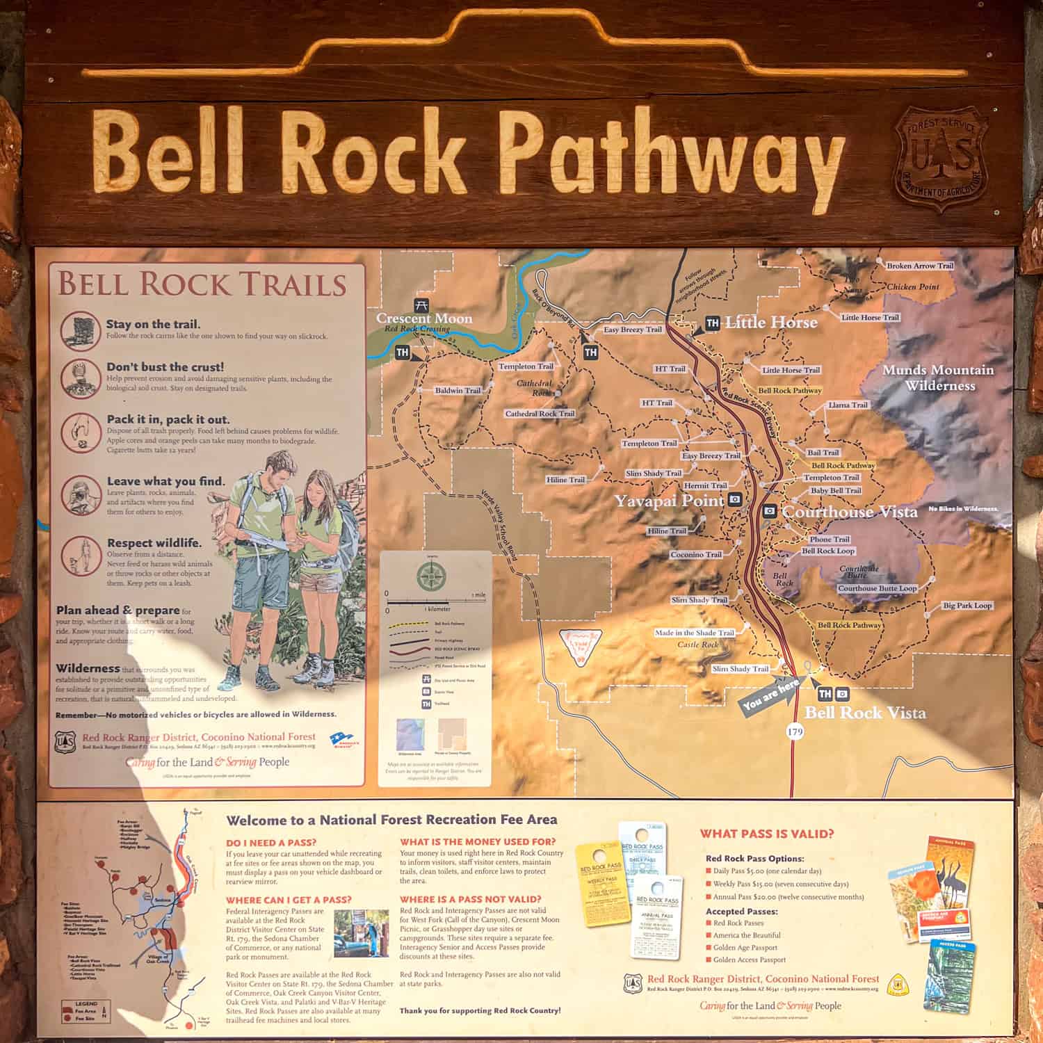
Before we began hiking, we got our bearings from a park map. A lot is happening amid the red rocks here, so allow me to break it down.
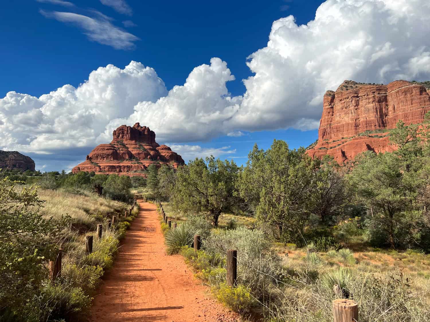
If you approach Bell Rock from the south trailhead and parking lot, you'll start on the Bell Rock Pathway, a 3.6-mile trail that runs north-south parallel to Highway 179. It will take you past the base of Bell Rock.
The climb is accessible from the one-mile Bell Rock Loop Trail on the Bell Rock Pathway. It has an elevation gain of about 700 feet. However, only experienced climbers should attempt to reach the top of Bell Rock. The lower levels of Bell Rock are more accessible to kids (and pets).
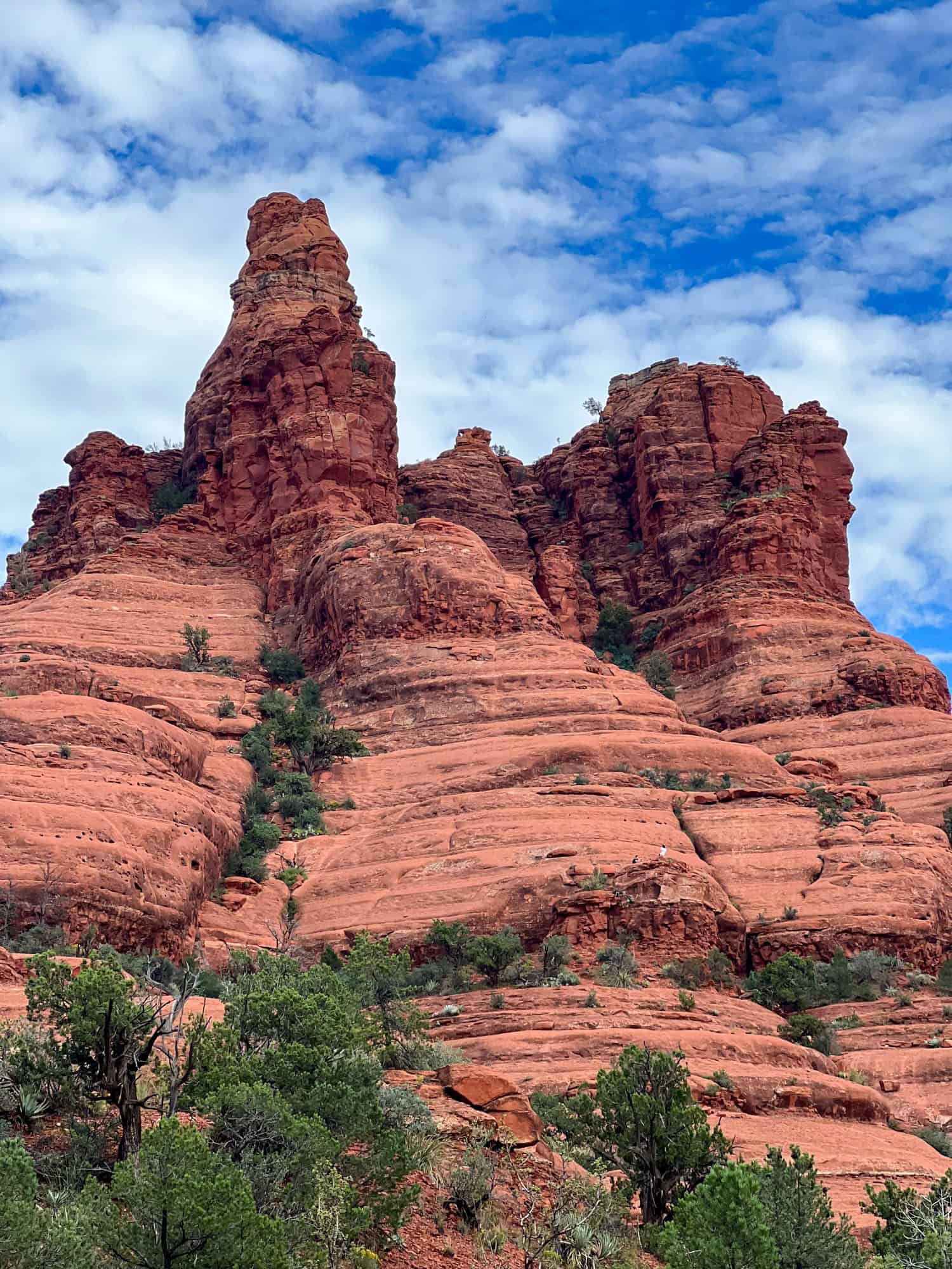
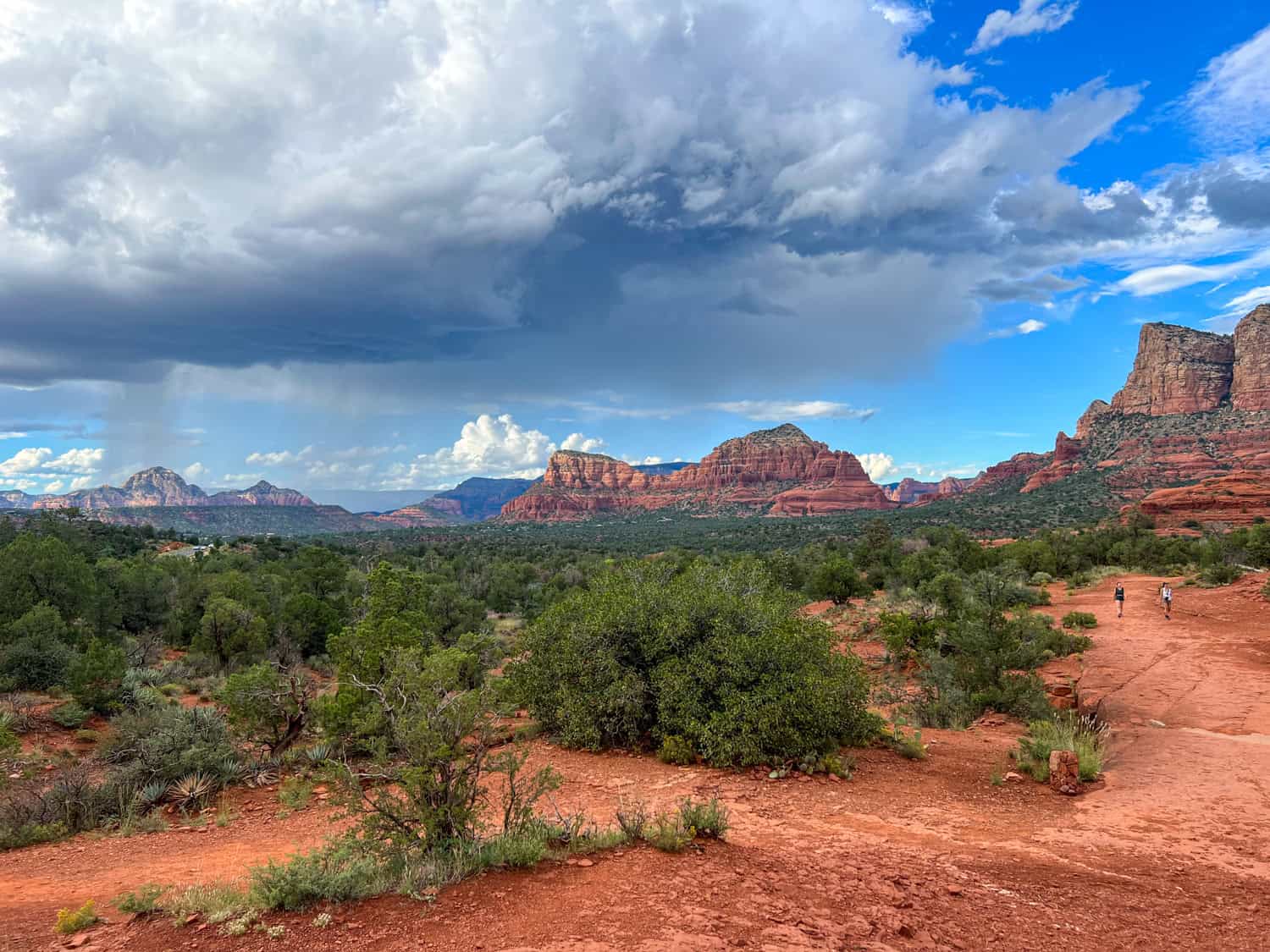
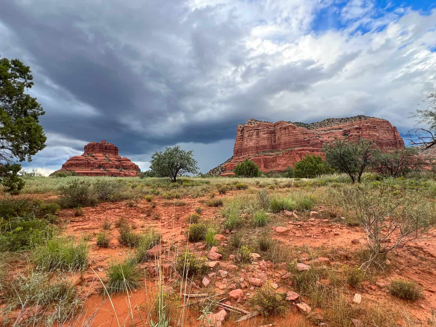
A third popular option is the Courthouse Butte Loop Trail, which encircles Bell Rock and the larger Courthouse Butte adjacent to it. The Chapel of the Holy Cross is also visible. This 4.5-mile hike is moderately challenging. While we didn't have time for it then, it's one of the best ways to enjoy the gorgeous views.
Hiking Bell Rock Pathway
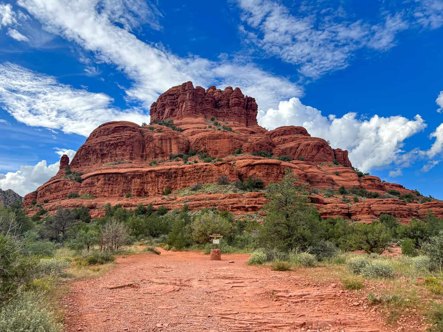
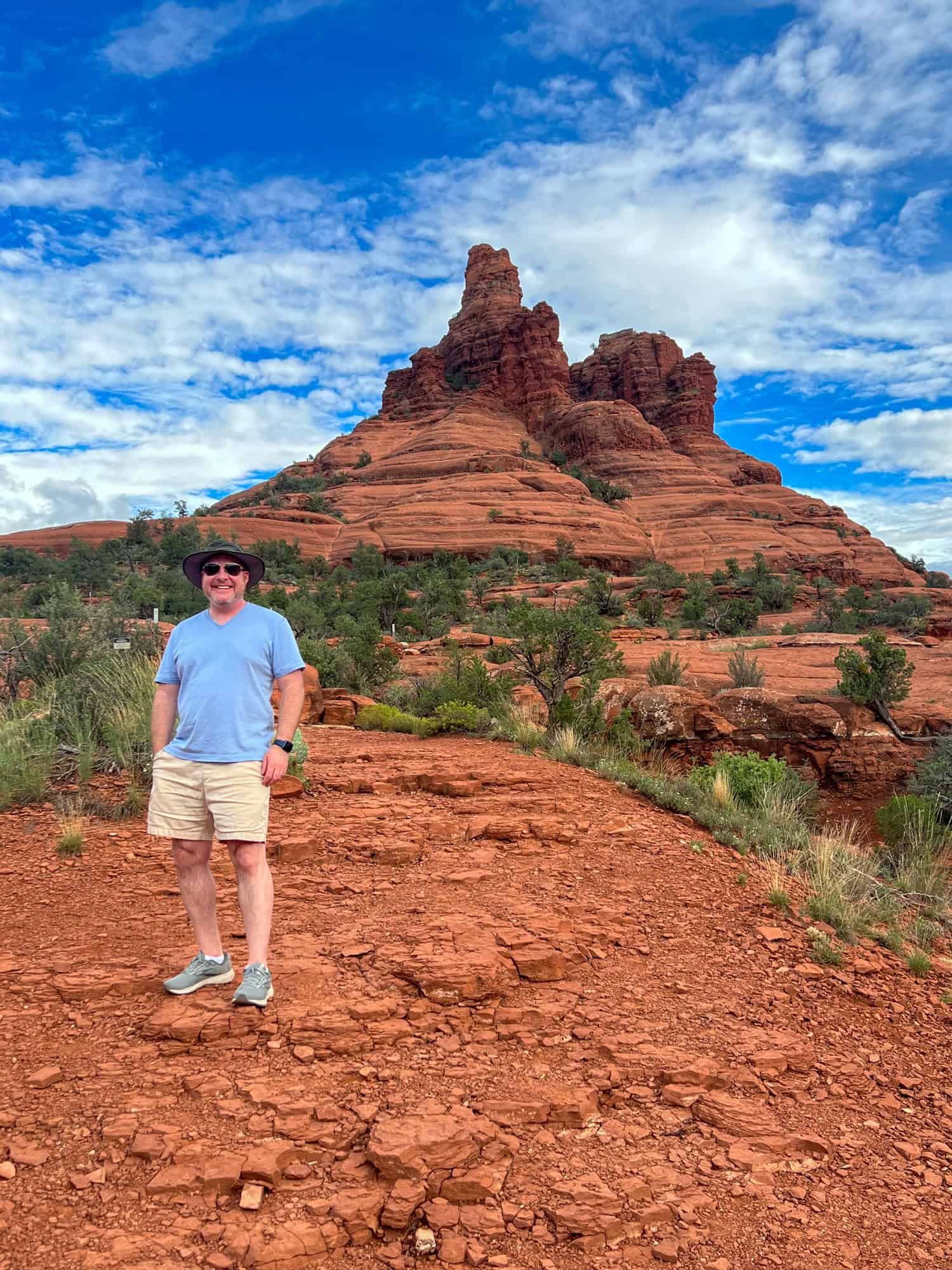
We began walking on the Bell Rock Pathway a few minutes before 4 p.m. I couldn't get enough of the views. Courthouse Butte was impressive, making Bell Rock appear small by comparison.
The trail was mostly flat and easy to follow. We saw several mountain bikers ride by us as we headed north to Bell Rock. As we got closer, details of the iconic red rock formation came into focus. A few people were climbing up Bell Rock, looking tiny from below.
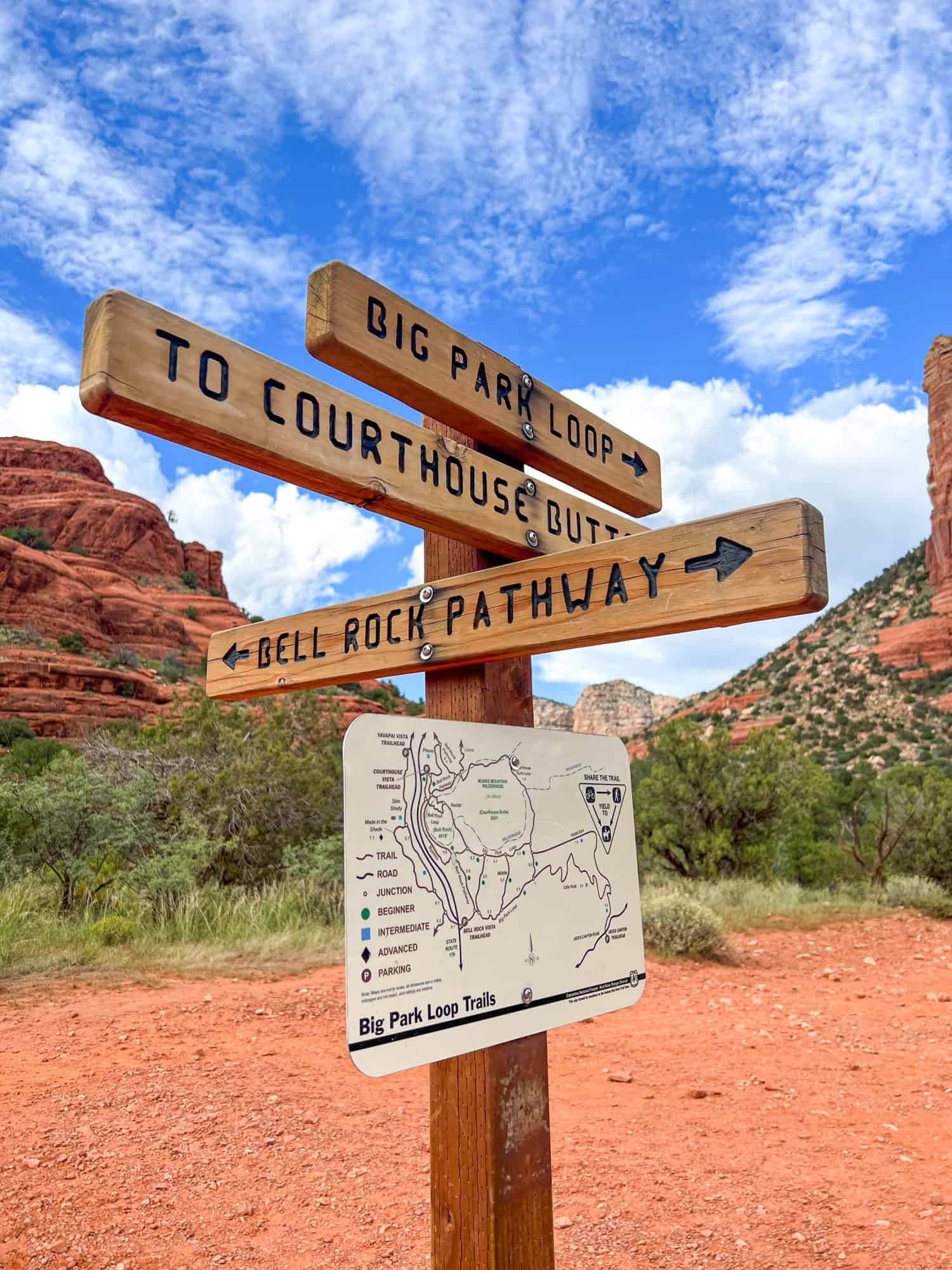
The first basket cairns had a Big Park Loop Trails map and signs pointing north-south for Bell Rock Pathway and two pointing east for the Big Park Loop and Courthouse Butte. I hadn't researched Bell Rock or these hiking trails, so I wasn't keen on attempting the climb.
The running sneakers I had were fine for flat trails. But, as I'd learn the following day at Devil's Bridge and the more difficult Cathedral Rock, they're unsuitable for hiking up and down the smooth, hard surfaces of Sedona's red rock formations.
Returning to the Car
So, instead of hanging a right and climbing Bell Rock, I was content to take some pictures and enjoy the view from below. Around 4:30 p.m., rain showers became visible to the north. I didn't want to get caught in the rain, especially if there was lightning, so we returned to the parking lot.
Related: Hiking Santa Elena Canyon
The walk to the south trailhead parking lot took another 30 minutes, making the round-trip hike to the base of Bell Rock in Sedona one hour. It was an easy hike with plenty of trail markers and a worthwhile way to spend time before checking into our hotel.
When we unpacked in our room, the skies opened up, and it was raining hard. It didn't last long, though, as an hour later, on our way to dinner, I could see a lovely double rainbow.