Bryce Canyon National Park in Utah is one of the most unusual and beautiful national parks. If you're planning a trip through Utah to some of the five National Parks in that state, consider a trip in the winter off-season for some relative peace and quiet.
Hiking in Bryce Canyon
Winter Weather
It is winter, or winter-like, for about seven months of the year in Bryce Canyon National Park. It just so happens that this is not the heavily trafficked tourist season. Sitting at an elevation of 8,000 feet (2,500 meters), it can be cold and snowy from October 1 to May 1 of any given year.
Our visit to Bryce Canyon National Park in Utah was in late November, two days before the Thanksgiving holiday. Although there was no snow on the ground yet, the weather had already turned very cold, even before the official start of winter.
The average temperature in November for Bryce Canyon National Park calls for a high of 44F and a low of 18F. For us, it was about those temperatures on day one, but the following day at sunrise, it was just 7 F (minus 14 C).
Empty Trails
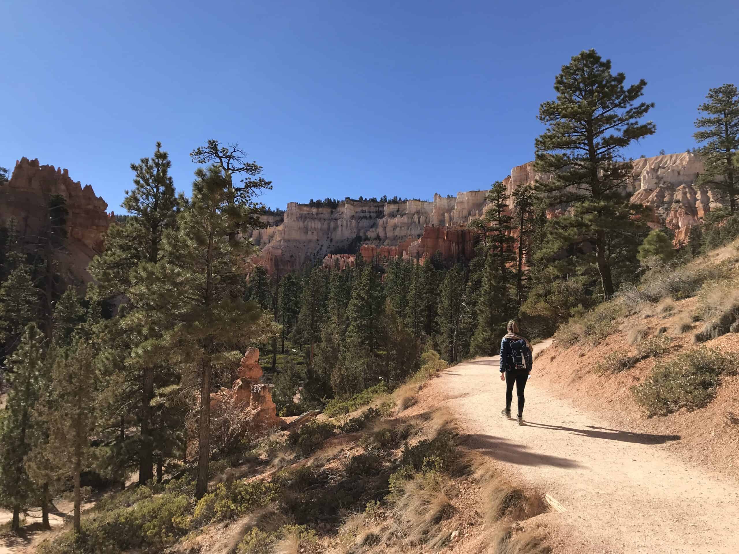
As you may expect, this time of year is not crowded at the park. Our hikes and explorations on foot were nearly people-free, and there was always parking available at each sightseeing parking lot.
We arranged an itinerary for two full days at Bryce Canyon, including an overnight stay at a motel just outside the park entrance.
Bryce Canyon National Park is located in a remote area, so planning is crucial.
Some of the common locations where automobile travelers start their trip to Bryce are as follows:
- St. George, Utah 2.7 hours
- Beaver, Utah 1.4 hours
- Zion National Park 1.5 hours
- Arches National Park 4 hours
- Salt Lake City, Utah 4 hours
We left St. George at about 6 a.m. with plans to drive to Bryce Canyon National Park and begin hiking down into the hoodoos immediately.
Our research and hiking preferences guided us in creating an amalgamation of two different trails, combining them into a 5-mile double loop. We were convinced then that if you have one full day to spend in Bryce Canyon, this is the hike you should take.
Related: Where To Hike on a Road Trip to Zion
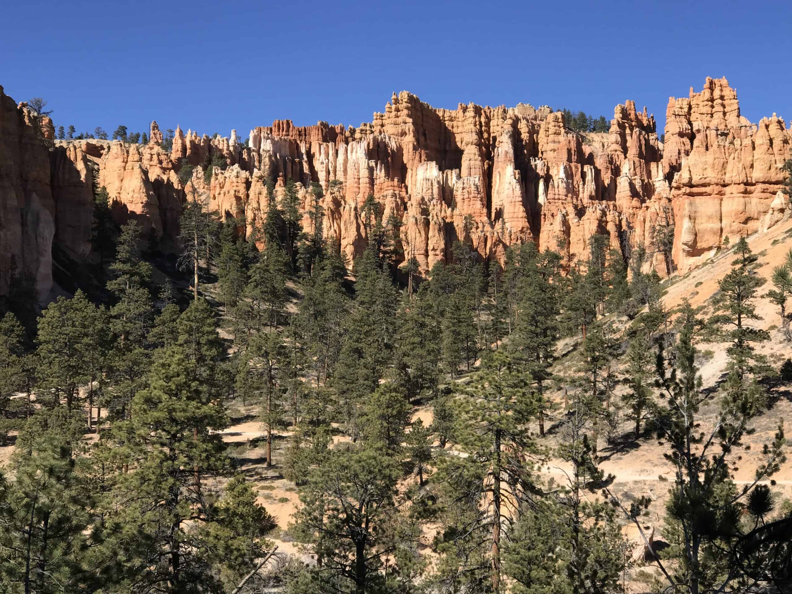
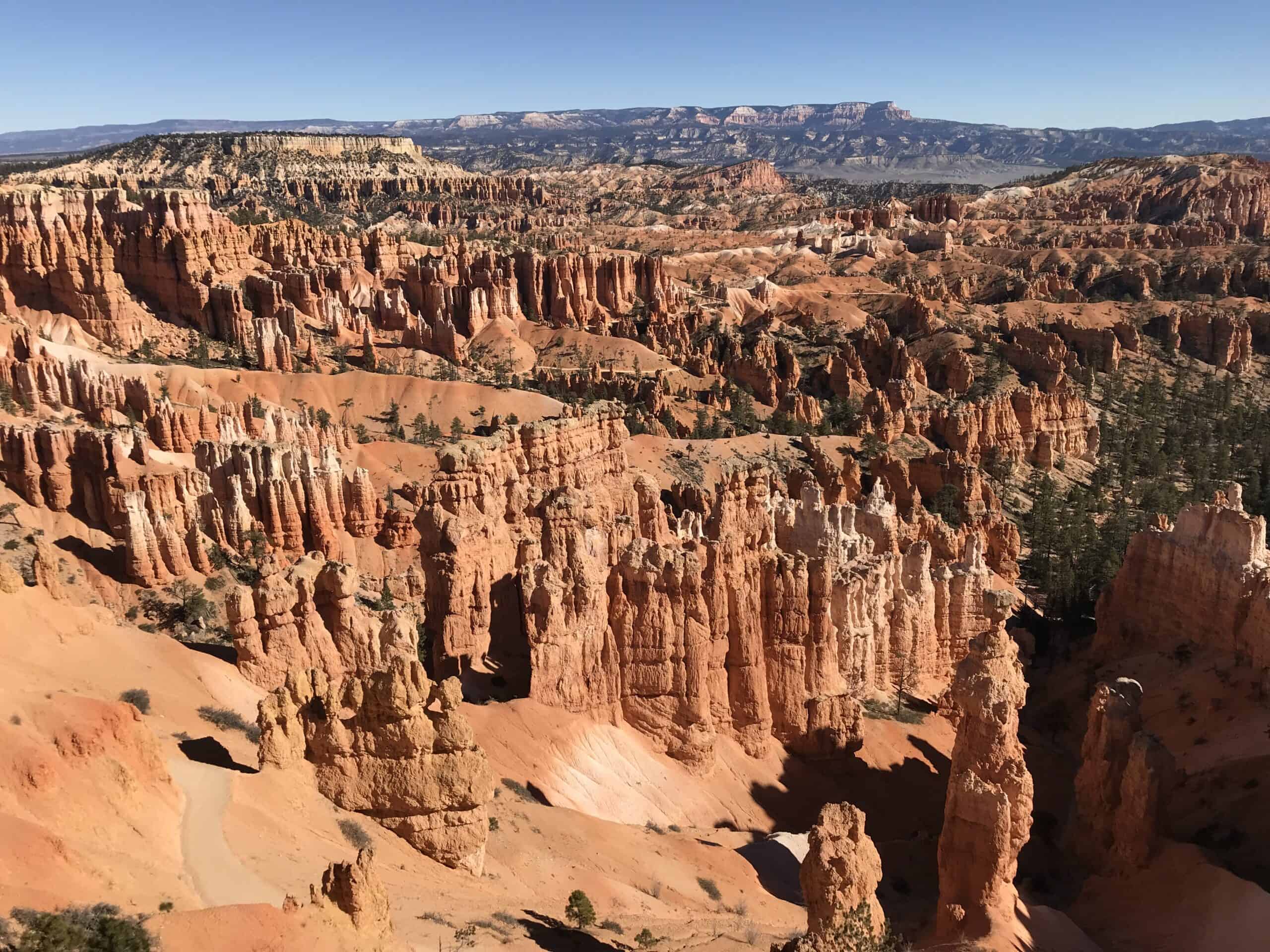
Red, White, and Orange Rocks
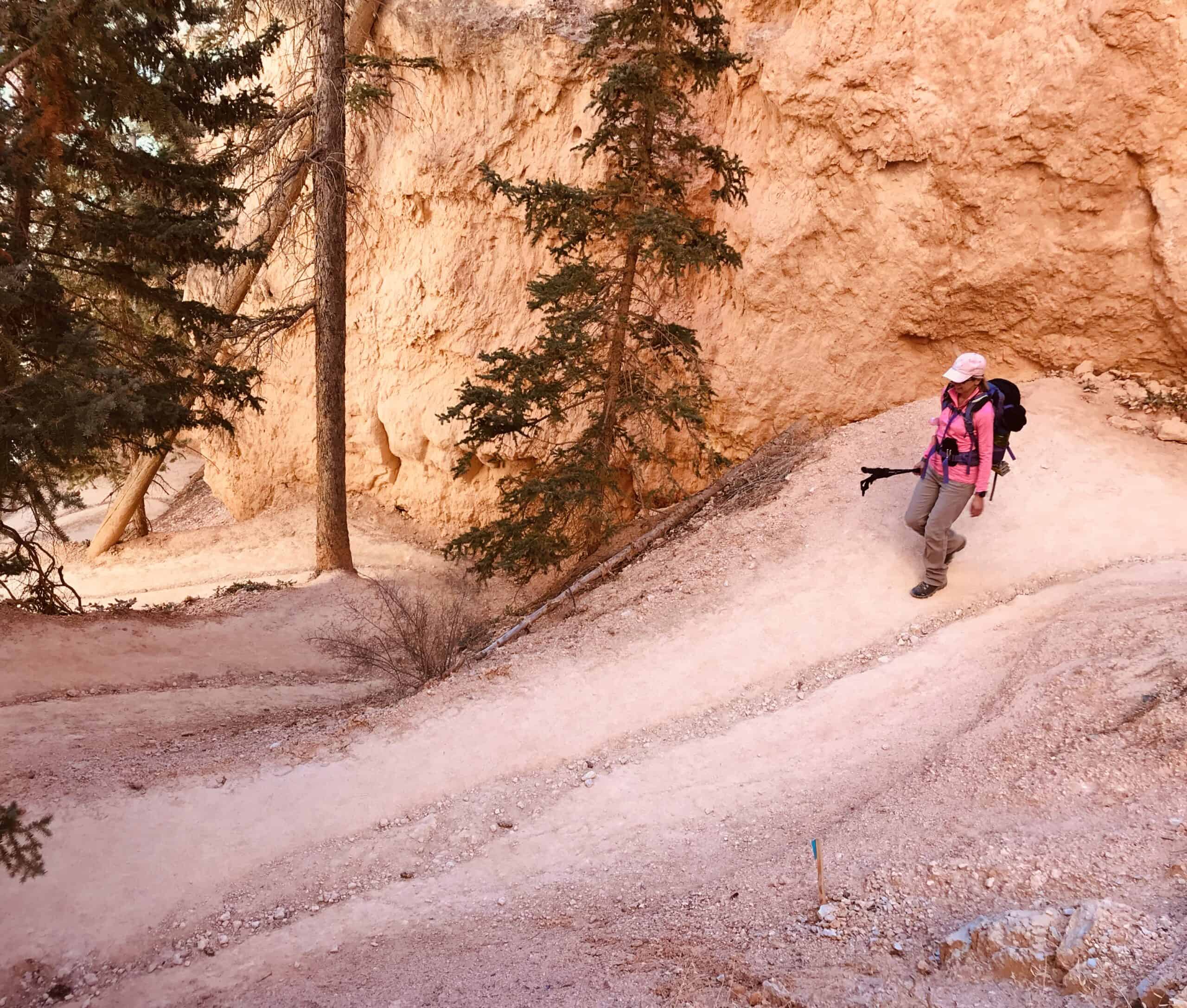
It is an up-and-down trail with a total elevation gain of 1,581 feet or nearly 500 meters. Additionally, we were hiking at an elevation of 8,000 ft., making it moderately strenuous.
We came prepared for the cold weather and packed a big lunch to picnic on the trail. Once we started hiking, it wasn't so cold, and we were thriving on the scenery.
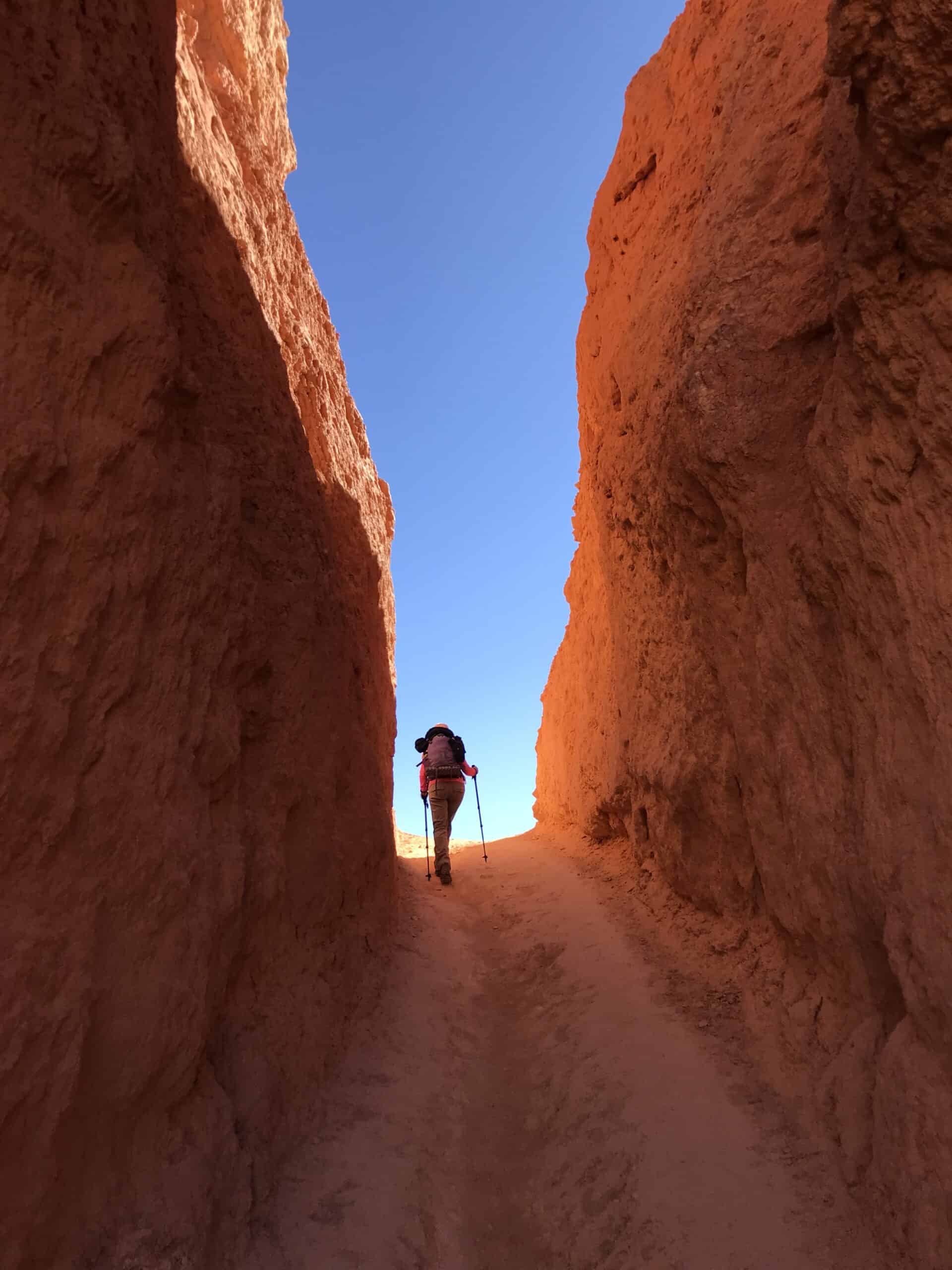
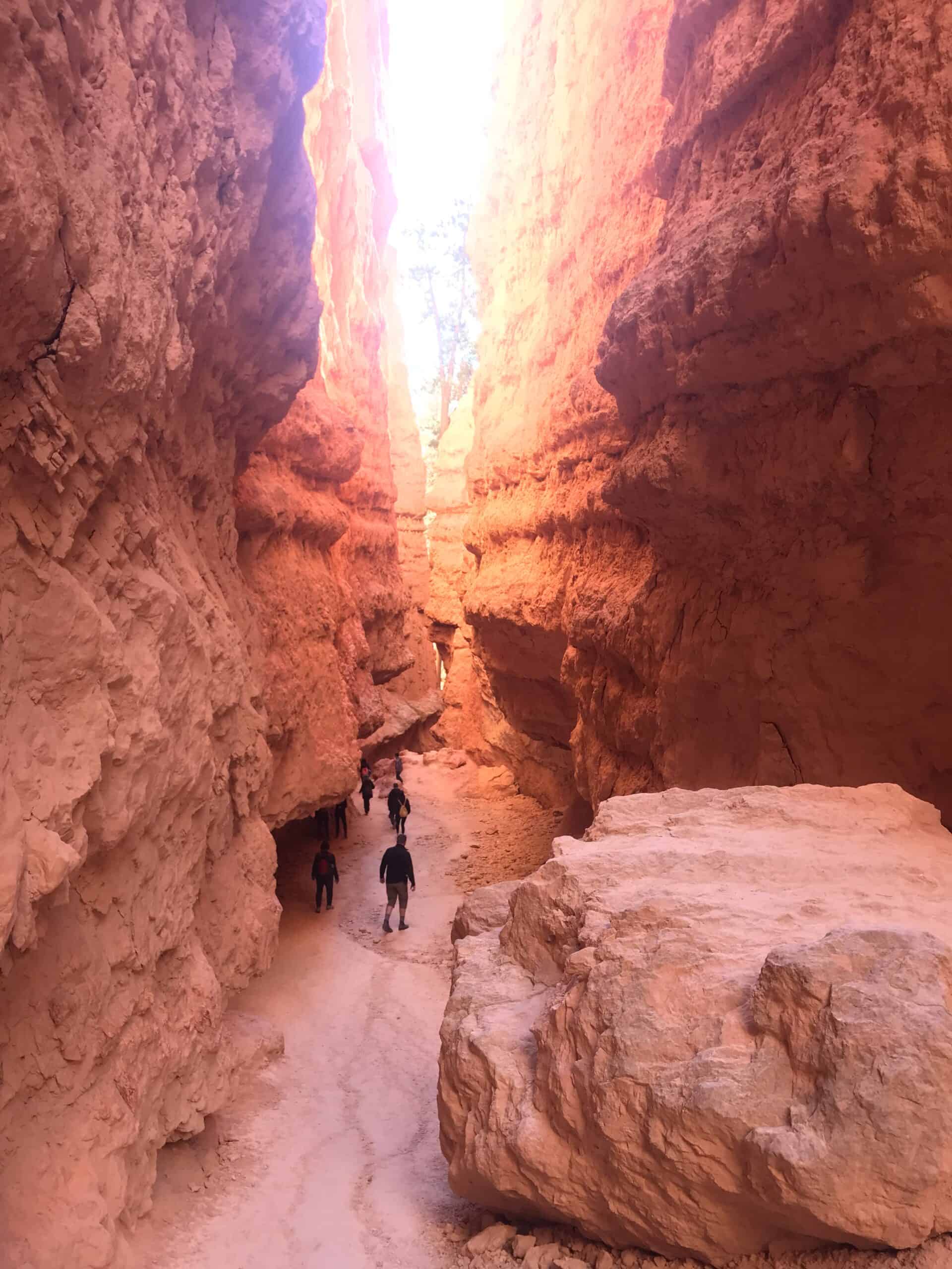
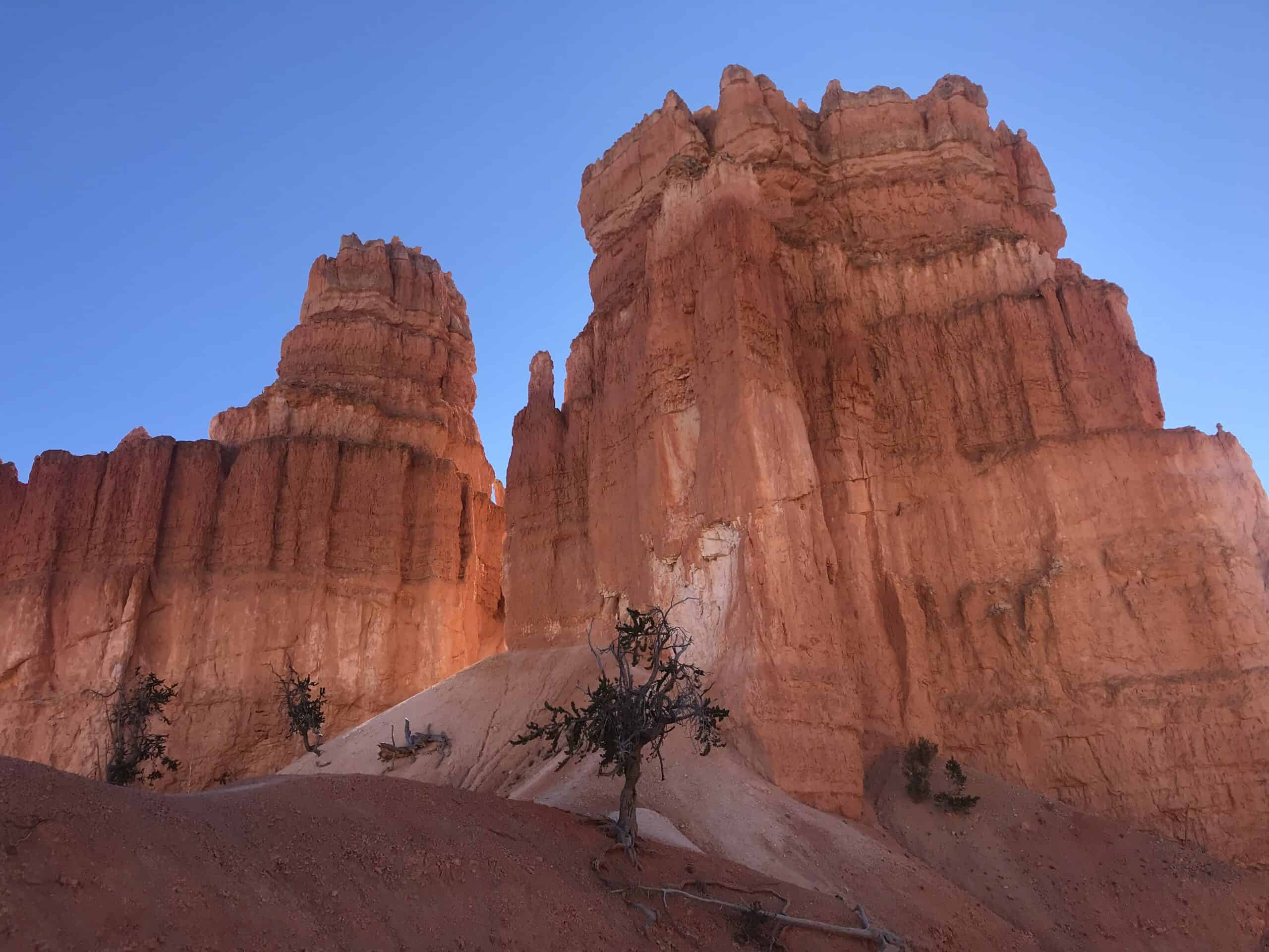
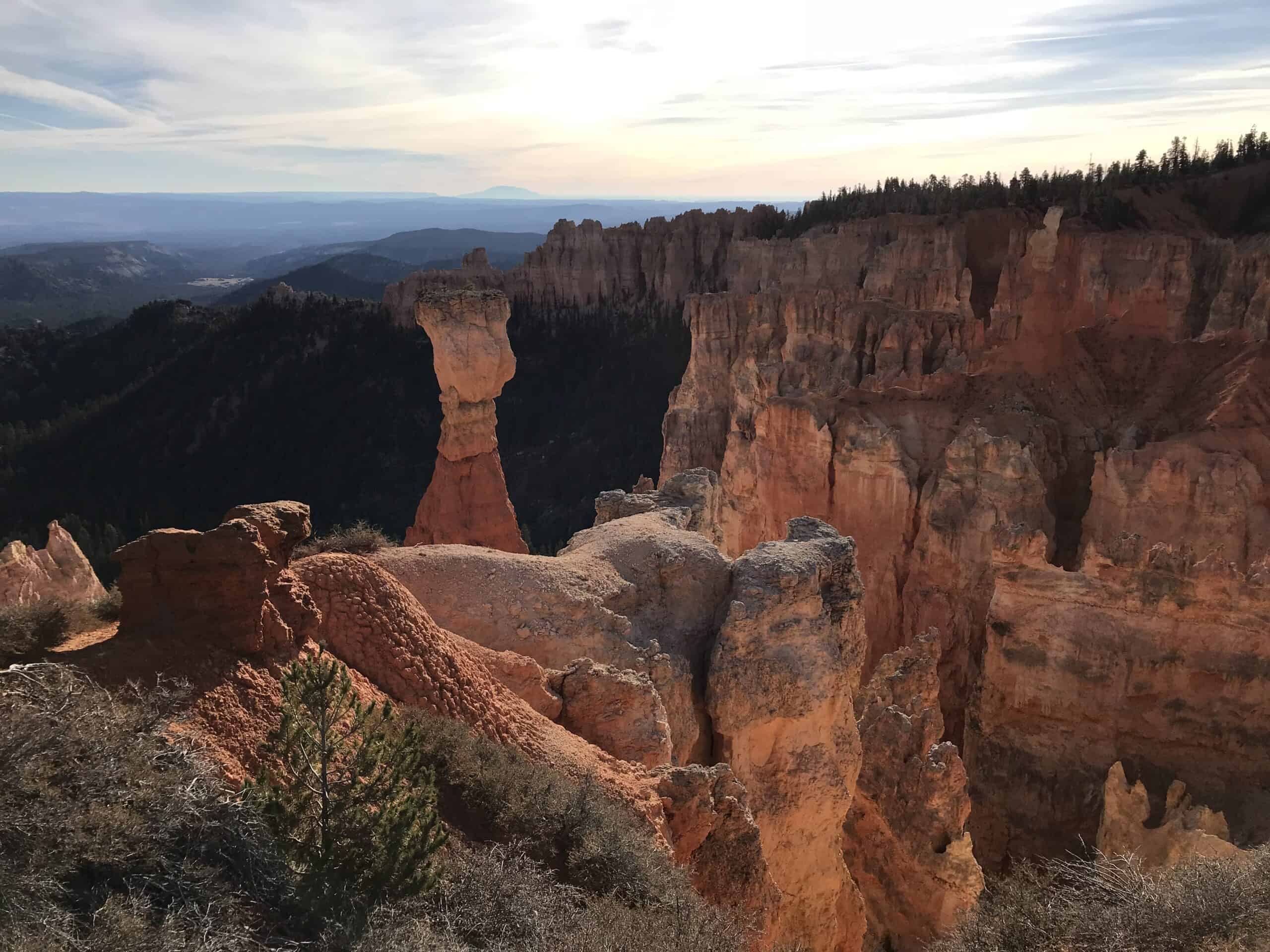
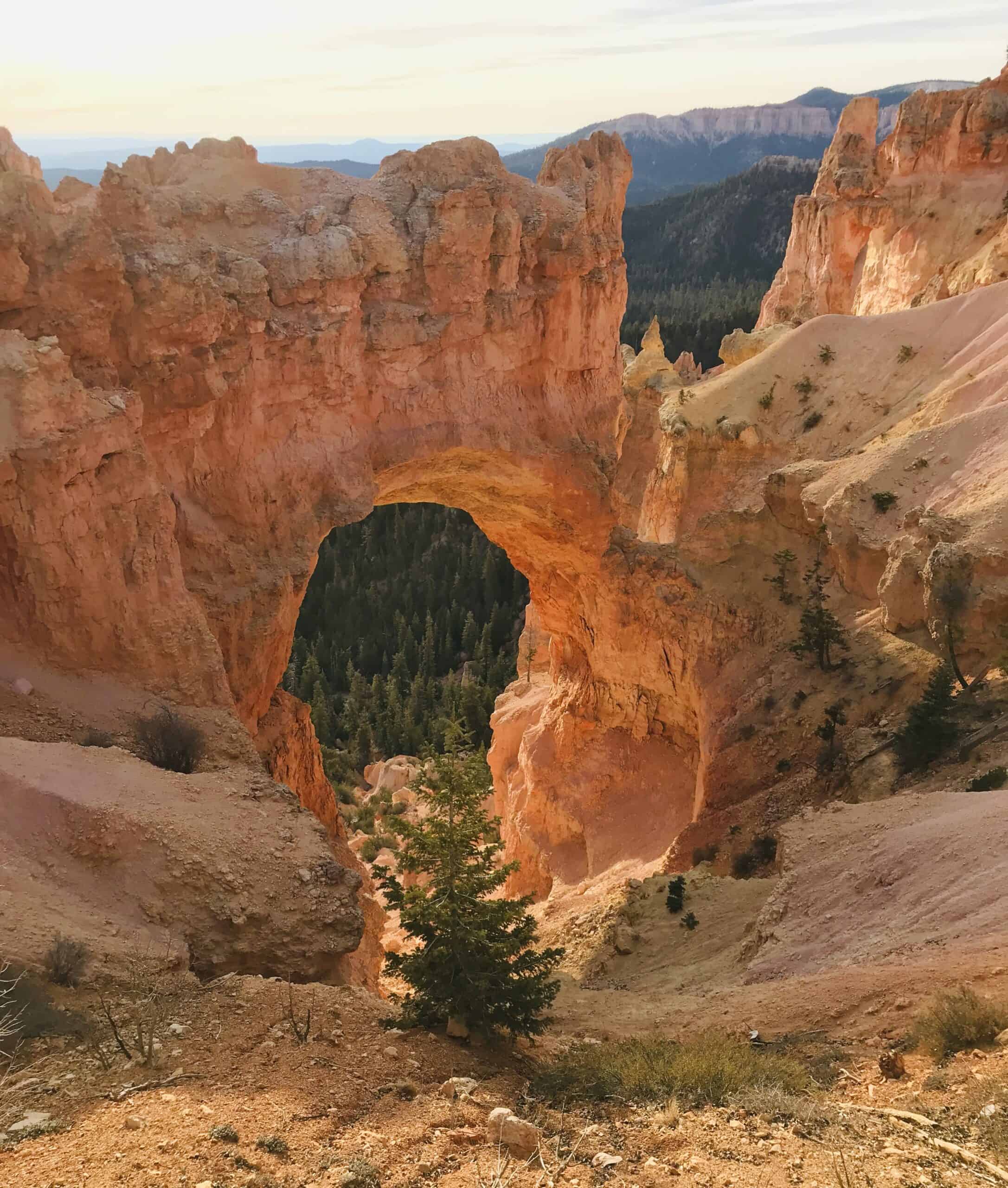
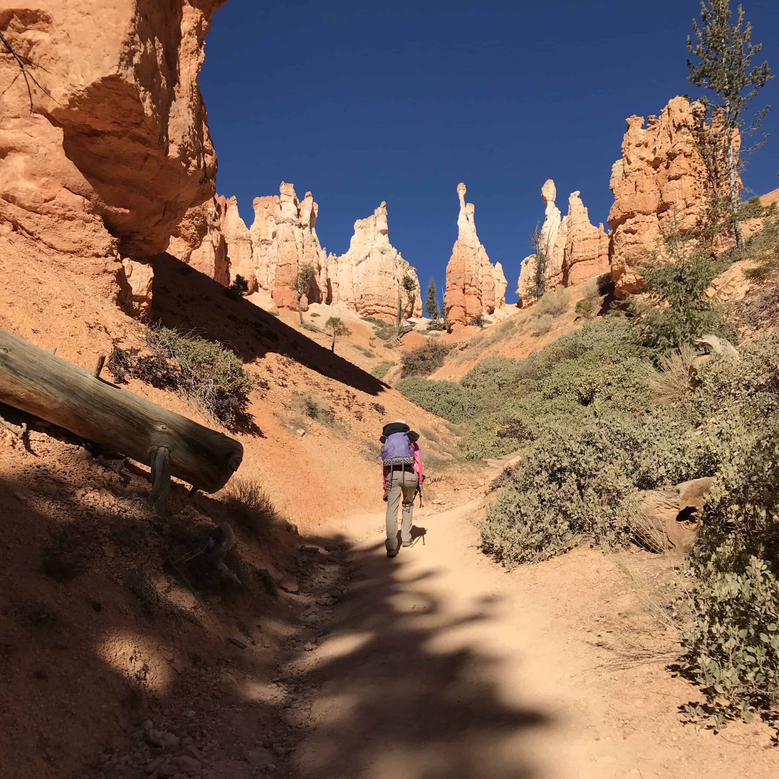
Our plans called for starting at Sunset Point and hiking down Navajo Loop Trail past Thor's Hammer and the Two Bridges rock formations. Down, down we went on the winding human-made trail, which snakes between two sheer red rock cliffs.
Our hike took us through tunnels, some of the best slot canyons in Utah, in and out of hoodoos, and through red rocks and red sand, as well as the green forests of Pinion Pines and Quaking Aspens.
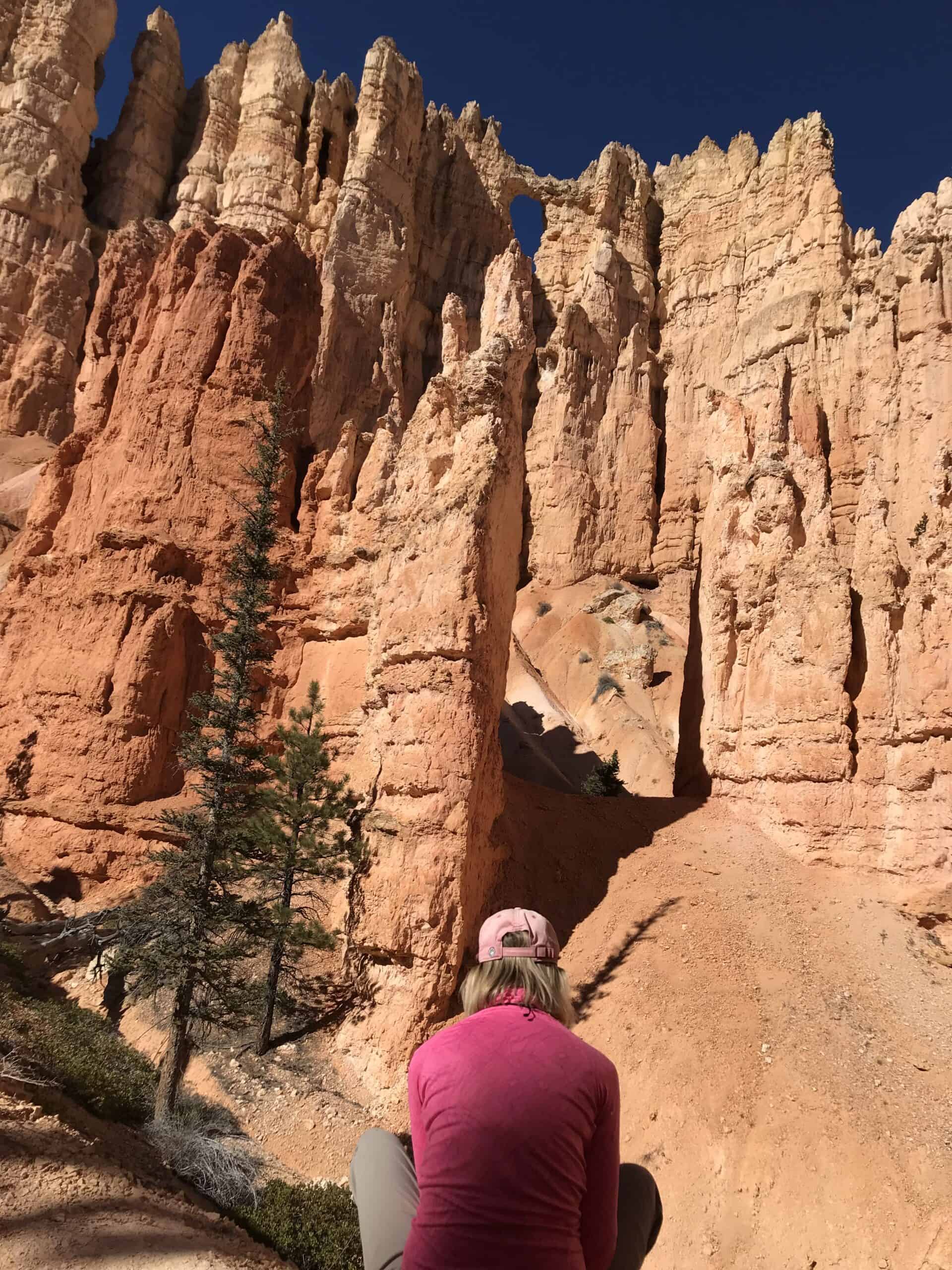
We stopped and marveled at the features known as The Alligator, the Wall of Windows, The Cathedral, and, toward the end of our journey, Wall Street.
When our hike was completed, our day was just getting started. We got in the truck and drove out to the lookout points, known as Inspiration Point and Bryce Point.
Arches and Windows
As the day wore on, we explored and hiked through the campground areas and around Bryce Canyon Lodge.
By this time of year, the lodge was closed and the camping sparse, but as we quietly strolled through the forest, we saw dozens of deer, who seemed oblivious to our presence.
We drove out to Fairyland Point for sunset, where we were the only car in the parking lot. A short hike later, we settled on the vantage point we were looking for and popped open a bottle of wine, watching the sun drop beneath the horizon.
After checking into the motel, we walked over to another hotel with a buffet and a warm fireplace roaring away.
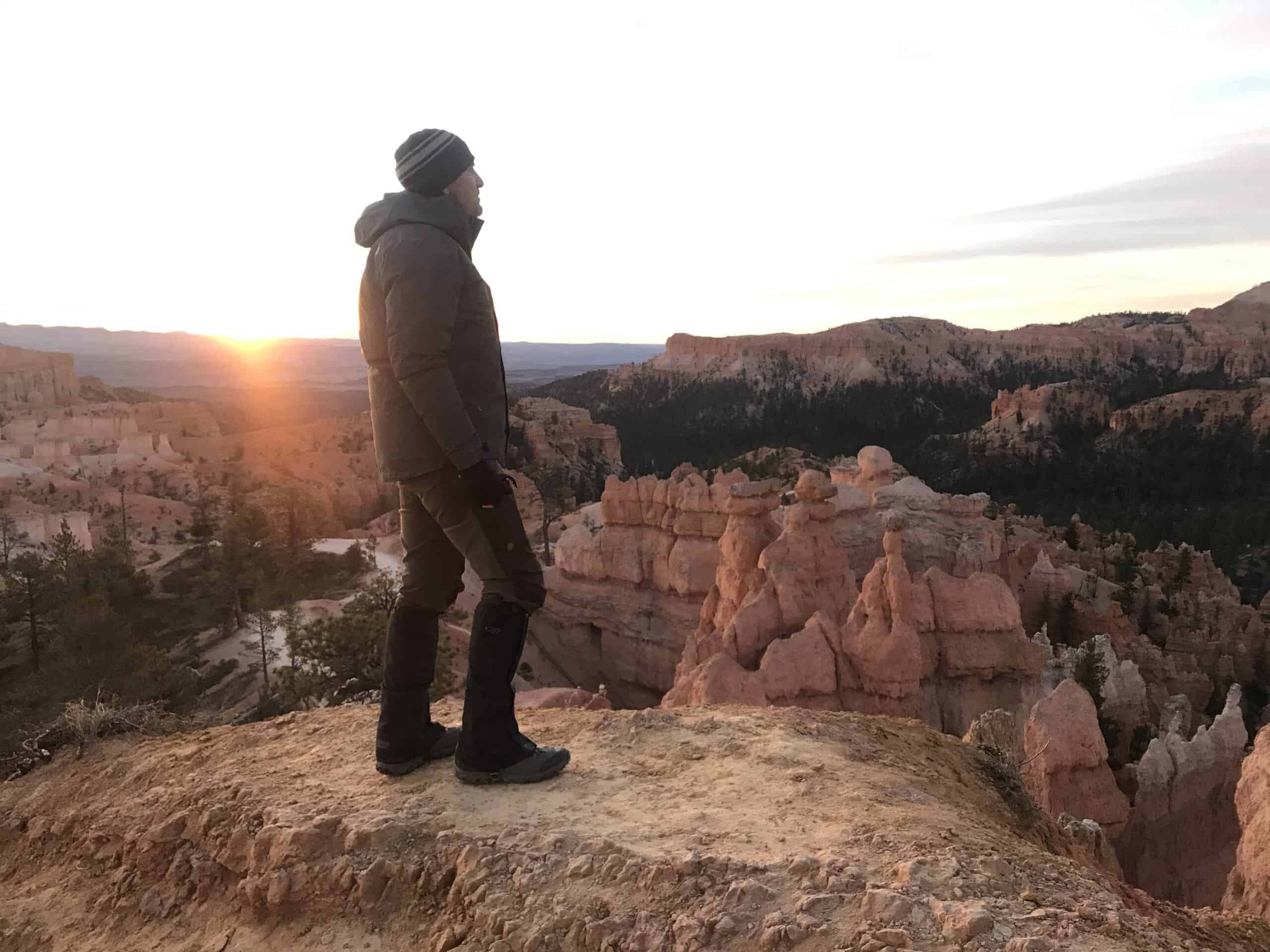
Seven Degrees
The morning coffee in the cozy bed of the motel room made us think twice about going out in the dark, pre-dawn, to find a spot to see the sunrise at Sunrise Point.
I put on every piece of clothing I could find in my duffle, and we headed out into what we now knew was a super chilly seven degrees Fahrenheit.
Most of the other visitors to the park were not braving the cold, so we were mostly alone on the trails leading to the photographic vantage points.
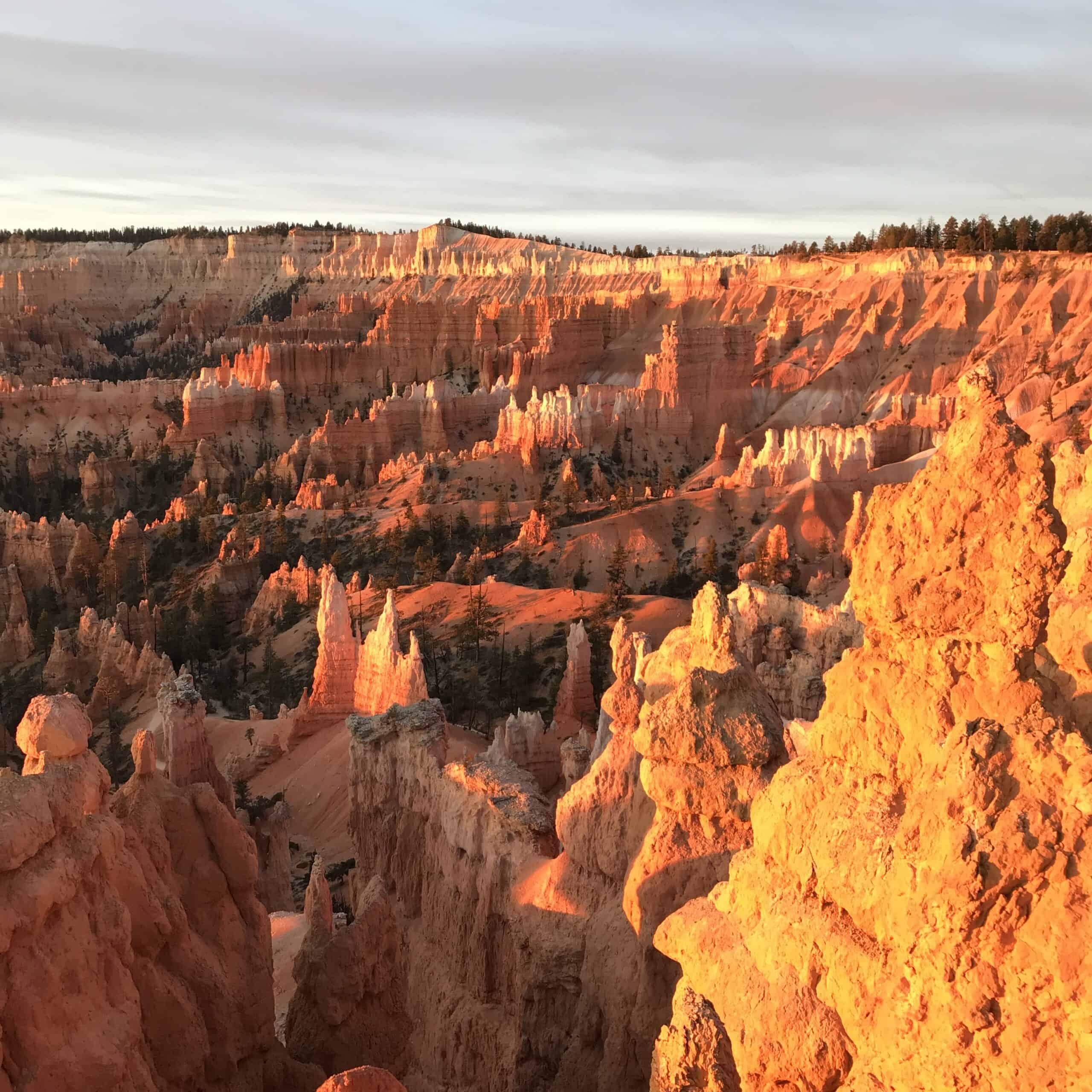
I noticed later that each of my photos of the brightly colored hoodoos, bathed in the morning light, is clear of distant people on the other paths below. It was just too cold, but not for us.
Rainbow Point
After a motel breakfast, we got back in the truck to visit Rainbow Point at the far end of Bryce Canyon National Park.
This road is paved and in great shape, but may be closed during parts of winter when the snow is too deep to plow. It's an 18-mile, one-way journey, and it is lightly traveled.
We watched a furry bobcat walk in front of us and saunter down the side of the road before jumping into the brush.
Along the route, we stopped to view Farview Point, Natural Bridge, and Ponderosa Canyon. Rainbow Point is the highest elevation in the park at 9,115 feet (2,778 meters). The views were endless, and the air was clean and clear. We loved Rainbow Point.
This end-of-the-road point marks the start of the Under the Rim Trail, a route backpackers take to enjoy nearly complete solitude on a two-to-three-day, 23-mile (37-kilometer) journey.
Backpacking in Bryce Canyon National Park requires a backcountry permit. In summer, the trail is hot, and the water is scarce. In winter, water sources could be frozen solid. Plan your backpacking trip in Bryce carefully.
It was afternoon by now, and we drove back to the park entrance, out to Highway 89, and looked for a place to have a late lunch before going back to St. George.
If you're considering a trip to Bryce Canyon National Park in Utah, consider visiting during the winter months. You won't regret it.