Some journeys begin where normal travel infrastructure ends. No train stations exist at the South Pole, no highways cross Greenland's ice cap, and no fixed sightseeing route runs through Svalbard's sea ice. Reaching these places depends on aircraft, expedition vessels, skis, crampons, horses, or specially equipped vehicles.
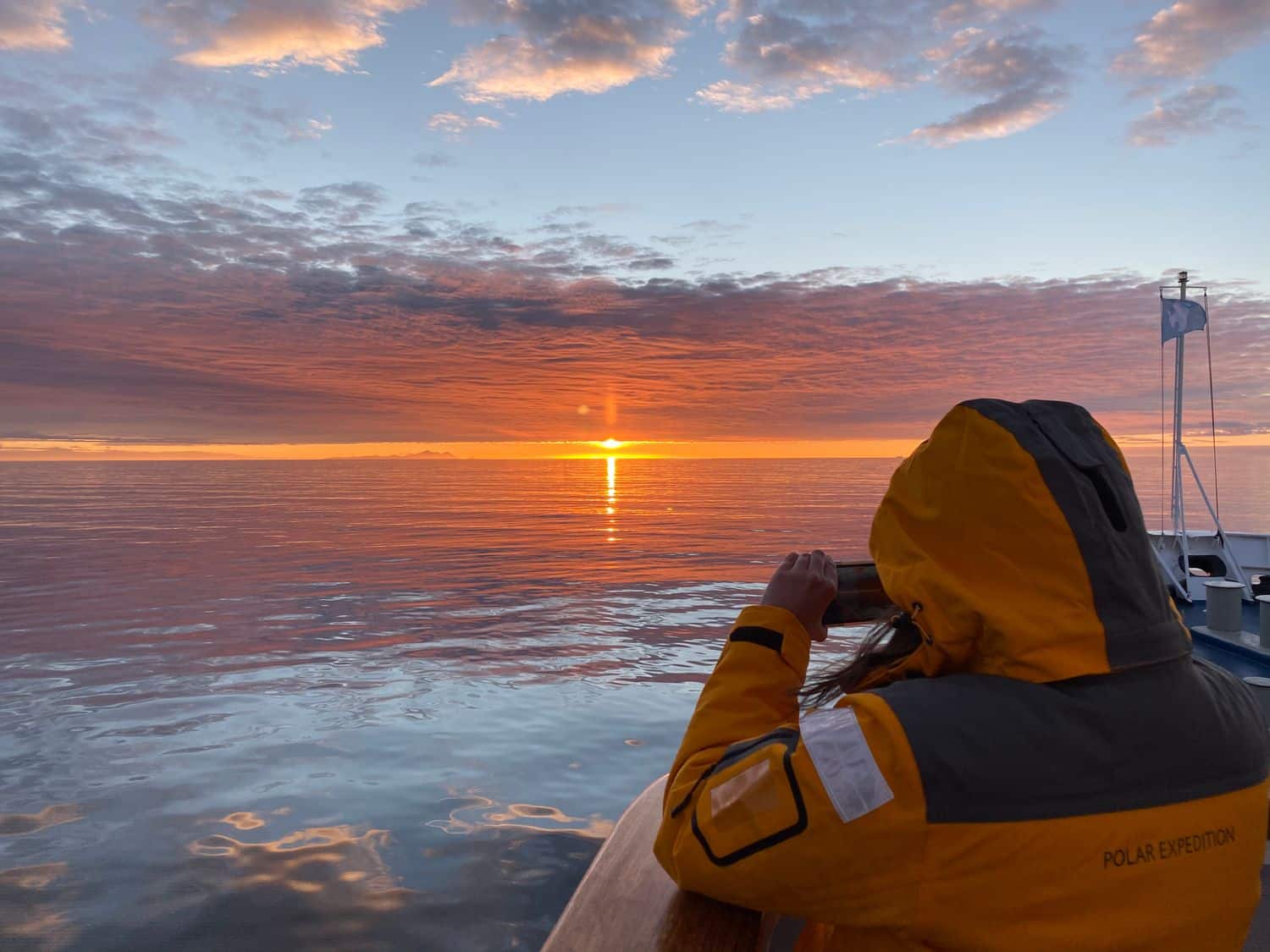
The Adventure Travel Trade Association's 2026 industry report, based on responses from 329 tour operators, found hiking and trekking remain among the sector's most in-demand activities. Customized itineraries have ranked as the most popular trip type every year since 2019.
These six expeditions from 90° South to Mongolia's Altai Mountains offer six very different ways to reach what feels like the edge of the world.
1. Stand Where Every Direction Is North
Geographic South Pole With EYOS Expeditions
At 90° South, you cannot go farther south. Every direction from the Geographic South Pole points north, while all meridians converge beneath the same patch of Antarctic ice.
The U.S. National Science Foundation places the pole at about 2,835 meters (9,301 feet) elevation on the Antarctic ice sheet. The ice moves, carrying the nearby Amundsen-Scott South Pole Station roughly 10 meters (33 feet) each year.
Reaching the pole requires a different operation than cruising along the Antarctic Peninsula.
EYOS Expeditions organizes journeys into the Antarctic interior using ski-equipped aircraft, remote camps, and purpose-built overland vehicles, depending on the itinerary. Weather, visibility, and ground conditions can alter departure times and routes with little warning.
For travelers who want more than a fly-in visit, EYOS South Pole expeditions have also operated overland journeys across the polar plateau using customized four-wheel-drive vehicles.
"The South Pole is a tremendous experience, one that has to be earned by all who venture here," said Rob McCallum, co-founder of EYOS Expeditions.
Modern transport has changed the mechanics of polar travel, but the geography has not. Reaching 90° South still ends at a single coordinate surrounded by thousands of kilometers of ice.
Expedition specialist: EYOS Expeditions
Expedition style: Antarctic interior and overland polar exploration
Why it feels remote: It ends at Earth's southernmost point.
2. Sail Through Svalbard's Fjords and Sea Ice
With EYOS Expeditions
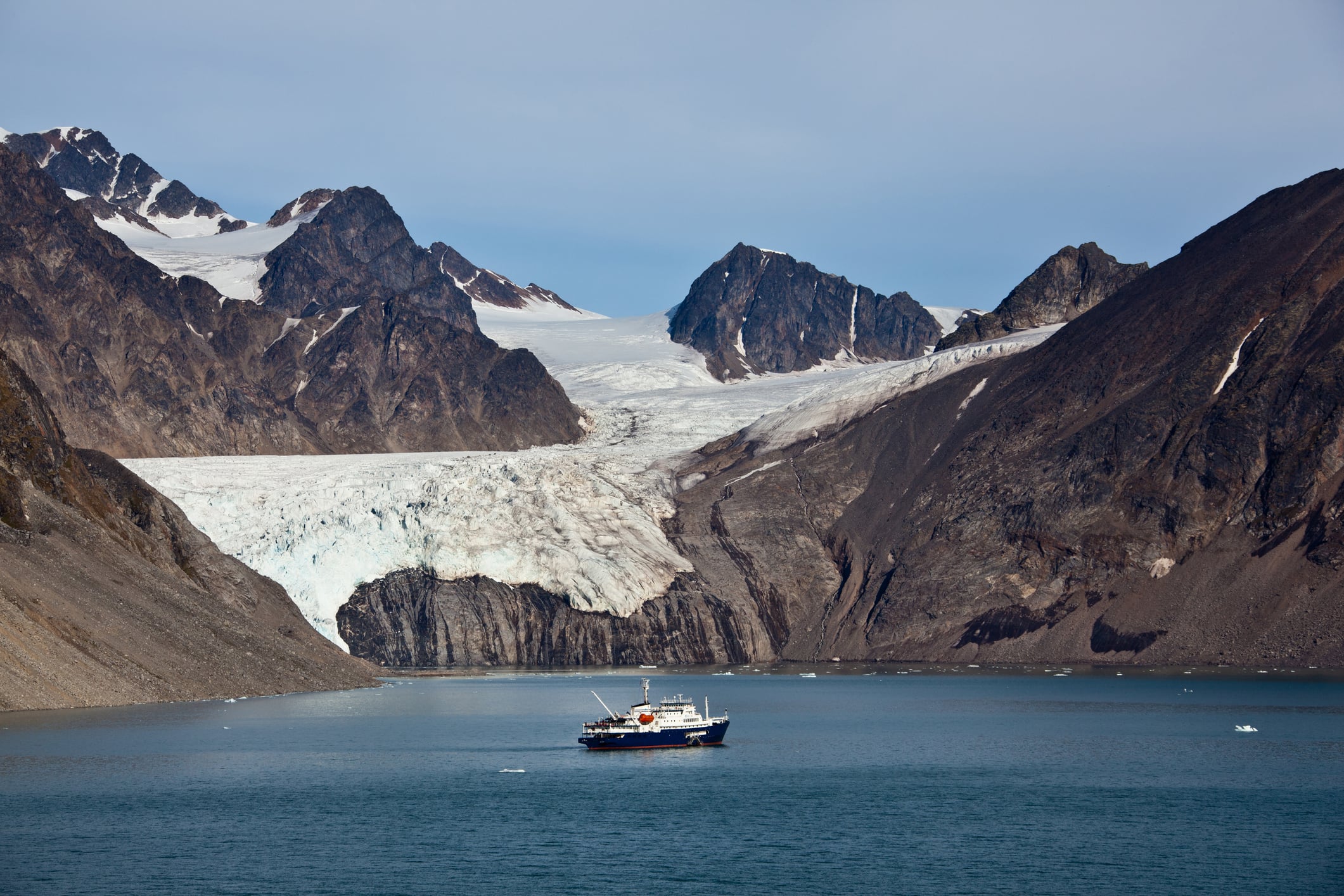
Svalbard sits deep inside the High Arctic, between mainland Norway and the North Pole.
Glaciers cover about 57% of the archipelago, according to the Norwegian Polar Institute. More than 900 kilometers of coastline are bordered by tidewater glaciers that flow directly into the sea.
Few roads go beyond the settlements; exploration quickly becomes a marine operation. EYOS uses expedition yachts as mobile bases in Svalbard, moving between fjords, glacier fronts, wildlife areas, and landing sites that shift with sea ice and weather.
Days may include Zodiac outings, kayaking, shore landings, and guided hikes. Routes remain flexible because Arctic ice rarely follows a fixed timetable.
Summer also brings continuous daylight. Svalbard's midnight-sun season runs from approximately April 20 to August 23, giving expeditions long hours to explore when conditions are favorable.
The appeal is not a single landmark. It is the ability to travel across a landscape where glaciers, sea ice, and wildlife determine where the vessel can go next.
Expedition specialist: EYOS Expeditions
Expedition style: Private expedition-yacht exploration
Why it feels remote: Fjords and sea ice replace roads between destinations.
3. Cross Patagonia's Southern Ice Field
With Chaltén Mountain Guides
Patagonia's famous trails draw hikers worldwide, but the terrain gets less forgiving once routes move beyond established paths around El Chaltén.
Los Glaciares National Park covers about 600,000 hectares, with glaciers covering roughly half of the UNESCO World Heritage site. Much of that ice descends from the Southern Patagonian Ice Field.
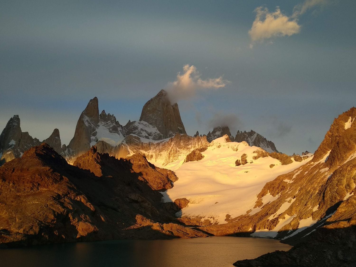
Chaltén Mountain Guides runs multi-day routes across this terrain, including traverses between Marconi Pass and Huemul Pass, as well as longer ice-cap expeditions that combine glacier travel with summit objectives.
Travel can involve crampons, ropes, moraine, snowfields, high passes, and exposed camps.
Weather is a major variable. Strong winds and rapidly moving systems can keep teams in camp or force changes to the planned route.
The ice field sits close enough to El Chaltén to appear accessible on a map, yet conditions can become alpine and isolated within a single day of leaving town.
For travelers approaching Patagonia via its established trail network, hiking in El Chaltén offers a useful introduction to day hikes around town. The Southern Ice Field begins where this accessible trail system gives way to glacier travel, exposed passes, and expedition camps.
Expedition specialist: Chaltén Mountain Guides
Expedition style: Glacier travel and expedition mountaineering
Why it feels remote: Marked trails give way to ice, high passes, and temporary camps.
4. Camp Across the Atacama Desert
With Atacama Experience
The Atacama replaces ice with extreme dryness. The U.S. Geological Survey describes it as the driest desert on Earth, noting some areas may receive measurable rainfall only once every five to 20 years.
The landscape includes salt flats, volcanic plateaus, geothermal fields, canyon systems, and high-altitude lagoons.
Atacama Experience, based in San Pedro de Atacama, runs a five-day Atacama Traverse and Desert Camping itinerary that moves through several of these environments rather than returning to the same hotel each night.
The route combines camping with highland landscapes, salt formations, canyon trekking, geyser fields, and Andean communities.
Other itineraries by the company travel above 5,000 meters, where altitude becomes an expedition factor alongside sun exposure, temperature swings, and limited water.
This is not the Atacama seen only from roadside viewpoints. Several days of desert travel reveal its scale, silence, and lack of infrastructure more clearly than a single excursion from San Pedro.
Expedition specialist: Atacama Experience
Expedition style: Desert traverse and high-altitude exploration
Why it feels remote: Water, altitude, and distance shape every day of travel.
5. Ski Across Greenland's Ice Cap
With Thule Expeditions
Greenland's ice sheet is the second-largest mass of land ice on Earth after Antarctica.
NASA data show Greenland covers roughly 2.175 million square kilometers, with ice covering most of the island. Crossing part of that landscape is not sightseeing.
Thule Expeditions runs a west-to-east Greenland Ice Cap Crossing from Kangerlussuaq toward Isortoq. Participants travel on Nordic backcountry skis and pull sleds loaded with expedition equipment, food, and personal gear.
Thule Expeditions runs a west-to-east Greenland Ice Cap Crossing from Kangerlussuaq to Isortoq. Participants travel on Nordic backcountry skis and pull sleds loaded with expedition equipment, food, and personal gear.
Once the crossing begins, no villages, hotels, or roadside stops exist between camps. Days revolve around ski distance, weather, snow conditions, navigation, and camp routines. The landscape can remain almost completely white for hours.
Greenland's scale becomes clearer when progress is measured in kilometers traveled under human power.
Expedition specialist: Thule Expeditions
Expedition style: Human-powered ski crossing
Why it feels remote: Travelers haul their own expedition systems across the ice.
6. Trek Into Mongolia's Altai Mountains
With Discover Altai
Western Mongolia lies thousands of kilometers from the country's most visited cultural and city centers. In Altai Tavan Bogd National Park, glaciers and high peaks rise above valleys used by Kazakh and Tuvan pastoral communities.
Discover Altai runs multi-day trekking and mountaineering routes through the region, including journeys to Potanin Glacier and expeditions toward 4,374-meter Mount Khüiten, Mongolia's highest peak.
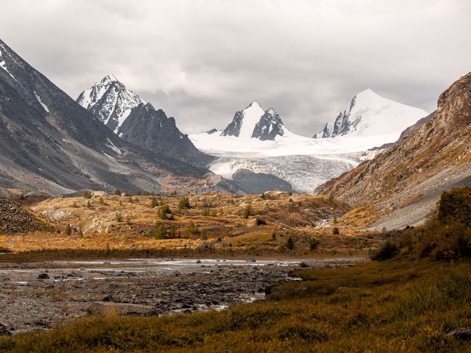
Some routes cover between 80 and 120 kilometers. Pack animals carry equipment along the valleys, while travelers continue on foot between temporary camps. Roads quickly disappear as routes move deeper into the park.
The landscape also contains thousands of prehistoric petroglyphs. UNESCO's Petroglyphic Complexes of the Mongolian Altai preserve engravings depicting hunting, animals, carts, horse travel, and changing ways of life across thousands of years.
Few expeditions combine remote alpine travel with such a visible record of human history.
Expedition specialist: Discover Altai
Expedition style: Supported trekking and mountaineering
Why it feels remote: Long approaches, high terrain, and limited road access separate the mountains from Mongolia's main travel routes.
What Travelers Should Look for Before Booking a Remote Expedition
Remote travel requires more scrutiny than a conventional tour. Travelers should check guide qualifications, emergency communications, evacuation plans, insurance requirements, physical demands, and contingency time included in the itinerary.
Operator experience matters most when the trip involves glaciers, polar environments, high altitude, or areas without rapid medical access.
Small groups also make a practical difference. They move more easily through difficult terrain, put less pressure on camps, and let guides modify plans when weather or surface conditions change.
At the South Pole, that may mean waiting for better visibility before an aircraft moves.
In Greenland, it may mean shortening a ski day because of snow conditions.
In Svalbard, it may involve abandoning one fjord and sailing to another because sea ice has shifted.
Those decisions don't interrupt the expedition. They are part of it.
This story was published in partnership with EYOS Expeditions.