Over 2,000 years ago, King Antiochus I chose the 7,000-foot-high Mount Nemrut in the Taurus mountains of southeastern Turkey for his tomb.
The result of his monumental effort to rest in peace close to the gods offers a fascinating experience for today's travelers.
I learned about these mountaintop ruins, recognized as a UNESCO World Heritage Site since 1987, from Adam Rapp of Clothing Arts.
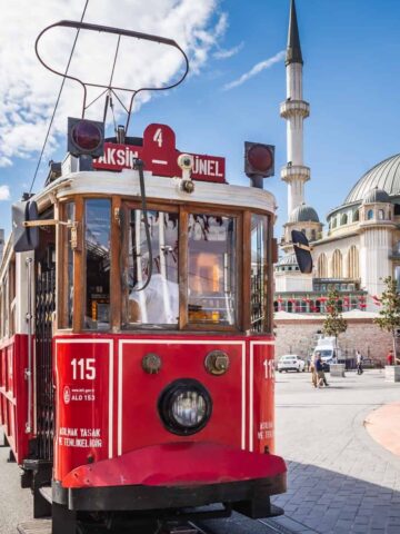
We'd met up for a day of food and sightseeing in New York City before I departed for Istanbul with Turkish Airlines.
Based on his recommendation and doing little more than researching how to get there, I soon found myself in the nearby town of Kahta asking around for guides.
I found one in Khadir, which charged $75 for a full-day tour with stops at:
- Mount Nemrut (Nemrut Dagi in Turkish)
- Yeni Kale Fortress
- Severan (Cendere) Bridge
- Karakus Tumulus
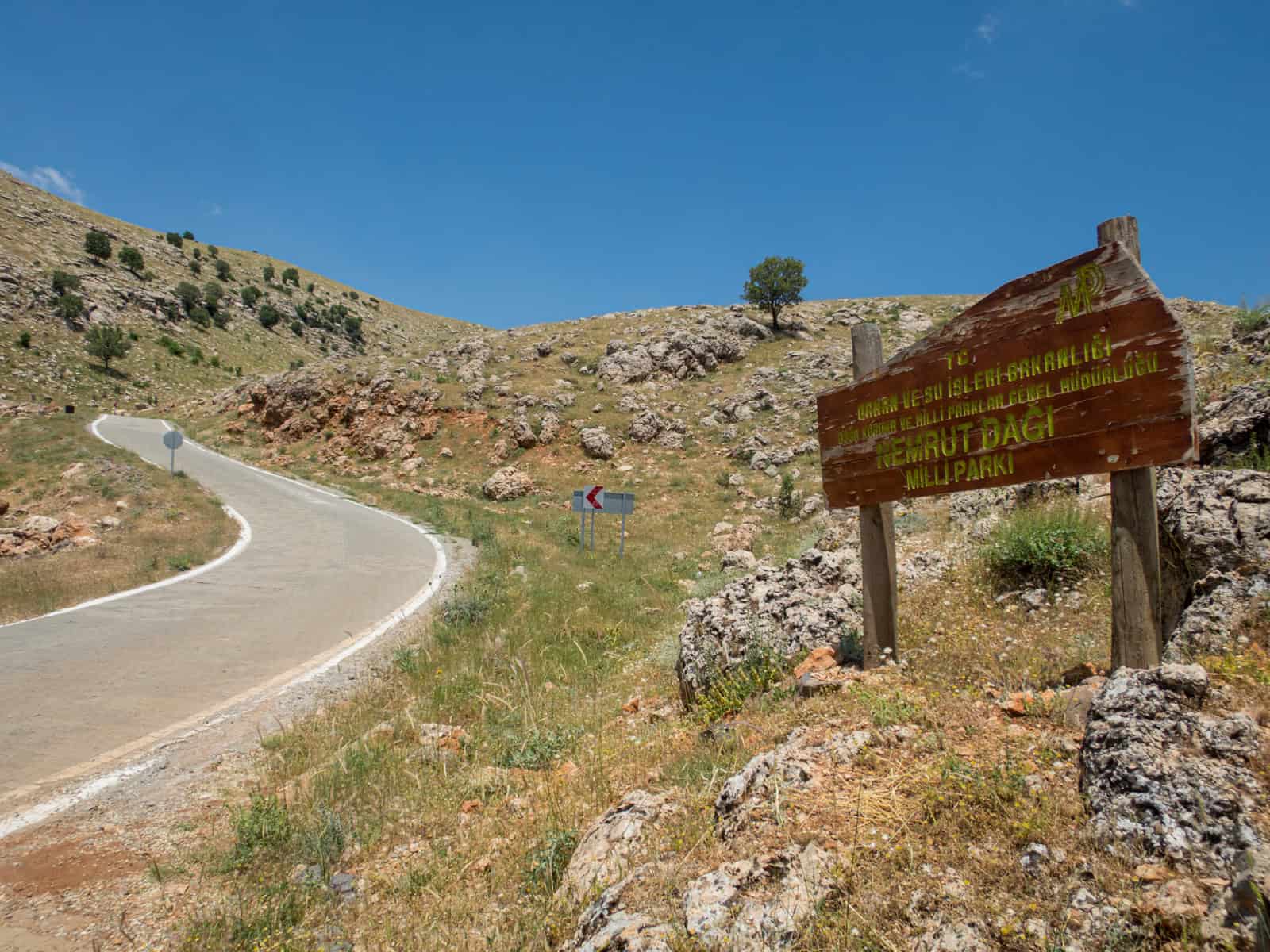
It was early June, and spring was in the air. Mount Nemrut is best visited in warmer months, from May to September. Snow makes the peak inaccessible from mid-October to April.
Visiting Mount Nemrut at sunrise or sunset is popular due to its commanding views of the surrounding countryside. I can't recall if I considered a sunrise visit or not.
I'd flown into Kahta (via Istanbul) from a side trip to Tbilisi, Georgia, and it's unlikely I'd have been interested.
The upside of skipping sunrise from Mount Nemrut was that there were fewer people by mid-morning. It felt like I had one of Turkey's most impressive sites to myself.
Getting to Mount Nemrut
Mount Nemrut is 25 miles (40 km) northeast of Kahta; the drive takes about an hour.
If you want to cut your drive time to Mount Nemrut in half, there are several guesthouses in Karadut, a town within the national park.
The road was nearly wholly paved when I visited, with the last section near the parking area still under construction. I'm sure it's finished by now.
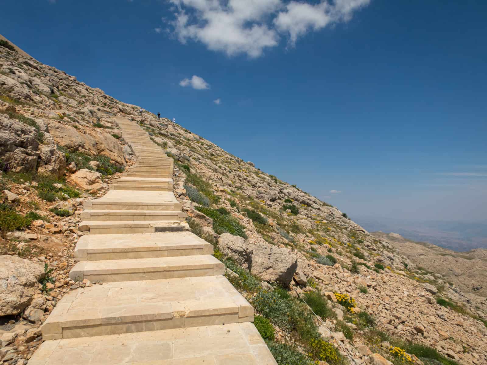
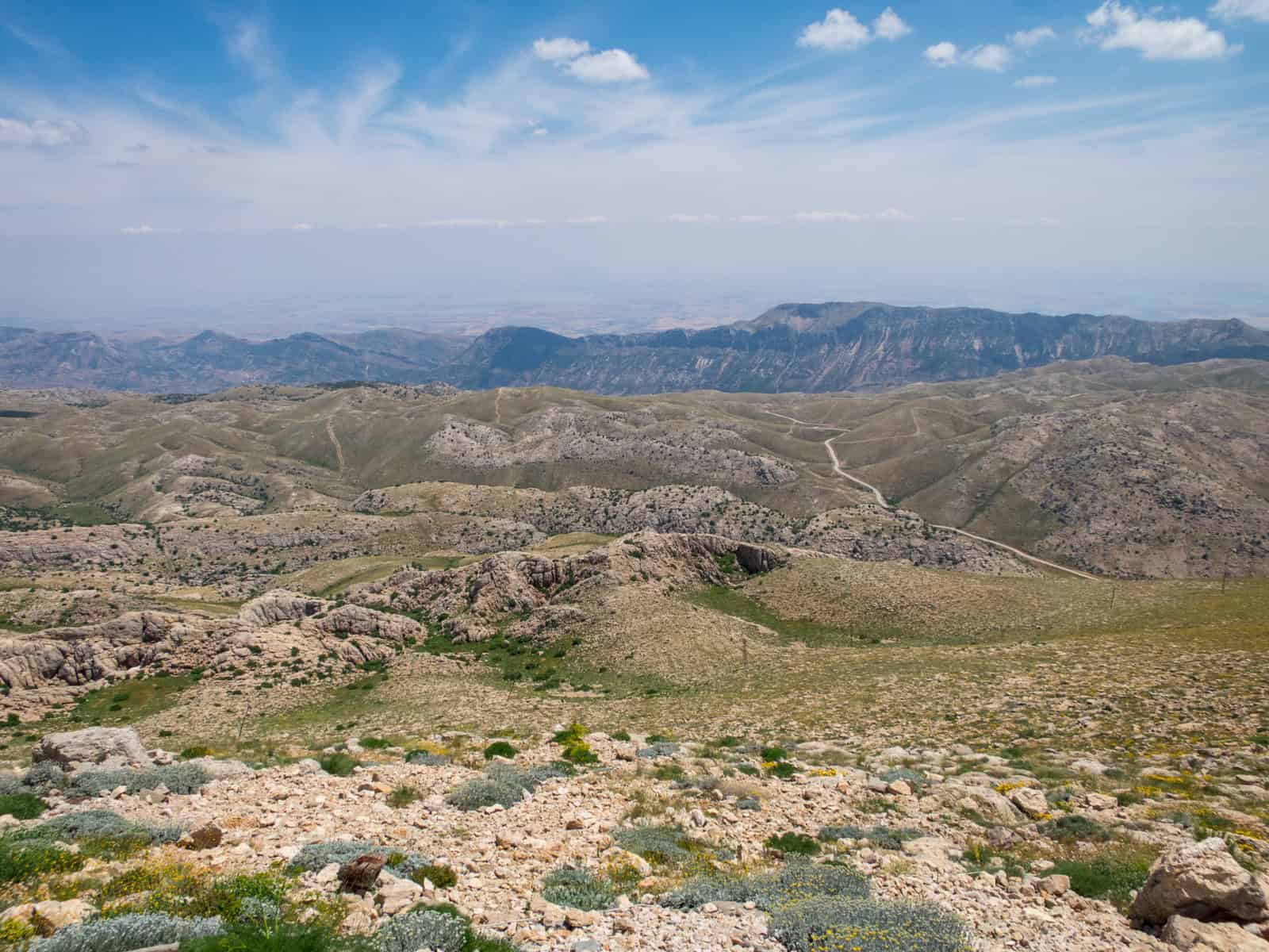
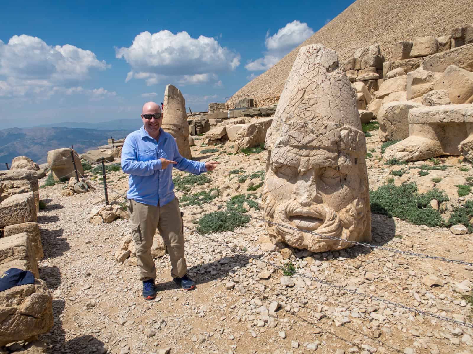
The final stretch from the parking area to the tomb is a 20-minute walk along a stone pathway.
It's not too hard, and you can stop anywhere along the way to catch your breath and take pictures.
There are a few stone benches, too. However, it's safe to say this is not a wheelchair-accessible site.
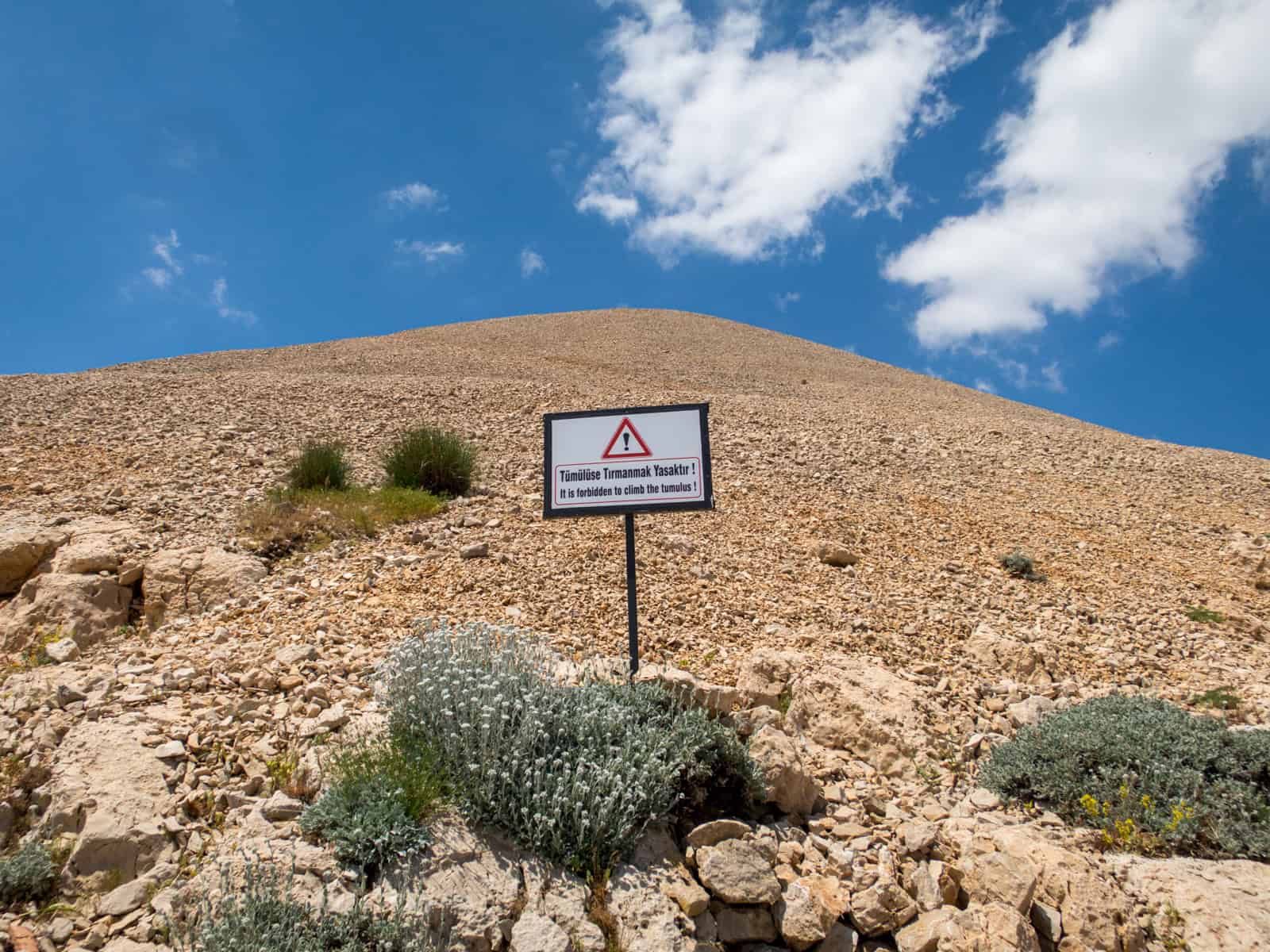
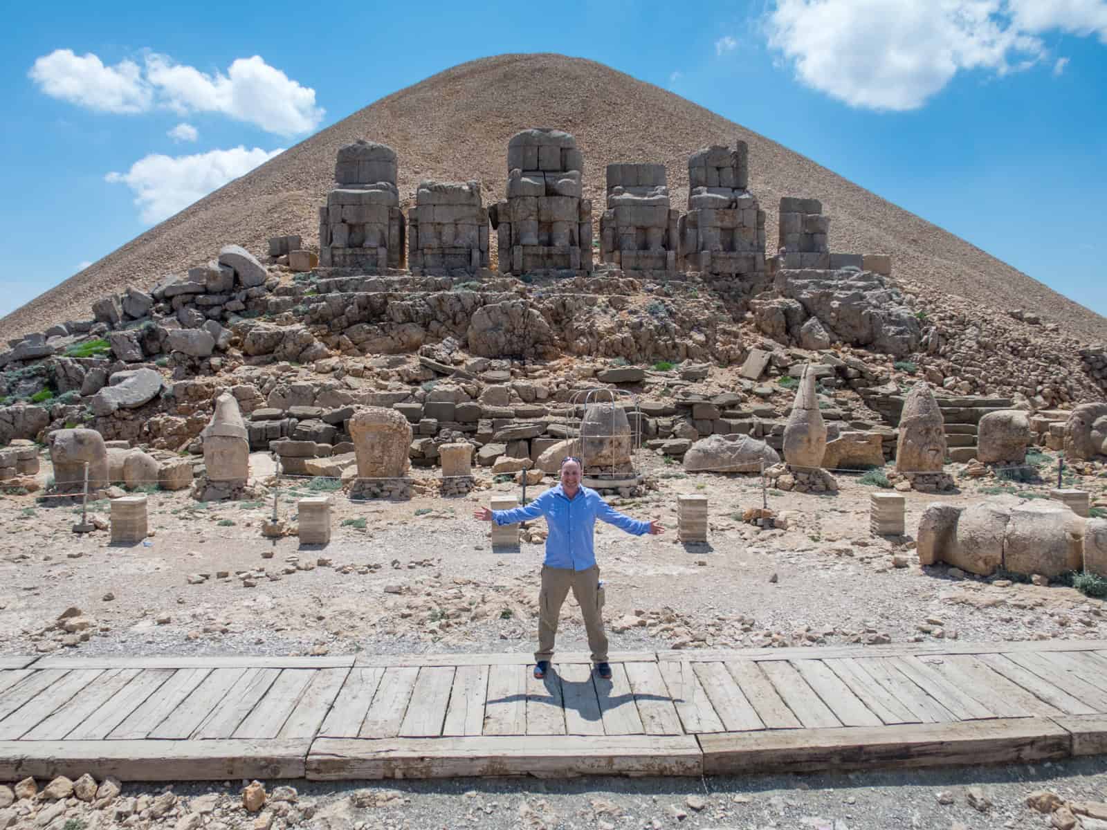
Once you reach the top, a sign warns against climbing on the tumulus, the loose rock used to create a burial mound on the mountaintop.
The tumulus is about 164 feet (50 meters) tall, although it's believed to have been as high as 197 feet (60 meters) when it was first created.
Over the last 2,000 years, the tumulus and statues atop Mount Nemrut have been subject to earthquakes, vandalism, erosion, and overzealous tourists.
If you visit, please act responsibly to help maintain this delicate site for future generations to enjoy.
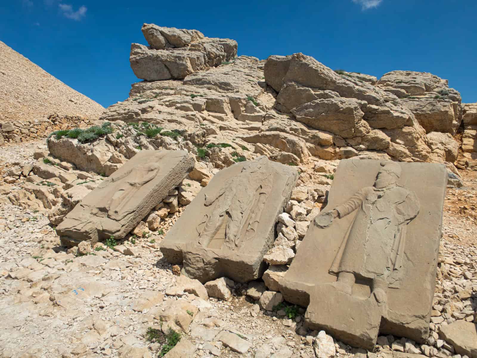
The Eastern Terrace
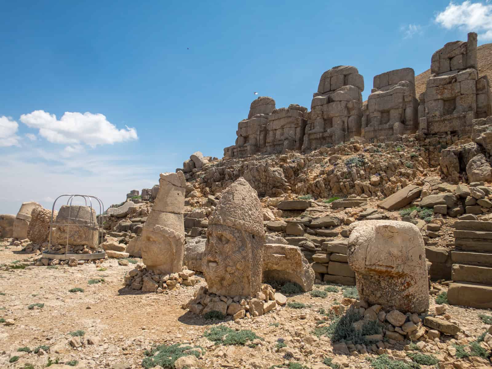
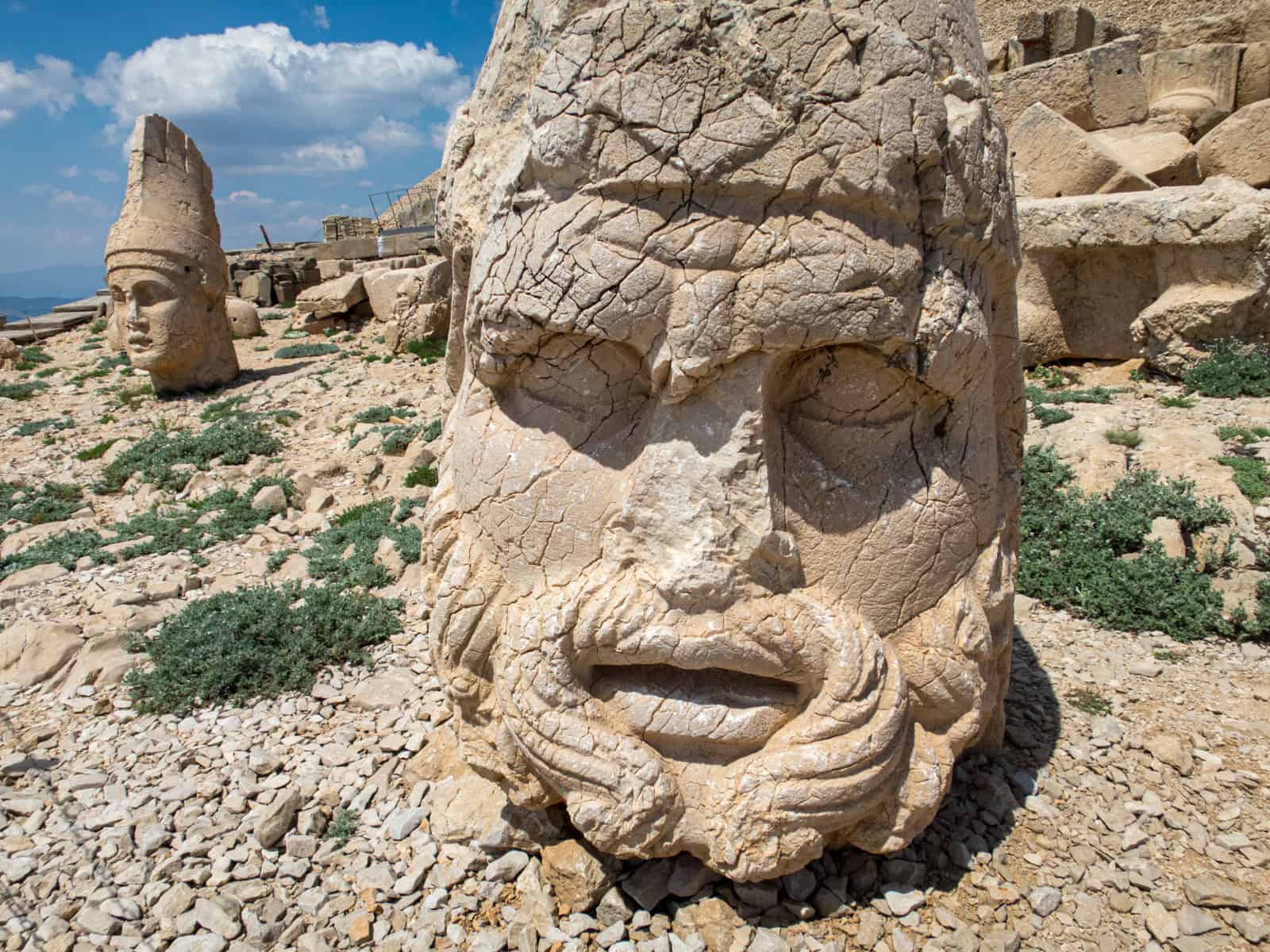
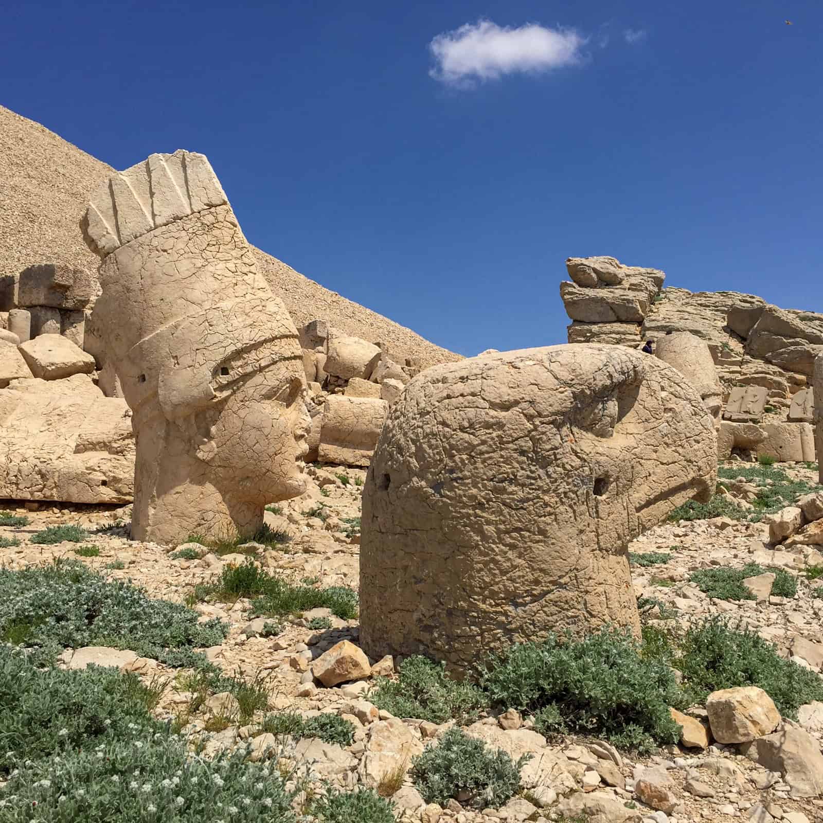
The base of the tumulus features two terraces, one on the eastern side and another on the western side, each of which has five 26 to 30-foot-high stone statues.
To the far left on the Eastern Terrace, the statue is King Antiochos I of Commagene, who lived from 69-34 B.C. and ruled over a small Greco-Iranian kingdom.
Three of the other four statues depict the gods of Zeus, Apollo, and Hercules. King Antiochos I certainly thought highly of himself.
Whether the heads of all ten statues were purposefully removed or shaken loose from earthquakes and erosion seems up for debate.
Regardless of how they ended up on the ground, the fact that you can stand next to them and examine their features in detail makes this site special.
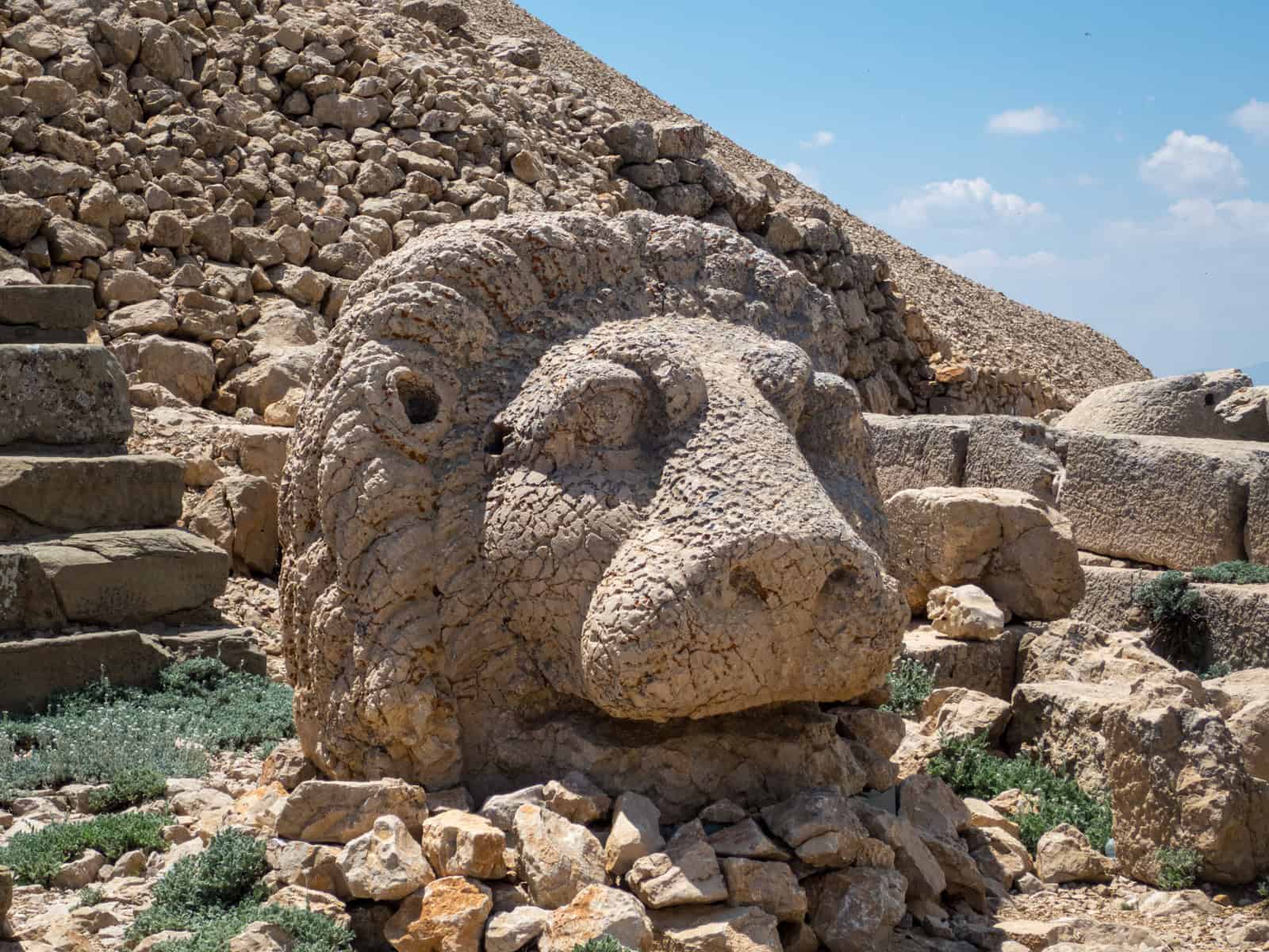
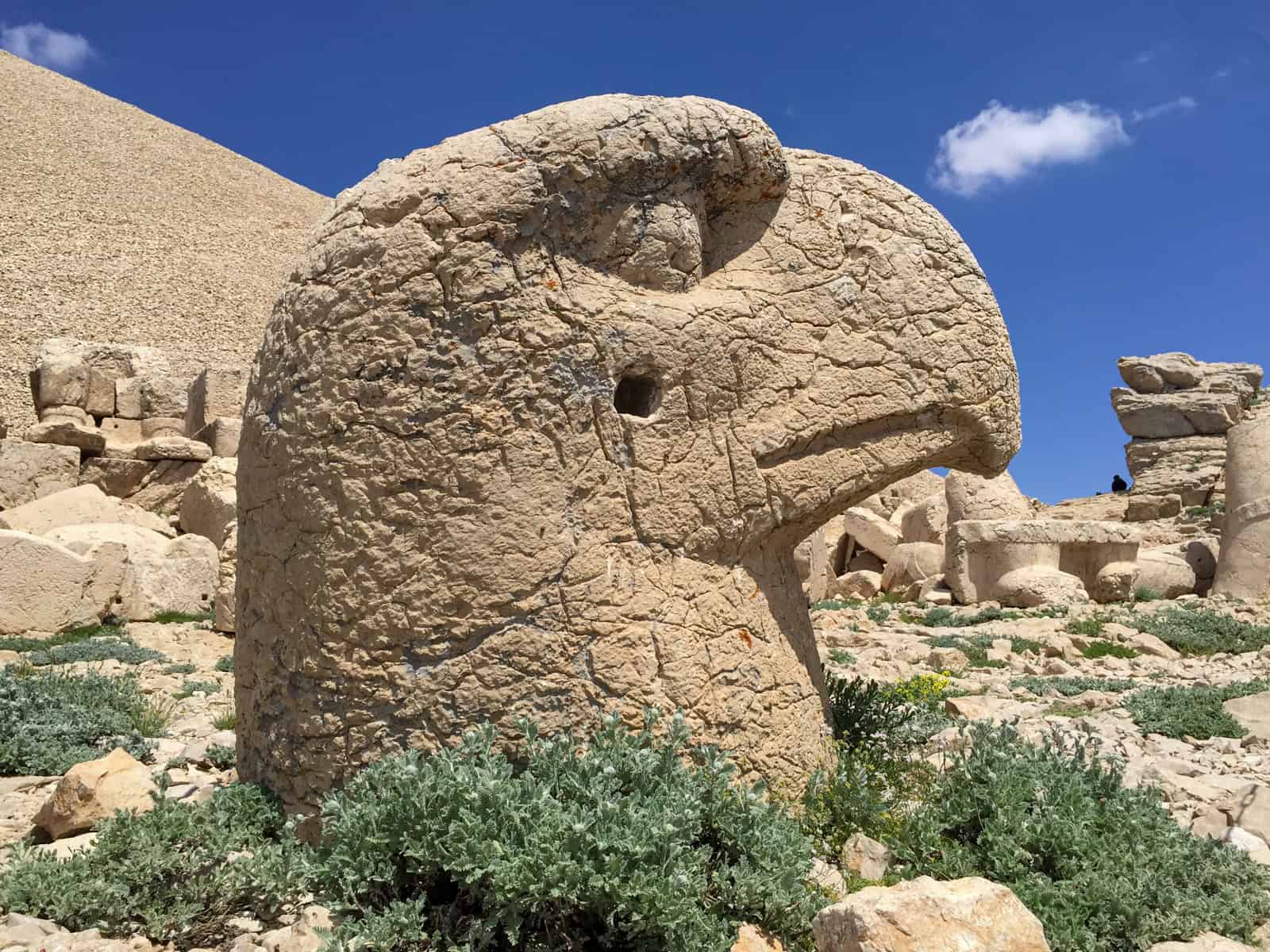
Guarding the King and gods are animal heads, including that of a lion and an eagle.
The Eastern Terrace also features an altar, likely used for sacrifices, opposite the statues. It's here that you can watch the sunrise, just as they did thousands of years ago.
The Western Terrace
Relatively flat pathways connect the Eastern and Western Terraces on both the north and south sides.
The seated statues aren't as well preserved on the Western Terrace, but the heads are better!
The sage-looking head of Heracles Artagnes Ares was one of my favorites. There's no altar on the western side, but it's where you'll want to be if you're there for sunset.
You'll also encounter sandstone steles with engravings in addition to the stone heads of gods and their protectors.
Relief carvings were also found here. They have since been moved to the Adiyaman Archaeological Museum, an hour's drive west of Kahta.

The museum's highlight is the relief of a lion with 19 stars and a crescent moon under its neck. It's thought to represent Leo and is, therefore, one of the earliest known representations of a horoscope.
After exploring the site for a little over an hour and taking all the photos I wanted, Khadir and I returned to the car.
We spent about two hours total at Mount Nemrut, including the walk up and down the peak. From there, Khadir took me to three nearby points of interest, all standard stops on any private or group tour.
Sites Near Mount Nemrut
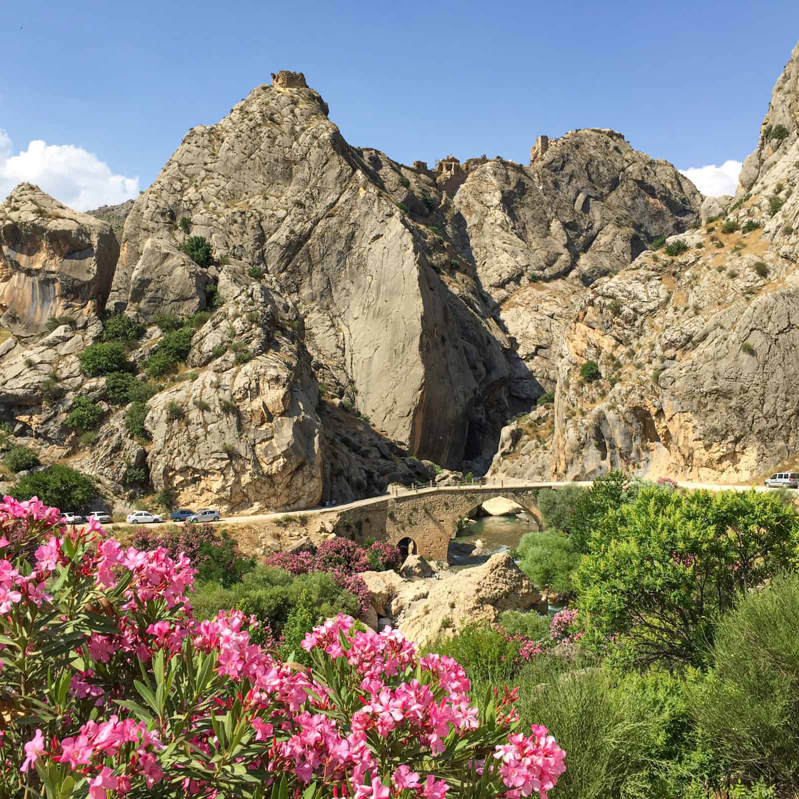
Yeni Kale Fortress is perched atop rocky cliffs in Eski Kahta. While we didn't visit the ruins, I was glad we stopped along the road as I love the photo I got with flowers in the foreground juxtaposed against the jagged rock.
The fortress occupies an area once home to Commagene's rulers, which presumably included King Antiochos I.
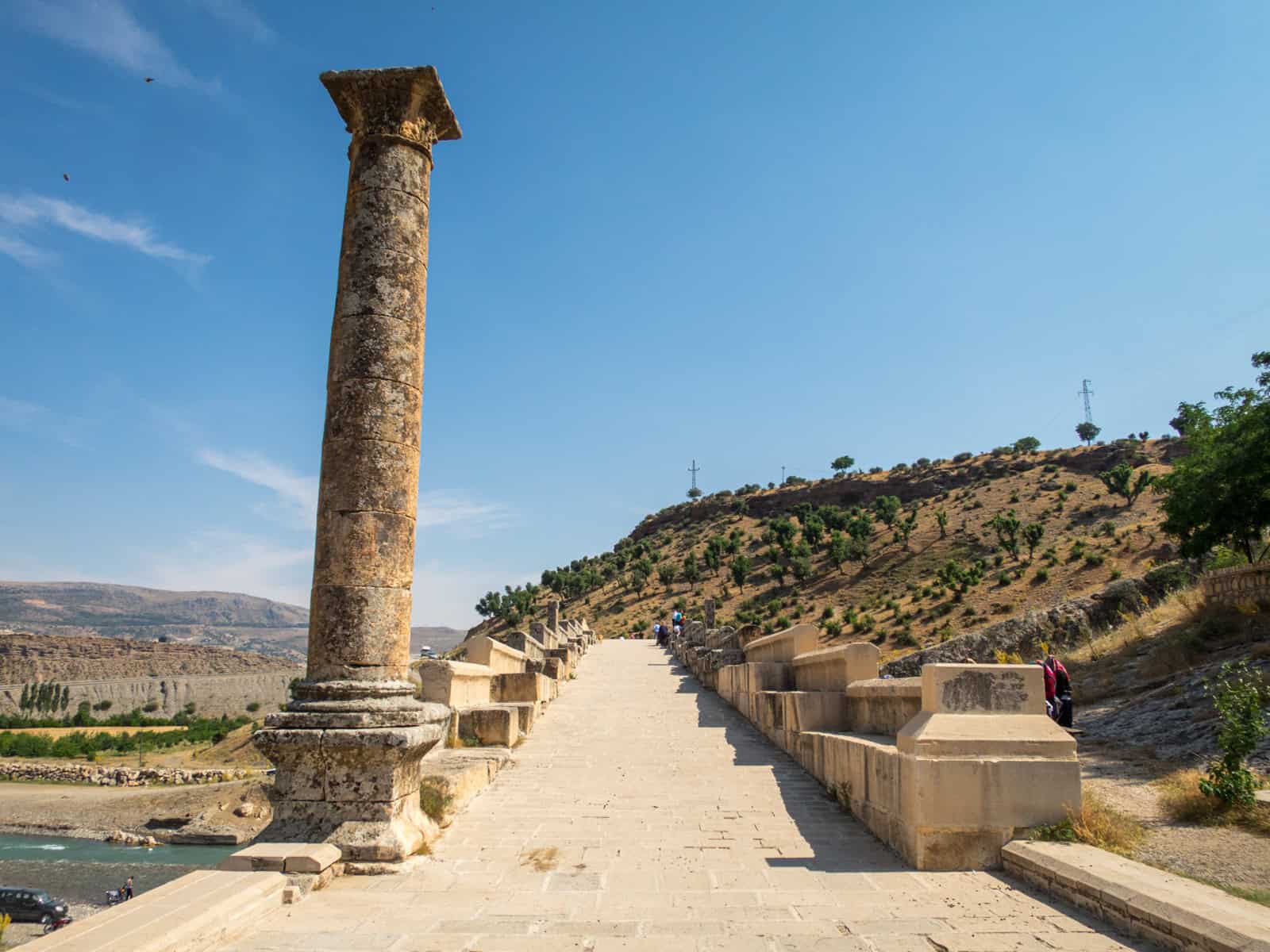
Our second stop was the Severan (Cendere) Bridge, which the Romans built in the 2nd century A.D.
Running a total length of 390 feet (120 meters) with a span of 112 feet (34.2 meters), it's one of the largest Roman arch bridges.
The bridge was restored in 1997 and is now closed to vehicle traffic to ensure its preservation.
While I was there, I saw locals in Chabinas Creek below. It appeared some were there to do laundry while the kids were there to swim.
Related: 13 Incredible Things to Do in Cappadocia
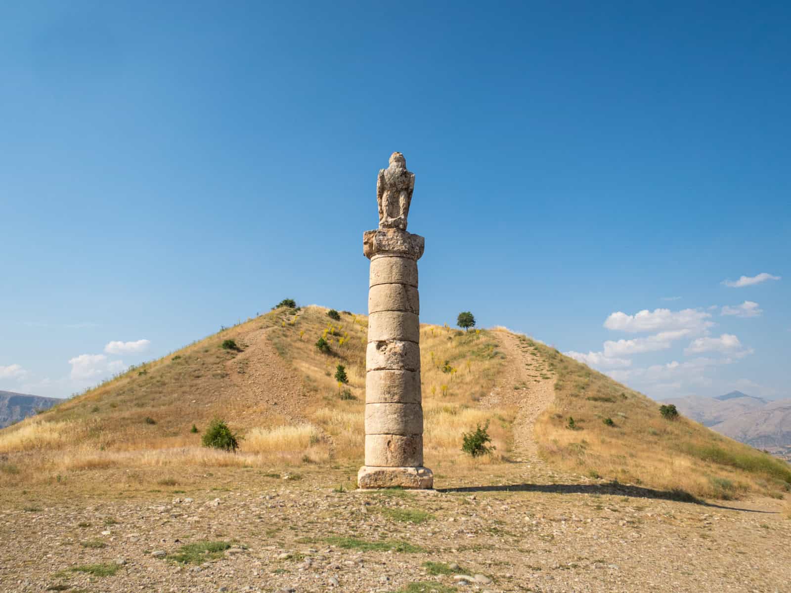
The third and final stop after my visit to Mount Nemrut was the Karakus Tumulus, a 115-foot (35-meter) high burial mound for three women:
- Queen Isias, wife of King Antiochos I.
- Princesses Antiochis, daughter of King Antiochos I
- Princess Aka I, daughter of Princess Antiochis
Karakus means "blackbird" in Turkish, and a single 30-foot (9-meter) Doric column on the south side features an eagle atop it.
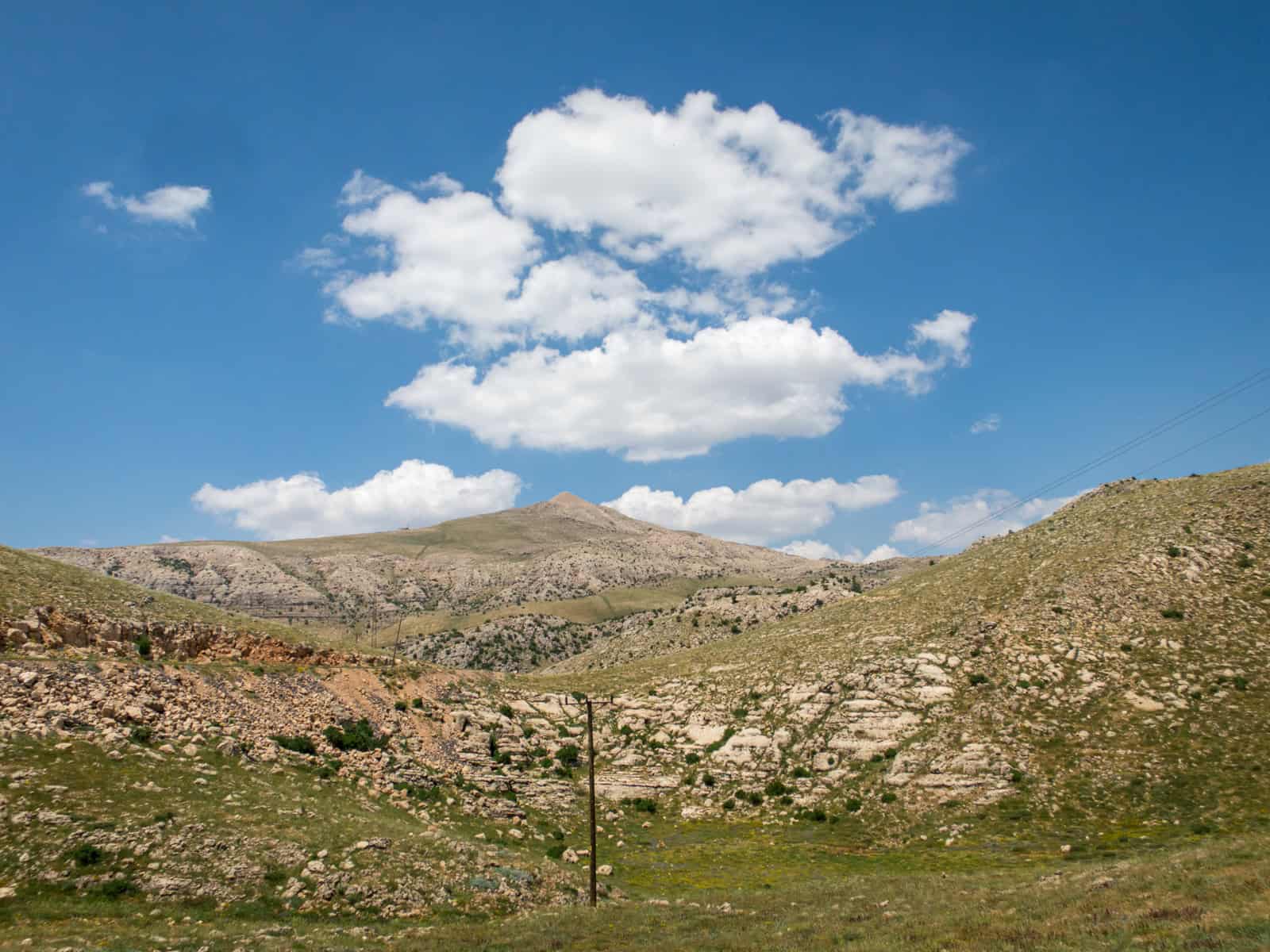
Facing the tumulus from the south, it was a clear enough day to see Mount Nemrut off to the northeast side. In the photo above, it appears as a dark triangular shape to the right of the burial mound.
***
It can be hard to decide where to spend your time in a culturally and historically rich country like Turkey. I spent six weeks backpacking in Turkey and saw ten UNESCO World Heritage Sites.
My experience visiting Mount Nemrut stands out as two of the most memorable hours of the entire trip.