"San Jacinto is the most sublime specticale to be found on this earth!"
- John Muir
Muir, the great environmentalist, mountain climber, and founder of the Sierra Club, was right. Mount San Jacinto is sublime. To be succinct, my partner, CT, has often called it her "happy place."

Mount San Jacinto in Southern California is not your first thought when thinking of the California lifestyle. Known for sunshine, sandy beaches, surfing, Hollywood, and amusement parks, the Golden State's southern half is also filled with mountains and snowy peaks. More than 26 named peaks are over 10,000 feet (3,226 meters) in elevation.


My partner, CT, and I have climbed to the top of all 26, but our favorite is the highest point on the San Jacinto massif. The peak is 10,834 feet high (3,611 meters) and is accessible from seven different trails.
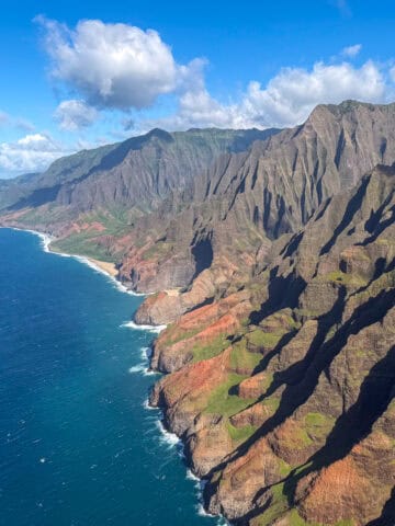
If you are hardy, fearless, and unafraid of the cold, you can climb the mountain all year. The view from the top of Mount San Jacinto goes in all directions and for many hundreds of miles. We have seen the Pacific Ocean, parts of Mexico, the Sultan Sea, and Telescope Peak in Death Valley.
Table of Contents
Where is Mount San Jacinto?
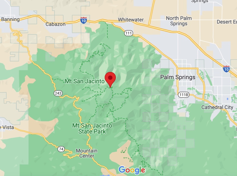
Hiking to the top of Mount San Jacinto can begin from either side of the mountain. The resort city of Palm Springs sits at the base of the mountain and is on the east side, and the little town of Idyllwild is on the west side. You can choose either side. It is a 2.5-hour drive from San Diego or a 3-hour drive from Los Angeles.
Every trailhead I list below is accessible through Google Maps, which will guide you directly to the parking area. Over the last seven years, I have climbed to the summit of more than 430 mountains, but only a few peaks have received a second hike. Conversely, since I have climbed Mount San Jacinto 21 times, it is my favorite mountain.

San Jacinto Routes to the Top
Climbing Mount San Jacinto never gets boring. There are eight routes to the top, and we have done seven of them.
- Via the Palm Springs Aerial Tramway / Round Trip 11 miles (17.8 kilometers) Elevation gain 2,200 feet (709 meters).
- Marion Mountain Trail / RT 11 miles (17.8 kilometers) Elevation gain 4,500 feet (1,451 meters).
- Skyline Trail or Cactus to Clouds RT 30 miles (48.3 kilometers) Elevation gain 10,100 feet (3,258 meters).
- Deer Springs Trail / RT 19 miles (30.6 kilometers) Elevation gain 5,121 feet (1,652 meters).
- Devil's Slide Trail / RT 16 miles (26 kilometers) Elevation gain 4,410 feet (1,422 meters).
- Fuller Ridge Trail / RT 15 miles (24.2 kilometers) Elevation gain 3,950 feet (1,274 meters).
- South Ridge Trail / RT 20.5 miles (33 kilometers) Elevation gain 6,500 feet (2,100 meters).

In addition to trying many trails to the top, we often used a snowshoe route in the winter when all the trails and bushes were covered in snow. We were able to hike Mount San Jacinto's summit every month of the year using snowshoes, crampons, or even microspikes.
Some of the trips we made in the winter were thrilling, and some were brutally cold and miserable. Each of them was memorable.

If there had been a recent snowfall, we would wear snowshoes the whole way. By springtime, the snow had begun to melt and become hard ice as it froze each night. Under these conditions, we used crampons and an ice axe.
See also: Sierra Nevada Adventure - White Mountain Peak

We have started our journey to the peak via the Palm Springs Aerial Tramway more than ten times. This ride not only saves time on the hike but also makes it safer and more reasonable in winter.
It is common to be in line for the first ride up the tram and see a dozen or more folks ready with snowshoes to try for the summit of Mount San Jacinto. The tram is not just for summit hikers, though.

Thousands of people take the tramway up to 8,500 feet daily for the viewing decks, to eat and drink in the restaurants, to play in the snow, or to stroll through the easy trails in Mount San Jacinto State Park.
The Tram is billed as the world's largest rotating tramcar. It takes guests 2.5 miles up the mountain in less than 15 minutes. It's also a great place to start a hike to the summit of San Jacinto Peak.
Mt. San Jacinto Camping
CT and I have often stayed in Idyllwild before climbing one of the peaks on San Jacinto. We have twice stayed at a friend's cabin and twice at a small hotel in Idyllwild. We have tent-camped at two places on the west side of San Jacinto near Idyllwild.
Idyllwild County Park is a Riverside County-owned RV and tent camping campground with 88 sites. We stayed here and hiked right out of the camp to the Deer Springs Trail and made it a long 24 mile (39 kilometer) round trip hike to the peak and back.
Marion Mountain Campground is the most secluded and pleasant of all the choices. It comprises just 24 sites and is at the trailhead for the Marion Trail to the peak. We stayed at campsite number 20, the best site in the campground.
Other sites for tent and RV camping at the base of the mountain include:
- Idyllwild Campground at Mt. San Jacinto State Park
- Stone Creek Campground
- Boulder Basin Campground
- Hurkey Creek Campground (best if you have a large recreational vehicle)
- Yellow Post Campsites are a good choice for primitive camping. There are no services or water, but the camping is free.

Backpacking
We have backpacked into San Jacinto State Park twice and pitched a tent in the wilderness area. While I have seen tents pitched in various places on the mountain, the three spots for camping are Little Round Valley, Round Valley, and Tamarack Valley. The official rules are designed to mitigate the wilderness's degradation and keep guests safe.

Permits and Fees
To hike into the wilderness areas of Mount San Jacinto State Park, which include the peak, you must have a permit. There is no permit fee, but volunteers and official rangers will check for permits on the trail.
If you plan to hike from the western side, permits can be obtained at the Idyllwild Ranger Station, 25905 Hwy 243, Idyllwild, CA 92549. Pick them up the day before your hike, or get there early, as the permits are limited.
If you ride the tram up the mountain or hike from the east side, you must stop in the Long Valley ranger station after getting off the tram to pick up and fill out a wilderness permit.
A backcountry wilderness permit is needed to backpack into the wilderness and stay the night, and a $5 per person fee is required.
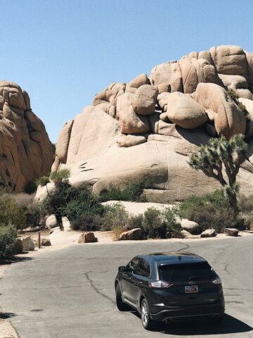
Related: Climbing the 10 Highest Peaks in Joshua Tree

Staying Safe on the Mountain
During the summer, the peak and the trails are crawling with people trying to reach the top. We have been on the summit on a summer's day with perhaps 50 people crowding the boulders. You will be in good shape if you bring enough water and stay on the trail.
However, if you decide to climb this peak in the dead of winter as we did, be ready and trained to take care of yourself. There have been many days when we have hiked to the summit in winter, and we have been the only people on the peak for hours.

Avalanches and slipping and sliding to one's death on mountain slopes are possibilities. We found that the best trip reports come from a blog called Sanjacjon.com. He hikes to the peak several hundred times annually and runs the blog to inform folks about the mountain and the current conditions.
Whatever your dreams may be, when it comes to climbing mountains, Mount San Jacinto can fulfill nearly anyone's climbing fantasies.